Directions to KFC (Osmanağa, Kadıköy) with public transportation
The following transit lines have routes that pass near KFC
 Bus: 10E, 14ÇK, 14M, 14ŞB, 19F.
- Metro: M4.
- Dolmus & Minibus: KADIKÖY - BOSTANCI, KADIKÖY - TAKSIM.
- Ferry: BEŞIKTAŞ - KADIKÖY, ÇINARCIK - KOCADERE - ESENKÖY.
How to get to KFC by bus?
Click on the bus route to see step by step directions with maps, line arrival times and updated time schedules.
From Yeditepe Üniversitesi, Ataşehir
85 minFrom Trump Alışveriş Merkezi, Şişli
66 minFrom Fatih Yarımada, Fatih
122 minFrom Koç Üniversitesi Hastanesi, Zeytinburnu
124 minFrom ATASEHIR ISTANBUL, Ataşehir
87 minFrom Cemil Topuzlu Harbiye Açıkhava Sahnesi, Harbiye, Şişli
84 minFrom Atasehir, Ataşehir
65 minFrom Etiler İETT Durağı, Etiler, Beşiktaş
92 minFrom çıkıkcı melek hanım, Maltepe
81 min
How to get to KFC by metro?
Click on the metro route to see step by step directions with maps, line arrival times and updated time schedules.
Tram stations near KFC in Osmanağa, Kadıköy
- Altıyol, 3 min walk,VIEW
Dolmus & Minibus station near KFC in Osmanağa, Kadıköy
- Altıyol / Pendik Yönü, 3 min walk,VIEW
Bus stops near KFC in Osmanağa, Kadıköy
Bus lines to KFC in Osmanağa, Kadıköy
- ER1, Kadıköy - Erenköy / Ring,VIEW
- FB1, Kadıköy - Fenerbahçe / Ring,VIEW
- GZ1, Kadıköy - Göztepe / Ring,VIEW
- ER2, Kadıköy - Erenköy / Ring,VIEW
- FB2, Kadıköy - Fenerbahçe / Ring,VIEW
- 4, Maltepe Peronlar-İskele,VIEW
- 8, Kadıköy-Akasya Konutları Göl Etabı,VIEW
- 8A, Batı Ataşehir Peronlar-Kadıköy,VIEW
- 8E, Esenevler Mahallesi-Yüksel Sokak,VIEW
- 9K, Atatürk Mahallesi Peronlar-Kadıköy,VIEW
- 10B, Kadıköy-Bostancı Peronlar,VIEW
- 10E, Esatpaşa-Kadıköy,VIEW
- 10G, Kadıköy-Eşref Bitlis Caddesi,VIEW
- 13Y, Kadıköy-Tepeüstü,VIEW
- 14AK, Özyeğin Üniversitesi Alt Kapı-Kadıköy,VIEW
- 14B, Kadıköy-Adem Yavuz Mahallesi,VIEW
- 14CE, Yeşiltepe Son Durak-Kadıköy,VIEW
- 14E, Kazım Karabekir-Kadıköy,VIEW
- 14ES, Sarıgazi Garajı-Kadıköy,VIEW
- 14Y, Yavuztürk Siteler-Kadıköy,VIEW
What are the closest stations to KFC?
The closest stations to KFC are:
- Altıyol is 158 meters away, 3 min walk.
- Altıyol / Pendik Yönü is 177 meters away, 3 min walk.
- Kadıköy Çarşı is 261 meters away, 4 min walk.
- Rıhtım - İbrahimağa Yönü is 483 meters away, 7 min walk.
- Kadıköy - Rihtim1 is 555 meters away, 8 min walk.
- Kadıköy - Rıhtım Peron Yönü is 645 meters away, 9 min walk.
- Söğütlüçeşme - Kadıköy Yönü is 686 meters away, 9 min walk.
- Kadıköy - Rihtim2 is 746 meters away, 10 min walk.
- Kadıköy is 982 meters away, 13 min walk.
Which bus lines stop near KFC?
These bus lines stop near KFC: 10E, 14ÇK, 14M, 14ŞB, 19F, 19S, 8A, 8E.
Which metro line stops near KFC?
M4 (Sabiha Gökçen Havalimanı→Kadıköy)
Which ferry lines stop near KFC?
These ferry lines stop near KFC: BEŞIKTAŞ - KADIKÖY, ÇINARCIK - KOCADERE - ESENKÖY.
What’s the nearest tram station to KFC in Osmanağa, Kadıköy?
The nearest tram station to KFC in Osmanağa, Kadıköy is Altıyol. It’s a 3 min walk away.
What’s the nearest bus station to KFC in Osmanağa, Kadıköy?
The nearest bus station to KFC in Osmanağa, Kadıköy is Kadıköy Çarşı. It’s a 4 min walk away.
What’s the nearest Dolmus & Minibus station to KFC in Osmanağa, Kadıköy?
The nearest Dolmus & Minibus station to KFC in Osmanağa, Kadıköy is Altıyol / Pendik Yönü. It’s a 3 min walk away.
What time is the first tram to KFC in Osmanağa, Kadıköy?
The T3 is the first tram that goes to KFC in Osmanağa, Kadıköy. It stops nearby at 10:02 AM.
What time is the last tram to KFC in Osmanağa, Kadıköy?
The T3 is the last tram that goes to KFC in Osmanağa, Kadıköy. It stops nearby at 8:02 PM.
What time is the first bus to KFC in Osmanağa, Kadıköy?
The HVL6 is the first bus that goes to KFC in Osmanağa, Kadıköy. It stops nearby at 3:00 AM.
What time is the last bus to KFC in Osmanağa, Kadıköy?
The 130A is the last bus that goes to KFC in Osmanağa, Kadıköy. It stops nearby at 5:19 AM.
What time is the first Dolmus & Minibus to KFC in Osmanağa, Kadıköy?
The KADIKÖY - TAKSIM is the first Dolmus & Minibus that goes to KFC in Osmanağa, Kadıköy. It stops nearby at 3:01 AM.
What time is the last Dolmus & Minibus to KFC in Osmanağa, Kadıköy?
The KADIKÖY - TAKSIM is the last Dolmus & Minibus that goes to KFC in Osmanağa, Kadıköy. It stops nearby at 3:22 AM.
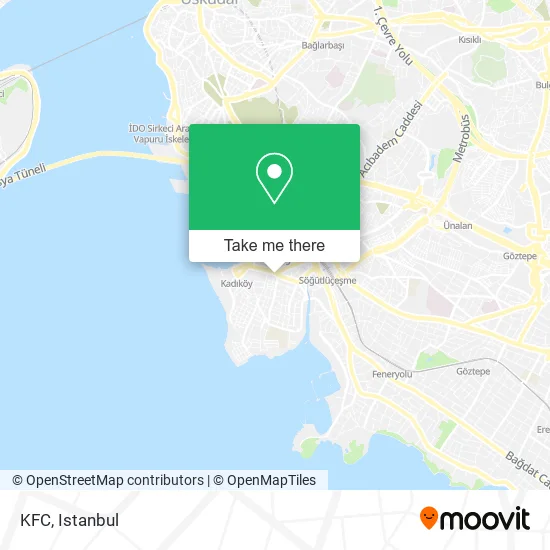
See KFC, Osmanağa, Kadıköy, on the map
Public Transit to KFC in Osmanağa, Kadıköy
Wondering how to get to KFC in Osmanağa, Kadıköy? Moovit helps you find the best way to get to KFC with step-by-step directions from the nearest public transit station.
Moovit provides free maps and live directions to help you navigate through your city. View schedules, routes, timetables, and find out how long does it take to get to KFC in real time.
Looking for the nearest stop or station to KFC? Check out this list of stops closest to your destination: Altıyol; Altıyol / Pendik Yönü; Kadıköy Çarşı; Rıhtım - İbrahimağa Yönü; Kadıköy - Rihtim1; Kadıköy - Rıhtım Peron Yönü; Söğütlüçeşme - Kadıköy Yönü; Kadıköy - Rihtim2; Kadıköy.
Bus: 10E, 14ÇK, 14M, 14ŞB, 19F, 19S, 8A, 8E, ER1, FB1, GZ1, ER2, FB2, KADIKÖY - TAŞDELEN, KADIKÖY - ÇEKMEKÖY, KADIKÖY - ÇIÇEKÇI - ÜSKÜDAR, 15BK, 14A, HVL6, SG-1, E-10, SÖĞÜTLÜÇEŞME METROBÜS-BOSTANCI, C50.Metro: M4.Dolmus & Minibus: KADIKÖY - BOSTANCI, KADIKÖY - TAKSIM.Ferry: BEŞIKTAŞ - KADIKÖY, ÇINARCIK - KOCADERE - ESENKÖY.
Want to see if there’s another route that gets you there at an earlier time? Moovit helps you find alternative routes or times. Get directions from and directions to KFC easily from the Moovit App or Website.
We make riding to KFC easy, which is why over 1.5 million users, including users in Osmanağa, Kadıköy, trust Moovit as the best app for public transit. You don’t need to download an individual bus app or train app, Moovit is your all-in-one transit app that helps you find the best bus time or train time available.
For information on prices of bus, metro, ferry, Metrobus, tram and Dolmus & Minibus, costs and ride fares to KFC, please check the Moovit app.
Use the app to navigate to popular places including to the airport, hospital, stadium, grocery store, mall, coffee shop, school, college, and university.
KFC Address: Altıyol Kırtasiyeciler Sok. Onur İş Hanı No:2Altıyol Kırtasiyeciler Sok. Onur İş Hanı No:2 street in Osmanağa, Kadıköy
- Loris Parfüm Kadıköy,
- Onur İş Hanı,
- Bınnaz Zehra Ove,
- Burak Kuyumcu,
- So Pung,
- Çağdaş Han,
- Kırtasiyeci Sok Onur Otopark,
- General Asım Gündüz Caddesi,
- Adrenalin Çanta,
- Prismart,
- Sez,
- Kırtasiyeci Sok., No:50,
- kadıköy bahariye,
- Pizza Hut (Pizza Hut Bahariye),
- 6yol,
- SmartPro Bilgisayar Akademisi,
- Seda Mücevherat Kuyumculuk,
- Altıyol Boga,
- Fany Abıye,
- Derma Queen Guzellık
Places Near KFC (Osmanağa, Kadıköy)
- İstinye Park, Sariyer,
- Mall Of İstanbul, Basaksehir,
- Gebze Koop Durağı, Gebze,
- Karaköy Genelevi, Karaköy, Beyoğlu,
- Şehit Prof. Dr. İlhan Varank Eğitim Ve Araştırma Hastanesi, Sancaktepe,
- Tersane İstanbul, Beyoğlu,
- 2 Nolu Minibüss, Beylikduzu,
- Bakırköy Sosyete Pazarı, Bakirköy,
- Hz. Yuşa Tepesi, Beykoz,
- İstanbul,
- Başakşehir Çam Ve Sakura Şehir Hastanesi, Basaksehir,
- Gebze-Harem Minibüs Hattı, Gebze,
- 212 AVM, Bagcilar,
- VİALAND AVM, Eyüp,
- Beylikdüzü - 4 Nolu Minibüs Hattı, Beylikduzu,
- 41 Burda AVM, Kocaeli Merkezi,
- Topkule Kışlası 47.Komando Tugay Komutanlığı, Esenler,
- Hilltown AVM, Maltepe,
- METROPOL IsTaNBuL, Ataşehir,
- Mehmet Emin Tokadî Hz. Türbesi, Fatih
How to get to popular places in Istanbul with public transit
Get around Osmanağa, Kadıköy by public transit!
Traveling around Osmanağa, Kadıköy has never been so easy. See step by step directions as you travel to any attraction, street or major public transit station. View bus and train schedules, arrival times, service alerts and detailed routes on a map, so you know exactly how to get to anywhere in Osmanağa, Kadıköy.
When traveling to any destination around Osmanağa, Kadıköy use Moovit's Live Directions with Get Off Notifications to know exactly where and how far to walk, how long to wait for your line, and how many stops are left. Moovit will alert you when it's time to get off — no need to constantly re-check whether yours is the next stop.
Wondering how to use public transit in Osmanağa, Kadıköy or how to pay for public transit in Osmanağa, Kadıköy? Moovit public transit app can help you navigate your way with public transit easily, and at minimum cost. It includes public transit fees, ticket prices, and costs. Looking for a map of Osmanağa, Kadıköy public transit lines? Moovit public transit app shows all public transit maps in Osmanağa, Kadıköy with all Bus, Train, Metro, Tram, Ferry, Metrobus and Dolmus & Minibus routes and stops on an interactive map.
Istanbul has 7 transit type(s), including: Bus, Train, Metro, Tram, Ferry, Metrobus and Dolmus & Minibus, operated by several transit agencies, including Marmaray, Metro İstanbul, Metrobüs, UAB, İETT, İETT ÇIFT KATLI HATLAR, İETT BÖLGESEL HATLAR, TCDD, Şehir Hatları, Dentur Avrasya, Beyden, Turyol, Mavi Marmara, Havaist and Prenstur
