How to get to K-Boo Disco Show by bus?
Click on the bus route to see step by step directions with maps, line arrival times and updated time schedules.
From Centro Comercial Arenales, Lince
44 minFrom Salaverry, Los Olivos
23 minFrom Hospital Naval, Lima
43 minFrom Hospital Nacional Alberto Sabogal, Lima
37 minFrom Calle BArtolome Herrera, Lince
48 minFrom AV AREQUIPA CUADRA 14, Lince
43 minFrom Clínica San Felipe, Jesus Mari
47 minFrom AV ABANCAY CUADRA 2 CENTRO DE LIMA 15001, Lima
37 minFrom Hospital Daniel Alcides Carrion, Ventanilla
54 minFrom AV MEXICO LA VICTORIA, La Victori
48 min
Bus stops near K-Boo Disco Show in Los Olivos
Bus lines to K-Boo Disco Show in Los Olivos
- 1005, Huánuco (La Victoria) - Punchauca (Carabayllo),VIEW
- 1010, Pte. Piedra - Magdalena - Pte. Piedra,VIEW
- 1016, La Florida (Ancon) - Aviación (La Victoria),VIEW
- 1017, Ancón - La Victoria,VIEW
- 1024, Los Sauces - Cerro Candela,VIEW
- 1030, Canta Callao (San Martin De Porres) - San Diego (San Martin De Porres),VIEW
- 1031, Jesus Maria - San Martin De Porres,VIEW
- 1033, S.M.P. - La Victoria - S.M.P.,VIEW
- 1131, Gamarra (La Victoria),VIEW
- 1159, Jesús María - Oquendo,VIEW
- 1160, Pachacútec (Ventanilla) - Gamarra (La Victoria),VIEW
- 1168, Ventanilla - Panam. Norte - Alfonso Ugarte - Salaverry - Panamericana Norte - Ancón,VIEW
- 1178, Tagore (Ate) - Km.22 (Carabayllo),VIEW
- 1179, Miramar (Ancón) - Upc (Santiago De Surco),VIEW
- 1180, Pamplona Alta (San Juan De Miraflores) - Torre Blanca (Carabayllo),VIEW
- 1183, Carabayllo - Surco - Carabayllo,VIEW
- 1184, Las Palmas (Pachacamac) - Profam (Santa Rosa),VIEW
- 1185, Ensenada (Puente Piedra) - Av. Lima (Villa El Salvador),VIEW
- 1235, Manchay (Pachacamac) - Santo Domingo (Carabayllo),VIEW
- 1238, El Sol (Villa El Salvador) - Lomas (Carabayllo),VIEW
What are the closest stations to K-Boo Disco Show?
The closest stations to K-Boo Disco Show are:
- Mega Plaza is 198 meters away, 3 min walk.
- Panamericana is 847 meters away, 11 min walk.
- El Pacífico is 907 meters away, 12 min walk.
Which bus lines stop near K-Boo Disco Show?
These bus lines stop near K-Boo Disco Show: 1005, 1024, 1159, 1168, 1180, 1262, 1275, 1468.
What’s the nearest bus station to K-Boo Disco Show in Los Olivos?
The nearest bus station to K-Boo Disco Show in Los Olivos is Mega Plaza. It’s a 3 min walk away.
What time is the first bus to K-Boo Disco Show in Los Olivos?
The 1180 is the first bus that goes to K-Boo Disco Show in Los Olivos. It stops nearby at 3:42 AM.
What time is the last bus to K-Boo Disco Show in Los Olivos?
The 1326 SX is the last bus that goes to K-Boo Disco Show in Los Olivos. It stops nearby at 2:28 AM.
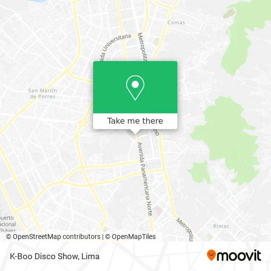
See K-Boo Disco Show, Los Olivos, on the map
Public Transit to K-Boo Disco Show in Los Olivos
Wondering how to get to K-Boo Disco Show in Los Olivos? Moovit helps you find the best way to get to K-Boo Disco Show with step-by-step directions from the nearest public transit station.
Moovit provides free maps and live directions to help you navigate through your city. View schedules, routes, timetables, and find out how long does it take to get to K-Boo Disco Show in real time.
Looking for the nearest stop or station to K-Boo Disco Show? Check out this list of stops closest to your destination: Mega Plaza; Panamericana; El Pacífico.
Bus: 1005, 1024, 1159, 1168, 1180, 1262, 1275, 1468, 1010, 1016, 1017, 1326 SX, 1177, 1237, 1240, 1243, 1260, 1037, 1194, 1195, 1424, 1469, 1176, IO38.
Want to see if there’s another route that gets you there at an earlier time? Moovit helps you find alternative routes or times. Get directions from and directions to K-Boo Disco Show easily from the Moovit App or Website.
We make riding to K-Boo Disco Show easy, which is why over 1.5 million users, including users in Los Olivos, trust Moovit as the best app for public transit. You don’t need to download an individual bus app or train app, Moovit is your all-in-one transit app that helps you find the best bus time or train time available.
For information on prices of bus, costs and ride fares to K-Boo Disco Show, please check the Moovit app.
Use the app to navigate to popular places including to the airport, hospital, stadium, grocery store, mall, coffee shop, school, college, and university.
K-Boo Disco Show Address: Calle Segura 145 Villa Los Ángeles, 15301 Los Olivos street in Los Olivos
- Macarena Retro Bar,
- Jr Manuel Ascencio Segura N° 123,
- D'Farandula - Salsa VIP,
- El Punto de Encuentro,
- Complejo Vicky,
- Institución Educativa Robert Letourneau,
- Instituto de Educación Superior Tecnológico CESCA,
- Los Portales del Club Huayllabamba,
- Iglesia Alianza Cristiana Y Misionera,
- I.E.P San Pio X,
- La Catolica Lima Norte,
- Songo - Rumba Club,
- Iglesia Alianza Cristiana Los Olivos,
- Calle Palacios Valdéz 151,
- Corporacion Boulevard Los Olivos,
- El Buho Disco & Bar,
- Cicex,
- La Matarina Perú,
- FISIOTER - Centro de Terapia Física y Rehabilitación,
- Kansas Jeans
Places Near K-Boo Disco Show (Los Olivos)
- av arequipa, Lima,
- Paradero Av.Brasil,
- Mall Del Sur,
- Hospital Edgardo Rebagliati Martins, Jesus Mari,
- Miraflores, Miraflores,
- Aeropuerto Internacional Jorge Chávez, Ventanilla,
- Parque Kennedy, Miraflores,
- Av. Abancay, Lima,
- Circuito Mágico Del Agua, Lima,
- Larcomar, Miraflores,
- Pontificia Universidad Católica del Perú - PUCP, San Miguel,
- Plaza San Miguel, San Miguel,
- Centro Comercial Plaza Norte, Independen,
- Parque de las Leyendas, San Miguel,
- Av. La Marina, San Miguel,
- Gamarra,
- Barranco, Barranco,
- Real Plaza Puruchuco, Ate,
- Av. Salaverry, Jesus Mari,
- Jockey Plaza, Santiago D
How to get to popular places in Lima with public transit
Get around Los Olivos by public transit!
Traveling around Los Olivos has never been so easy. See step by step directions as you travel to any attraction, street or major public transit station. View bus and train schedules, arrival times, service alerts and detailed routes on a map, so you know exactly how to get to anywhere in Los Olivos.
When traveling to any destination around Los Olivos use Moovit's Live Directions with Get Off Notifications to know exactly where and how far to walk, how long to wait for your line, and how many stops are left. Moovit will alert you when it's time to get off — no need to constantly re-check whether yours is the next stop.
Wondering how to use public transit in Los Olivos or how to pay for public transit in Los Olivos? Moovit public transit app can help you navigate your way with public transit easily, and at minimum cost. It includes public transit fees, ticket prices, and costs. Looking for a map of Los Olivos public transit lines? Moovit public transit app shows all public transit maps in Los Olivos with all Bus, Metro and Ferry routes and stops on an interactive map.
Lima has 3 transit type(s), including: Bus, Metro and Ferry, operated by several transit agencies, including Metro de Lima Línea 2 , Metro de Lima, Corredor Rojo, Metropolitano, Metropolitano - Alimentadores, Corredor Morado, Corredor Azul, Rutas Tradicionales, Transportes y Servicios La Esperanza S.A., Las Flores S.A., Virgen de la Asunción S.A., Consorcio HAM, Transportes y Service Canadá S.A., ETUL4SA and ETUCHISA