Directions to Kalayaan Flyover station (Makati City) with public transit
The following transit lines have routes that pass near Kalayaan Flyover
How to get to Kalayaan Flyover station by bus?
Click on the bus route to see step by step directions with maps, line arrival times and updated time schedules.
How to get to Kalayaan Flyover station by train?
Click on the train route to see step by step directions with maps, line arrival times and updated time schedules.
Bus stops near Kalayaan Flyover in Makati City
- Kalayaan Ave / 32nd Street Intersection, Taguig City, Manila, 5 min walk,
- Epifanio De Los Santos Avenue / Senator Gil Puyat Ave, Makati City, Manila, 6 min walk,
- Buendia, 6 min walk,
- Canopus / Jupiter Intersection, Makati City, Manila, 7 min walk,
- Estrella Flyover, Makati City, Manila, 7 min walk,
- Kalayaan Ave / Gen. Jacinto St Intersection, Taguig City, Manila, 11 min walk,
- Crescent Park West, 12 min walk,
Train station near Kalayaan Flyover in Makati City
- Buendia Mrt, 25 min walk,
Bus lines to Kalayaan Flyover station in Makati City
- JEEP, PATEROS - AYALA,
- JEEP, BUENDIA KALAYAAN - F BONIFACIO,
- JEEP, Ayala - Pateros via J.P. Rizal,
- BUS, Baclaran Navotas via Ayala,
- BUS, Grotto - NAIA via EDSA, Fairview,
- BUS, FTI - Navotas Terminal via EDSA,
- BUS, Baclaran SJDM via Commonwealth EDSA,
- BUS, Baclaran - Minuyan via Commonwealth Ave,
- BUS, Malanday - Muntinlupa via Edsa, Monumento,
- BUS, Baclaran Novaliches via EDSA Quirino,
- BUS, FTI - Tungko, SJDM via Lagro, C'wealth Ave EDSA,
- BUS, Baclaran - Grotto via Commonwealth Ave,
- BUS, Baclaran-Nvaliches via EDSA Mind AveAyala,
- BUS, Baclaran-Navotas Terminal via Edsa Ayala,
- BUS, Navotas Terminal Pacita Complex via EDSA,
- BUS, Norzgry / Spalay-NAIA / Baclrn Via Comm Fairv Ed,
- BUS, Baclaran-BgSilang via Edsa Commonwealth,
- BUS, FTI-Monumento via EDSA,
- BUS, Baclaran - SM Fairview via Lagro, Ayala,
- BUS, Monumento Sucat via EDSA,
What are the closest stations to Kalayaan Flyover?
The closest stations to Kalayaan Flyover are:
- Kalayaan Ave / 32nd Street Intersection, Taguig City, Manila is 347 meters away, 5 min walk.
- Epifanio De Los Santos Avenue / Senator Gil Puyat Ave, Makati City, Manila is 412 meters away, 6 min walk.
- Buendia is 415 meters away, 6 min walk.
- Canopus / Jupiter Intersection, Makati City, Manila is 492 meters away, 7 min walk.
- Estrella Flyover, Makati City, Manila is 528 meters away, 7 min walk.
- Kalayaan Ave / Gen. Jacinto St Intersection, Taguig City, Manila is 805 meters away, 11 min walk.
- Crescent Park West is 898 meters away, 12 min walk.
- Buendia Mrt is 1915 meters away, 25 min walk.
Which bus lines stop near Kalayaan Flyover?
These bus lines stop near Kalayaan Flyover: BUS, E, JEEP.
Which train line stops near Kalayaan Flyover?
MRT3 (North Avenue)
What’s the nearest train station to Kalayaan Flyover in Makati City?
The nearest train station to Kalayaan Flyover in Makati City is Buendia Mrt. It’s a 25 min walk away.
What’s the nearest bus stop to Kalayaan Flyover in Makati City?
The nearest bus stop to Kalayaan Flyover in Makati City is Kalayaan Ave / 32nd Street Intersection, Taguig City, Manila. It’s a 5 min walk away.
What time is the first train to Kalayaan Flyover in Makati City?
The MRT3 is the first train that goes to Kalayaan Flyover in Makati City. It stops nearby at 5:13 AM.
What time is the last train to Kalayaan Flyover in Makati City?
The MRT3 is the last train that goes to Kalayaan Flyover in Makati City. It stops nearby at 11:22 PM.
What time is the first bus to Kalayaan Flyover in Makati City?
The BUS is the first bus that goes to Kalayaan Flyover in Makati City. It stops nearby at 3:00 AM.
What time is the last bus to Kalayaan Flyover in Makati City?
The BUS is the last bus that goes to Kalayaan Flyover in Makati City. It stops nearby at 3:54 AM.
See Kalayaan Flyover, Makati City, on the map
Public Transit to Kalayaan Flyover in Makati City
How to get to Kalayaan Flyover in Makati City, Philippines?
It’s easy with Moovit. Type in your street address and Moovit’s route finder will locate the fastest way to get you there! Not sure where to get off on the street? Download the Moovit App to find live directions (including where to get off on Kalayaan Flyover), see timetables and get the estimated arrival times for your favorite bus or train lines.
Looking for the nearest stop or station to Kalayaan Flyover? Check out this list of closest stops available to your destination: Kalayaan Ave / 32nd Street Intersection; Epifanio De Los Santos Avenue / Senator Gil Puyat Ave; Buendia; Canopus / Jupiter Intersection; Estrella Flyover; Kalayaan Ave / Gen. Jacinto St Intersection; Crescent Park West; Buendia Mrt.
Bus: BUS, E, JEEP.Train: MRT3.
Download the Moovit App to see the current schedule and routes available for Makati City. No need to install a special bus app to check the bus time or a train app to get train time. Moovit is the only all-in-one transit app that helps you get where you need to go.
We make riding on public transit to Kalayaan Flyover easy, which is why over 1.5 million users, including users in Makati City trust Moovit as the best app for public transit.
Use the app to navigate to popular places including to the airport, hospital, stadium, grocery store, mall, coffee shop, school, college, and university.
Location: Makati City, Manila
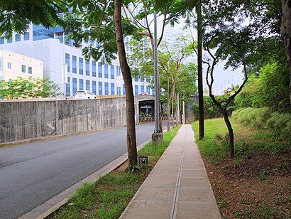
Streets near Kalayaan Flyover, Makati City
Get around Makati City by public transit!
Traveling around Makati City has never been so easy. See step by step directions as you travel to any attraction, street or major public transit station. View bus and train schedules, arrival times, service alerts and detailed routes on a map, so you know exactly how to get to anywhere in Makati City.
When traveling to any destination around Makati City use Moovit's Live Directions with Get Off Notifications to know exactly where and how far to walk, how long to wait for your line, and how many stops are left. Moovit will alert you when it's time to get off — no need to constantly re-check whether yours is the next stop.
Wondering how to use public transit in Makati City or how to pay for public transit in Makati City? Moovit public transit app can help you navigate your way with public transit easily, and at minimum cost. It includes public transit fees, ticket prices, and costs. Looking for a map of Makati City public transit lines? Moovit public transit app shows all public transit maps in Makati City with all Bus and Train routes and stops on an interactive map.
Manila has 2 transit type(s), including: Bus and Train, operated by several transit agencies, including LRTA, LTFRB, MRTC, PNR, P2P, UV Express and BGC Bus