Directions to Kaplan Auto Group (Norwood) with public transportation
The following transit lines have routes that pass near Kaplan Auto Group
 Bus: 34E.
- Train: FRANKLIN/FOXBORO.
How to get to Kaplan Auto Group by bus?
Click on the bus route to see step by step directions with maps, line arrival times and updated time schedules.
From Beth Israel Deaconess Hospital-Milton, Milton
99 minFrom Academy Of the Pacific Rim Charter Public School, Boston
96 minFrom VFW Parkway, Boston
78 minFrom West Roxbury, Boston
76 minFrom West Roxbury, Boston
66 minFrom Walpole, MA, Walpole
48 minFrom Milton, MA, Milton
110 minFrom Curry College, Milton
112 min
How to get to Kaplan Auto Group by train?
Click on the train route to see step by step directions with maps, line arrival times and updated time schedules.
Train station near Kaplan Auto Group in Norwood
- Norwood Depot, 20 min walk,VIEW
What are the closest stations to Kaplan Auto Group?
The closest stations to Kaplan Auto Group are:
- Norwood Depot is 1710 yards away, 20 min walk.
Which bus line stops near Kaplan Auto Group?
34E (Walpole Center Via Washington St)
Which train line stops near Kaplan Auto Group?
FRANKLIN/FOXBORO (#1709 | Foxboro)
What’s the nearest train station to Kaplan Auto Group in Norwood?
The nearest train station to Kaplan Auto Group in Norwood is Norwood Depot. It’s a 20 min walk away.
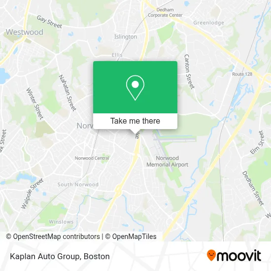
See Kaplan Auto Group, Norwood, on the map
Public Transit to Kaplan Auto Group in Norwood
Wondering how to get to Kaplan Auto Group in Norwood? Moovit helps you find the best way to get to Kaplan Auto Group with step-by-step directions from the nearest public transit station.
Moovit provides free maps and live directions to help you navigate through your city. View schedules, routes, timetables, and find out how long does it take to get to Kaplan Auto Group in real time.
Looking for the nearest stop or station to Kaplan Auto Group? Check out this list of stops closest to your destination: Norwood Depot.
Bus: 34E.Train: FRANKLIN/FOXBORO.
Want to see if there’s another route that gets you there at an earlier time? Moovit helps you find alternative routes or times. Get directions from and directions to Kaplan Auto Group easily from the Moovit App or Website.
We make riding to Kaplan Auto Group easy, which is why over 1.7 million users, including users in Norwood, trust Moovit as the best app for public transit. You don’t need to download an individual bus app or train app, Moovit is your all-in-one transit app that helps you find the best bus time or train time available.
For information on prices of bus and train, costs and ride fares to Kaplan Auto Group, please check the Moovit app.
Use the app to navigate to popular places including to the airport, hospital, stadium, grocery store, mall, coffee shop, school, college, and university.
Kaplan Auto Group Address: 449 Neponset St street in Norwood
- 1UOL,
- Hampton Inn-Norwood,
- Chateau,
- Building Construction Professionals Corporation,
- Sons Of Sam Pizza,
- Nassau Gardens Rental Office,
- Tnt Auto Detailing,
- Lockout Locksmith,
- Old Koots Rods - Kustoms,
- Avf Equipment Co.,
- Tiny Footprints Family Child Care,
- Automall Service Center,
- Nassau Gardens Co-Op,
- Norwood Memorial Airport ,
- Norwood Memorial Airport (OWD),
- Bitcoin Depot | Bitcoin Atm,
- Coinstar Kiosk – Bitcoin Atm,
- Boch Honda,
- Atm Best City Nails,
- D'Angelo Grilled Sandwiches
Places Near Kaplan Auto Group (Norwood)
- Seaport District, Boston,
- Boston Convention & Exhibition Center, Boston,
- Td Garden, Boston,
- Quincy Market, Boston,
- Isabella Stewart Gardner Museum, Boston,
- House Of Blues, Boston,
- Wilbur Theatre, Boston,
- Faneuil Hall, Boston,
- Wang Theater, Boston,
- Cheers, Boston,
- Museum Of Science, Boston,
- Leader Bank Pavilion (Leader Bank Pavillion), Boston,
- Boston Children's Hospital, Boston,
- Massachusetts General Hospital, Boston,
- Boston Medical Center, Boston,
- North End, Boston,
- Boston Common, Boston,
- Castle Island, Boston,
- Mgm Music Hall, Boston,
- Prudential Center, Boston
How to get to popular places in Boston with public transit
Get around Norwood by public transit!
Traveling around Norwood has never been so easy. See step by step directions as you travel to any attraction, street or major public transit station. View bus and train schedules, arrival times, service alerts and detailed routes on a map, so you know exactly how to get to anywhere in Norwood.
When traveling to any destination around Norwood use Moovit's Live Directions with Get Off Notifications to know exactly where and how far to walk, how long to wait for your line, and how many stops are left. Moovit will alert you when it's time to get off — no need to constantly re-check whether yours is the next stop.
Wondering how to use public transit in Norwood or how to pay for public transit in Norwood? Moovit public transit app can help you navigate your way with public transit easily, and at minimum cost. It includes public transit fees, ticket prices, and costs. Looking for a map of Norwood public transit lines? Moovit public transit app shows all public transit maps in Norwood with all Bus, Train, Subway and Ferry routes and stops on an interactive map.
Boston has 4 transit type(s), including: Bus, Train, Subway and Ferry, operated by several transit agencies, including MBTA, Southeastern Regional Transit Authority, MetroWest Regional Transit Authority, Rhode Island Public Transit Authority, WRTA, Lowell Regional Transit Authority, Merrimack Valley Transit, Montachusett Regional Transit Authority, Cape Cod Regional Transit Authority, Brockton Area Transit Authority, Martha's Vineyard Transit Authority, the WAVE - Nantucket Regional Transit Authority, GATRA, Cape Ann Transportation Authority and Massport