Directions to Kaps Construction (Brockton) with public transportation
The following transit lines have routes that pass near Kaps Construction
 Bus: 14, 230, 4A.
- Train: FALL RIVER/NEW BEDFORD, CAPEFLYER.
How to get to Kaps Construction by bus?
Click on the bus route to see step by step directions with maps, line arrival times and updated time schedules.
How to get to Kaps Construction by train?
Click on the train route to see step by step directions with maps, line arrival times and updated time schedules.
Bus stops near Kaps Construction in Brockton
Train stations near Kaps Construction in Brockton
Bus lines to Kaps Construction in Brockton
What are the closest stations to Kaps Construction?
The closest stations to Kaps Construction are:
- Belair St at Anne Ave is 242 yards away, 3 min walk.
- Oak Street at Dw Field Golf Course is 448 yards away, 6 min walk.
- Montello is 3284 yards away, 39 min walk.
- Brockton is 3528 yards away, 42 min walk.
Which bus lines stop near Kaps Construction?
These bus lines stop near Kaps Construction: 14, 230.
Which train line stops near Kaps Construction?
FALL RIVER/NEW BEDFORD (#2011 | New Bedford)
What’s the nearest bus station to Kaps Construction in Brockton?
The nearest bus station to Kaps Construction in Brockton is Belair St at Anne Ave. It’s a 3 min walk away.
What time is the first train to Kaps Construction in Brockton?
The FALL RIVER/NEW BEDFORD is the first train that goes to Kaps Construction in Brockton. It stops nearby at 5:11 AM.
What time is the last train to Kaps Construction in Brockton?
The FALL RIVER/NEW BEDFORD is the last train that goes to Kaps Construction in Brockton. It stops nearby at 12:38 AM.
What time is the first bus to Kaps Construction in Brockton?
The 14 is the first bus that goes to Kaps Construction in Brockton. It stops nearby at 6:04 AM.
What time is the last bus to Kaps Construction in Brockton?
The 4A is the last bus that goes to Kaps Construction in Brockton. It stops nearby at 9:44 PM.
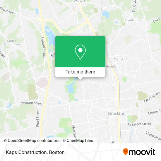
See Kaps Construction, Brockton, on the map
Public Transit to Kaps Construction in Brockton
Wondering how to get to Kaps Construction in Brockton? Moovit helps you find the best way to get to Kaps Construction with step-by-step directions from the nearest public transit station.
Moovit provides free maps and live directions to help you navigate through your city. View schedules, routes, timetables, and find out how long does it take to get to Kaps Construction in real time.
Looking for the nearest stop or station to Kaps Construction? Check out this list of stops closest to your destination: Belair St at Anne Ave; Oak Street at Dw Field Golf Course; Montello; Brockton.
Bus: 14, 230, 4A.Train: FALL RIVER/NEW BEDFORD, CAPEFLYER.
Want to see if there’s another route that gets you there at an earlier time? Moovit helps you find alternative routes or times. Get directions from and directions to Kaps Construction easily from the Moovit App or Website.
We make riding to Kaps Construction easy, which is why over 1.7 million users, including users in Brockton, trust Moovit as the best app for public transit. You don’t need to download an individual bus app or train app, Moovit is your all-in-one transit app that helps you find the best bus time or train time available.
For information on prices of bus and train, costs and ride fares to Kaps Construction, please check the Moovit app.
Use the app to navigate to popular places including to the airport, hospital, stadium, grocery store, mall, coffee shop, school, college, and university.
Kaps Construction Address: 248 Colonel Bell Dr street in Brockton
- Americanautodetailing2,
- BP & BM Transportation,
- Consulting with Smith Vil,
- Manthala George Jr Elementary,
- RCCG Chapel of Resurrection,
- Colonel Bell Drive Apartment Complex,
- Alpha Omega Embroidery,
- Brockton Housing Authority,
- USPS Collection Box - Blue Box,
- City of Brockton,
- Robert McAuley General Contractor,
- USPS Collection Box - Blue Box,
- Michele A Logan Family Center,
- Sarcia Landscaping,
- Crown Healthcare Apparel Service,
- Fairway Oaks Life Support,
- Earle St Building 88,
- 1st Battalion, 101st Field Artillery Regiment,
- Cr89 Cars,
- Levelup Services
Places Near Kaps Construction (Brockton)
- Seaport District, Boston,
- Museum Of Science, Boston,
- Massachusetts General Hospital, Boston,
- Boston Medical Center, Boston,
- Faneuil Hall, Boston,
- Prudential Center, Boston,
- Castle Island, Boston,
- Boston Children's Hospital, Boston,
- Boston Convention & Exhibition Center, Boston,
- Mgm Music Hall, Boston,
- North End, Boston,
- Wilbur Theatre, Boston,
- Td Garden, Boston,
- Wang Theater, Boston,
- Boston Common, Boston,
- Cheers, Boston,
- House Of Blues, Boston,
- Quincy Market, Boston,
- Leader Bank Pavilion (Leader Bank Pavillion), Boston,
- Isabella Stewart Gardner Museum, Boston
How to get to popular places in Boston with public transit
Get around Brockton by public transit!
Traveling around Brockton has never been so easy. See step by step directions as you travel to any attraction, street or major public transit station. View bus and train schedules, arrival times, service alerts and detailed routes on a map, so you know exactly how to get to anywhere in Brockton.
When traveling to any destination around Brockton use Moovit's Live Directions with Get Off Notifications to know exactly where and how far to walk, how long to wait for your line, and how many stops are left. Moovit will alert you when it's time to get off — no need to constantly re-check whether yours is the next stop.
Wondering how to use public transit in Brockton or how to pay for public transit in Brockton? Moovit public transit app can help you navigate your way with public transit easily, and at minimum cost. It includes public transit fees, ticket prices, and costs. Looking for a map of Brockton public transit lines? Moovit public transit app shows all public transit maps in Brockton with all Bus, Train, Subway and Ferry routes and stops on an interactive map.
Boston has 4 transit type(s), including: Bus, Train, Subway and Ferry, operated by several transit agencies, including MBTA, Southeastern Regional Transit Authority, MetroWest Regional Transit Authority, Rhode Island Public Transit Authority, WRTA, Lowell Regional Transit Authority, Merrimack Valley Transit, Montachusett Regional Transit Authority, Cape Cod Regional Transit Authority, Brockton Area Transit Authority, Martha's Vineyard Transit Authority, the WAVE - Nantucket Regional Transit Authority, GATRA, Cape Ann Transportation Authority and Massport