Directions to Karen Tashima, Md (Boston) with public transportation
The following transit lines have routes that pass near Karen Tashima, Md
 Bus: 1, 71, R.
- Train: PROVIDENCE/STOUGHTON, ACELA, NORTHEAST REGIONAL, PROVIDENCE LINE SHUTTLE, PROVIDENCE LINE SHUTTLE.
How to get to Karen Tashima, Md by bus?
Click on the bus route to see step by step directions with maps, line arrival times and updated time schedules.
How to get to Karen Tashima, Md by train?
Click on the train route to see step by step directions with maps, line arrival times and updated time schedules.
Bus stops near Karen Tashima, Md in Boston
Train stations near Karen Tashima, Md in Boston
- Providence, 41 min walk,VIEW
Bus lines to Karen Tashima, Md in Boston
What are the closest stations to Karen Tashima, Md?
The closest stations to Karen Tashima, Md are:
- Hope After North is 163 yards away, 3 min walk.
- Third Street is 609 yards away, 8 min walk.
- Job Lot (Pawtucket) is 881 yards away, 11 min walk.
- Providence is 3388 yards away, 41 min walk.
Which bus lines stop near Karen Tashima, Md?
These bus lines stop near Karen Tashima, Md: 1, 71, R.
Which train line stops near Karen Tashima, Md?
PROVIDENCE/STOUGHTON (#819 | Providence)
What’s the nearest bus station to Karen Tashima, Md in Boston?
The nearest bus station to Karen Tashima, Md in Boston is Hope After North. It’s a 3 min walk away.
What time is the first train to Karen Tashima, Md in Boston?
The PROVIDENCE/STOUGHTON is the first train that goes to Karen Tashima, Md in Boston. It stops nearby at 4:10 AM.
What time is the last train to Karen Tashima, Md in Boston?
The NORTHEAST REGIONAL is the last train that goes to Karen Tashima, Md in Boston. It stops nearby at 9:17 AM.
What time is the first bus to Karen Tashima, Md in Boston?
The R is the first bus that goes to Karen Tashima, Md in Boston. It stops nearby at 5:25 AM.
What time is the last bus to Karen Tashima, Md in Boston?
The R is the last bus that goes to Karen Tashima, Md in Boston. It stops nearby at 12:51 AM.
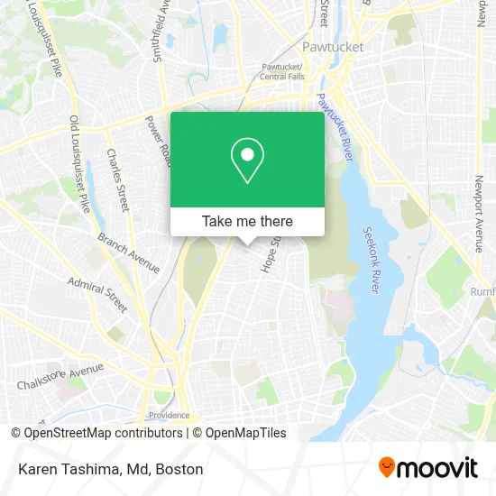
See Karen Tashima, Md, Boston, on the map
Public Transit to Karen Tashima, Md in Boston
Wondering how to get to Karen Tashima, Md in Boston? Moovit helps you find the best way to get to Karen Tashima, Md with step-by-step directions from the nearest public transit station.
Moovit provides free maps and live directions to help you navigate through your city. View schedules, routes, timetables, and find out how long does it take to get to Karen Tashima, Md in real time.
Looking for the nearest stop or station to Karen Tashima, Md? Check out this list of stops closest to your destination: Hope After North; Third Street; Job Lot (Pawtucket); Providence.
Bus: 1, 71, R.Train: PROVIDENCE/STOUGHTON, ACELA, NORTHEAST REGIONAL, PROVIDENCE LINE SHUTTLE, PROVIDENCE LINE SHUTTLE, PROVIDENCE LINE SHUTTLE, FOXBORO EVENT SERVICE.
Want to see if there’s another route that gets you there at an earlier time? Moovit helps you find alternative routes or times. Get directions from and directions to Karen Tashima, Md easily from the Moovit App or Website.
We make riding to Karen Tashima, Md easy, which is why over 1.7 million users, including users in Boston, trust Moovit as the best app for public transit. You don’t need to download an individual bus app or train app, Moovit is your all-in-one transit app that helps you find the best bus time or train time available.
For information on prices of bus and train, costs and ride fares to Karen Tashima, Md, please check the Moovit app.
Use the app to navigate to popular places including to the airport, hospital, stadium, grocery store, mall, coffee shop, school, college, and university.
Karen Tashima, Md Address: 164 Summit Ave street in Boston
- Kolberg Irene NP - Adele R Decof Comprehensive Cancer Center,
- Marie J. Langlois Cafe,
- Vera Bradley,
- Aggarwal, Sucht, MD - Miriam Hospital,
- Miriam Hospital (Miriam Diagnostic Imaging),
- Miriam Hospital EV Charging Station,
- Ri4ctv Studio,
- Sullivan Painting,
- Wholesale Jewelry Supply Co.,
- Rutan, Gailia L,
- Robert Rutley,
- Jewish Collaborative Services of Ri,
- Kerry Kohring Park,
- Western Liquors,
- DUNKIN',
- Azura Vascular Care,
- Coast Locksmith,
- Home & Hospice Care of Ri Philip Hulitar Inpatient Center,
- Hope Hospice & Palliative Care Rhode Island,
- AutoZone
Places Near Karen Tashima, Md (Boston)
- Wilbur Theatre, Boston,
- Seaport District, Boston,
- Massachusetts General Hospital, Boston,
- Wang Theater, Boston,
- Cheers, Boston,
- Td Garden, Boston,
- Prudential Center, Boston,
- Boston Convention & Exhibition Center, Boston,
- Faneuil Hall, Boston,
- Boston Children's Hospital, Boston,
- Boston Common, Boston,
- Museum Of Science, Boston,
- Isabella Stewart Gardner Museum, Boston,
- Boston Medical Center, Boston,
- Leader Bank Pavilion (Leader Bank Pavillion), Boston,
- Quincy Market, Boston,
- North End, Boston,
- House Of Blues, Boston,
- Castle Island, Boston,
- Mgm Music Hall, Boston
How to get to popular places in Boston with public transit
Get around Boston by public transit!
Traveling around Boston has never been so easy. See step by step directions as you travel to any attraction, street or major public transit station. View bus and train schedules, arrival times, service alerts and detailed routes on a map, so you know exactly how to get to anywhere in Boston.
When traveling to any destination around Boston use Moovit's Live Directions with Get Off Notifications to know exactly where and how far to walk, how long to wait for your line, and how many stops are left. Moovit will alert you when it's time to get off — no need to constantly re-check whether yours is the next stop.
Wondering how to use public transit in Boston or how to pay for public transit in Boston? Moovit public transit app can help you navigate your way with public transit easily, and at minimum cost. It includes public transit fees, ticket prices, and costs. Looking for a map of Boston public transit lines? Moovit public transit app shows all public transit maps in Boston with all Bus, Train, Subway and Ferry routes and stops on an interactive map.
Boston has 4 transit type(s), including: Bus, Train, Subway and Ferry, operated by several transit agencies, including MBTA, Southeastern Regional Transit Authority, MetroWest Regional Transit Authority, Rhode Island Public Transit Authority, WRTA, Lowell Regional Transit Authority, Merrimack Valley Transit, Montachusett Regional Transit Authority, Cape Cod Regional Transit Authority, Brockton Area Transit Authority, Martha's Vineyard Transit Authority, the WAVE - Nantucket Regional Transit Authority, GATRA, Cape Ann Transportation Authority and Massport