Directions to Kati Elizabeth Hair Co (Quincy) with public transportation
The following transit lines have routes that pass near Kati Elizabeth Hair Co
 Bus: 215, 245, 217.
- Train: FALL RIVER/NEW BEDFORD, GREENBUSH.
- Subway: RED LINE, MATTAPAN LINE.
How to get to Kati Elizabeth Hair Co by bus?
Click on the bus route to see step by step directions with maps, line arrival times and updated time schedules.
From Shapiro Center, Boston
60 minFrom 240 Mount Vernon Street, Boston
58 minFrom The Westin Boston Waterfront, Boston
94 minFrom Curry College, Milton
52 minFrom JFK Library, Boston
85 minFrom Showa Boston Institute, Boston
53 minFrom SoWa Vintage Market, Boston
71 minFrom Cathedral High School, Boston
69 minFrom Beth Israel Deaconess Medical Center Is, Boston
49 minFrom Boston Convention & Exhibition Center, Boston
88 min
How to get to Kati Elizabeth Hair Co by train?
Click on the train route to see step by step directions with maps, line arrival times and updated time schedules.
From Shapiro Center, Boston
106 minFrom 240 Mount Vernon Street, Boston
82 minFrom The Westin Boston Waterfront, Boston
69 minFrom Curry College, Milton
113 minFrom JFK Library, Boston
100 minFrom SoWa Vintage Market, Boston
73 minFrom Cathedral High School, Boston
78 minFrom Beth Israel Deaconess Medical Center Is, Boston
72 minFrom Boston Convention & Exhibition Center, Boston
74 min
How to get to Kati Elizabeth Hair Co by subway?
Click on the subway route to see step by step directions with maps, line arrival times and updated time schedules.
From Shapiro Center, Boston
58 minFrom 240 Mount Vernon Street, Boston
41 minFrom The Westin Boston Waterfront, Boston
57 minFrom JFK Library, Boston
59 minFrom SoWa Vintage Market, Boston
50 minFrom Cathedral High School, Boston
56 minFrom Beth Israel Deaconess Medical Center Is, Boston
56 minFrom Boston Convention & Exhibition Center, Boston
58 min
Subway stations near Kati Elizabeth Hair Co in Quincy
Bus stops near Kati Elizabeth Hair Co in Quincy
Bus lines to Kati Elizabeth Hair Co in Quincy
What are the closest stations to Kati Elizabeth Hair Co?
The closest stations to Kati Elizabeth Hair Co are:
- North Quincy is 221 yards away, 3 min walk.
- Adams St @ Robertson St is 253 yards away, 3 min walk.
- 77 Robertson St is 267 yards away, 4 min walk.
- Milton is 2946 yards away, 35 min walk.
Which bus lines stop near Kati Elizabeth Hair Co?
These bus lines stop near Kati Elizabeth Hair Co: 215, 245.
Which train lines stop near Kati Elizabeth Hair Co?
These train lines stop near Kati Elizabeth Hair Co: FALL RIVER/NEW BEDFORD, GREENBUSH.
Which subway line stops near Kati Elizabeth Hair Co?
RED LINE (Ashmont/Braintree)
What’s the nearest subway station to Kati Elizabeth Hair Co in Quincy?
The nearest subway station to Kati Elizabeth Hair Co in Quincy is North Quincy. It’s a 3 min walk away.
What’s the nearest bus station to Kati Elizabeth Hair Co in Quincy?
The nearest bus station to Kati Elizabeth Hair Co in Quincy is Adams St @ Robertson St. It’s a 3 min walk away.
What time is the first subway to Kati Elizabeth Hair Co in Quincy?
The MATTAPAN LINE is the first subway that goes to Kati Elizabeth Hair Co in Quincy. It stops nearby at 5:06 AM.
What time is the last subway to Kati Elizabeth Hair Co in Quincy?
The MATTAPAN LINE is the last subway that goes to Kati Elizabeth Hair Co in Quincy. It stops nearby at 2:35 AM.
What time is the first bus to Kati Elizabeth Hair Co in Quincy?
The 215 is the first bus that goes to Kati Elizabeth Hair Co in Quincy. It stops nearby at 5:15 AM.
What time is the last bus to Kati Elizabeth Hair Co in Quincy?
The 215 is the last bus that goes to Kati Elizabeth Hair Co in Quincy. It stops nearby at 1:08 AM.
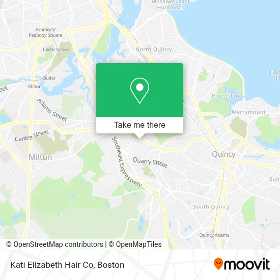
See Kati Elizabeth Hair Co, Quincy, on the map
Public Transit to Kati Elizabeth Hair Co in Quincy
Wondering how to get to Kati Elizabeth Hair Co in Quincy? Moovit helps you find the best way to get to Kati Elizabeth Hair Co with step-by-step directions from the nearest public transit station.
Moovit provides free maps and live directions to help you navigate through your city. View schedules, routes, timetables, and find out how long does it take to get to Kati Elizabeth Hair Co in real time.
Looking for the nearest stop or station to Kati Elizabeth Hair Co? Check out this list of stops closest to your destination: North Quincy; Adams St @ Robertson St; 77 Robertson St; Milton.
Bus: 215, 245, 217.Train: FALL RIVER/NEW BEDFORD, GREENBUSH.Subway: RED LINE, MATTAPAN LINE.
Want to see if there’s another route that gets you there at an earlier time? Moovit helps you find alternative routes or times. Get directions from and directions to Kati Elizabeth Hair Co easily from the Moovit App or Website.
We make riding to Kati Elizabeth Hair Co easy, which is why over 1.7 million users, including users in Quincy, trust Moovit as the best app for public transit. You don’t need to download an individual bus app or train app, Moovit is your all-in-one transit app that helps you find the best bus time or train time available.
For information on prices of bus, subway and train, costs and ride fares to Kati Elizabeth Hair Co, please check the Moovit app.
Use the app to navigate to popular places including to the airport, hospital, stadium, grocery store, mall, coffee shop, school, college, and university.
Kati Elizabeth Hair Co Address: 646 Adams St street in Quincy
- The Color Bar,
- Keyme Locksmiths,
- Quincy AAA RMV,
- Montilios Quincy,
- Amazon Locker-Rulo,
- AAA,
- Locksmith Day And Night,
- Care Dental,
- Care Dental Implants & Invisalign Center,
- Bright Horizons,
- United Scientific,
- Brick & Beam Fruity Toot Tootskis,
- Crime Scene Cleanup Massachusetts,
- Paintzen,
- Larry Moreton Fence Co.,
- Quincy Youth Baseball & Softball,
- Atm Walgreens,
- TD Bank Atm,
- In Sync Dance,
- Tello Jorge MD
Places Near Kati Elizabeth Hair Co (Quincy)
- North End, Boston,
- Seaport District, Boston,
- Prudential Center, Boston,
- Castle Island, Boston,
- Wilbur Theatre, Boston,
- Wang Theater, Boston,
- Mgm Music Hall, Boston,
- Boston Convention & Exhibition Center, Boston,
- Boston Children's Hospital, Boston,
- Leader Bank Pavilion (Leader Bank Pavillion), Boston,
- Faneuil Hall, Boston,
- Boston Common, Boston,
- Td Garden, Boston,
- Boston Medical Center, Boston,
- House Of Blues, Boston,
- Isabella Stewart Gardner Museum, Boston,
- Museum Of Science, Boston,
- Cheers, Boston,
- Quincy Market, Boston,
- Massachusetts General Hospital, Boston
How to get to popular places in Boston with public transit
Get around Quincy by public transit!
Traveling around Quincy has never been so easy. See step by step directions as you travel to any attraction, street or major public transit station. View bus and train schedules, arrival times, service alerts and detailed routes on a map, so you know exactly how to get to anywhere in Quincy.
When traveling to any destination around Quincy use Moovit's Live Directions with Get Off Notifications to know exactly where and how far to walk, how long to wait for your line, and how many stops are left. Moovit will alert you when it's time to get off — no need to constantly re-check whether yours is the next stop.
Wondering how to use public transit in Quincy or how to pay for public transit in Quincy? Moovit public transit app can help you navigate your way with public transit easily, and at minimum cost. It includes public transit fees, ticket prices, and costs. Looking for a map of Quincy public transit lines? Moovit public transit app shows all public transit maps in Quincy with all Bus, Train, Subway and Ferry routes and stops on an interactive map.
Boston has 4 transit type(s), including: Bus, Train, Subway and Ferry, operated by several transit agencies, including MBTA, Southeastern Regional Transit Authority, MetroWest Regional Transit Authority, Rhode Island Public Transit Authority, WRTA, Lowell Regional Transit Authority, Merrimack Valley Transit, Montachusett Regional Transit Authority, Cape Cod Regional Transit Authority, Brockton Area Transit Authority, Martha's Vineyard Transit Authority, the WAVE - Nantucket Regional Transit Authority, GATRA, Cape Ann Transportation Authority and Massport