Directions to Kay Lee Kim, Md (Boston) with public transportation
The following transit lines have routes that pass near Kay Lee Kim, Md
 Bus: EMERSON HOSPITAL SHUTTLE.
- Train: FITCHBURG.
Bus stop near Kay Lee Kim, Md in Boston
- Concord/Emerson Hospital-Main Entrance, 6 min walk,VIEW
Train station near Kay Lee Kim, Md in Boston
- West Concord, 21 min walk,VIEW
Bus lines to Kay Lee Kim, Md in Boston
- EMERSON HOSPITAL SHUTTLE, Emerson Hospital Center For Specialty Care,VIEW
- Emerson Hospital,
- Emerson Hospital - Main Campus,
- Massachusetts General Hospital,
- Bigelow Woods And Hubbard Brook Conservation Area,
- Hubbard Brook Farmfield,
- Citizens Bank & Trust,
- Chase,
- Hudson National Bank,
- Bruce Freeman Rrail Trail West Concord,
- Diamond Psychiatric Care,
- Gallagher Insurance, Risk Management & Consulting,
- Sandeep Rajguru - Chase Home Lending Advisor - NMLS ID,
- Earle Pughe,
- Doodycalls of Boston Metrowest,
- Spec Engineering,
- Shipe Consulting Group,
- Cambridge Center-Behavioral,
- Salubris Muscular Therapy,
- Director of Operations,
- Association of Raytheon Retirees
Places Near Kay Lee Kim, Md (Boston)
- Boston Medical Center, Boston,
- Cheers, Boston,
- Castle Island, Boston,
- Boston Children's Hospital, Boston,
- Wang Theater, Boston,
- Td Garden, Boston,
- Isabella Stewart Gardner Museum, Boston,
- Wilbur Theatre, Boston,
- Mgm Music Hall, Boston,
- Leader Bank Pavilion (Leader Bank Pavillion), Boston,
- North End, Boston,
- Prudential Center, Boston,
- Faneuil Hall, Boston,
- Boston Common, Boston,
- Seaport District, Boston,
- House Of Blues, Boston,
- Museum Of Science, Boston,
- Quincy Market, Boston,
- Boston Convention & Exhibition Center, Boston,
- Massachusetts General Hospital, Boston
How to get to popular places in Boston with public transit
What are the closest stations to Kay Lee Kim, Md?
The closest stations to Kay Lee Kim, Md are:
- Concord/Emerson Hospital-Main Entrance is 465 yards away, 6 min walk.
- West Concord is 1772 yards away, 21 min walk.
Which train line stops near Kay Lee Kim, Md?
FITCHBURG (#409 | Wachusett)
What’s the nearest train station to Kay Lee Kim, Md in Boston?
The nearest train station to Kay Lee Kim, Md in Boston is West Concord. It’s a 21 min walk away.
What’s the nearest bus station to Kay Lee Kim, Md in Boston?
The nearest bus station to Kay Lee Kim, Md in Boston is Concord/Emerson Hospital-Main Entrance. It’s a 6 min walk away.
What time is the first train to Kay Lee Kim, Md in Boston?
The FITCHBURG is the first train that goes to Kay Lee Kim, Md in Boston. It stops nearby at 5:11 AM.
What time is the last train to Kay Lee Kim, Md in Boston?
The FITCHBURG is the last train that goes to Kay Lee Kim, Md in Boston. It stops nearby at 12:33 AM.
What time is the first bus to Kay Lee Kim, Md in Boston?
The EMERSON HOSPITAL SHUTTLE is the first bus that goes to Kay Lee Kim, Md in Boston. It stops nearby at 7:53 AM.
What time is the last bus to Kay Lee Kim, Md in Boston?
The EMERSON HOSPITAL SHUTTLE is the last bus that goes to Kay Lee Kim, Md in Boston. It stops nearby at 4:10 PM.
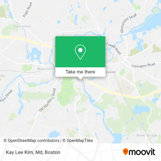
See Kay Lee Kim, Md, Boston, on the map
Public Transit to Kay Lee Kim, Md in Boston
Wondering how to get to Kay Lee Kim, Md in Boston? Moovit helps you find the best way to get to Kay Lee Kim, Md with step-by-step directions from the nearest public transit station.
Moovit provides free maps and live directions to help you navigate through your city. View schedules, routes, timetables, and find out how long does it take to get to Kay Lee Kim, Md in real time.
Looking for the nearest stop or station to Kay Lee Kim, Md? Check out this list of stops closest to your destination: Concord/Emerson Hospital-Main Entrance; West Concord.
Bus: EMERSON HOSPITAL SHUTTLE.Train: FITCHBURG.
Want to see if there’s another route that gets you there at an earlier time? Moovit helps you find alternative routes or times. Get directions from and directions to Kay Lee Kim, Md easily from the Moovit App or Website.
We make riding to Kay Lee Kim, Md easy, which is why over 1.7 million users, including users in Boston, trust Moovit as the best app for public transit. You don’t need to download an individual bus app or train app, Moovit is your all-in-one transit app that helps you find the best bus time or train time available.
For information on prices of train, bus and subway, costs and ride fares to Kay Lee Kim, Md, please check the Moovit app.
Use the app to navigate to popular places including to the airport, hospital, stadium, grocery store, mall, coffee shop, school, college, and university.
Kay Lee Kim, Md Address: 131 Old Road to 9 Acre Corner, Ste 330 street in Boston
Get around Boston by public transit!
Traveling around Boston has never been so easy. See step by step directions as you travel to any attraction, street or major public transit station. View bus and train schedules, arrival times, service alerts and detailed routes on a map, so you know exactly how to get to anywhere in Boston.
When traveling to any destination around Boston use Moovit's Live Directions with Get Off Notifications to know exactly where and how far to walk, how long to wait for your line, and how many stops are left. Moovit will alert you when it's time to get off — no need to constantly re-check whether yours is the next stop.
Wondering how to use public transit in Boston or how to pay for public transit in Boston? Moovit public transit app can help you navigate your way with public transit easily, and at minimum cost. It includes public transit fees, ticket prices, and costs. Looking for a map of Boston public transit lines? Moovit public transit app shows all public transit maps in Boston with all Bus, Train, Subway and Ferry routes and stops on an interactive map.
Boston has 4 transit type(s), including: Bus, Train, Subway and Ferry, operated by several transit agencies, including MBTA, Southeastern Regional Transit Authority, MetroWest Regional Transit Authority, Rhode Island Public Transit Authority, WRTA, Lowell Regional Transit Authority, Merrimack Valley Transit, Montachusett Regional Transit Authority, Cape Cod Regional Transit Authority, Brockton Area Transit Authority, Martha's Vineyard Transit Authority, the WAVE - Nantucket Regional Transit Authority, GATRA, Cape Ann Transportation Authority and Massport