How to get to Kayacity by bus?
Click on the bus route to see step by step directions with maps, line arrival times and updated time schedules.
From mall of istanbul, Küçükçekmece
90 minFrom Esenler Otogar, Basaksehir
81 minFrom Sultangazi Nikah Salonu, Sultangazi
69 minFrom bağcılar eğitim araştırma hastanesi, Bagcilar
94 minFrom Tema İstanbul, Küçükçekmece
87 minFrom Başakşehir Metrobüs durağı, Basaksehir
70 minFrom SULTANGAZİ, Sultangazi
65 minFrom Fatih Mahallesi, Bagcilar
90 minFrom Oruç Reis, Esenler
103 minFrom Tekstilkent, Esenler
73 min
How to get to Kayacity by metro?
Click on the metro route to see step by step directions with maps, line arrival times and updated time schedules.
Bus stops near Kayacity in Basaksehir
Dolmus & Minibus station near Kayacity in Basaksehir
- Fenertepe - Sultançiftliği Yönü, 16 min walk,VIEW
Metro station near Kayacity in Basaksehir
- Onurkent, 36 min walk,VIEW
Bus lines to Kayacity in Basaksehir
- A47, Başakşehir Çam Sakura Şehir Hastanesi,VIEW
- MK22, Taşoluk Peronlar-Şehir Hastanesi,VIEW
- 36F, Cebeci Peronlar-Olimpiyatköy Metro,VIEW
- 78E, Merkez Kayaşehir-Başakşehir Metrokent,VIEW
- 78F, Fenertepe Peronlar-Başakşehir Metrokent,VIEW
- 79F, Fenertepe Peronlar-Kayaşehir,VIEW
- 79FY, Fenertepe Peronlar-Yenibosna Metro,VIEW
- 79GE, Eminönü-Osmanlı Caddesi,VIEW
- 79KM, Kayaşehir-Mecidiyeköy Metrobüs,VIEW
- 79KT, Tekstilkent-Giyimkent Metro İstasyonu-Kayabaşı Kiptaş Peron,VIEW
- 98, Bakırköy-Fenertepe Peronlar,VIEW
- 98KM, Fenertepe Peronlar-Fenertepe Yolu,VIEW
- 78Ş, Aşık Veysel Caddesi-Fenertepe Peronlar,VIEW
- MK31, K.S.S Hastanesi-Başakşehir/Fenertepe Peron,VIEW
- 78B, Fenertepe Peron/Başakşehir - Yenibosna Metro,VIEW
- 78C, Yunus Emre Mahallesi - Fenertepe,VIEW
- 78G, Fenertepe Peron/Başakşehir - Kayaşehir,VIEW
- 78H, Fenertepe Peron/Başakşehir - Eminönü,VIEW
- 78K, Fenertepe Peron/Başakşehır-K.S.S. Hastanesi,VIEW
- 78ZB, Fenertepe Peron/Başakşehir - Zeytinburnu,VIEW
What are the closest stations to Kayacity?
The closest stations to Kayacity are:
- 13. Bölge - Kayaşehir Yönü is 311 meters away, 5 min walk.
- 13. Bölge - Fenertepe Yönü is 311 meters away, 5 min walk.
- Fenertepe - Sultançiftliği Yönü is 1212 meters away, 16 min walk.
- İbn Haldun Üniversitesi - Fenertepe Yönü is 1628 meters away, 21 min walk.
- Onurkent is 2796 meters away, 36 min walk.
Which bus lines stop near Kayacity?
These bus lines stop near Kayacity: 36F, 79F, 79KM, 79KT, 98KM.
Which metro line stops near Kayacity?
M3 (Bakırköy Sahil→Kayaşehir Merkez)
Which Dolmus & Minibus line stops near Kayacity?
A47 (-Halkalı)
What’s the nearest bus station to Kayacity in Basaksehir?
The nearest bus stations to Kayacity in Basaksehir are 13. Bölge - Kayaşehir Yönü and 13. Bölge - Fenertepe Yönü. The closest one is a 5 min walk away.
What’s the nearest Dolmus & Minibus station to Kayacity in Basaksehir?
The nearest Dolmus & Minibus station to Kayacity in Basaksehir is Fenertepe - Sultançiftliği Yönü. It’s a 16 min walk away.
What time is the first metro to Kayacity in Basaksehir?
The M3 is the first metro that goes to Kayacity in Basaksehir. It stops nearby at 6:06 AM.
What time is the last metro to Kayacity in Basaksehir?
The M3 is the last metro that goes to Kayacity in Basaksehir. It stops nearby at 12:34 AM.
What time is the first bus to Kayacity in Basaksehir?
The 98 is the first bus that goes to Kayacity in Basaksehir. It stops nearby at 5:18 AM.
What time is the last bus to Kayacity in Basaksehir?
The 98 is the last bus that goes to Kayacity in Basaksehir. It stops nearby at 2:09 AM.
What time is the first Dolmus & Minibus to Kayacity in Basaksehir?
The A47 is the first Dolmus & Minibus that goes to Kayacity in Basaksehir. It stops nearby at 6:15 AM.
What time is the last Dolmus & Minibus to Kayacity in Basaksehir?
The A15 is the last Dolmus & Minibus that goes to Kayacity in Basaksehir. It stops nearby at 1:24 AM.
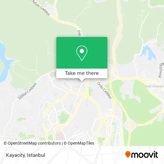
See Kayacity, Basaksehir, on the map
Public Transit to Kayacity in Basaksehir
Wondering how to get to Kayacity in Basaksehir? Moovit helps you find the best way to get to Kayacity with step-by-step directions from the nearest public transit station.
Moovit provides free maps and live directions to help you navigate through your city. View schedules, routes, timetables, and find out how long does it take to get to Kayacity in real time.
Looking for the nearest stop or station to Kayacity? Check out this list of stops closest to your destination: 13. Bölge - Kayaşehir Yönü; 13. Bölge - Fenertepe Yönü; Fenertepe - Sultançiftliği Yönü; İbn Haldun Üniversitesi - Fenertepe Yönü; Onurkent.
Bus: 36F, 79F, 79KM, 79KT, 98KM, 78Ş, A47, MK22, 78E, 78F, MK31, 78B, 78C, 78G, 78H.Metro: M3.Dolmus & Minibus: A47, A15.
Want to see if there’s another route that gets you there at an earlier time? Moovit helps you find alternative routes or times. Get directions from and directions to Kayacity easily from the Moovit App or Website.
We make riding to Kayacity easy, which is why over 1.5 million users, including users in Basaksehir, trust Moovit as the best app for public transit. You don’t need to download an individual bus app or train app, Moovit is your all-in-one transit app that helps you find the best bus time or train time available.
For information on prices of bus, metro and Dolmus & Minibus, costs and ride fares to Kayacity, please check the Moovit app.
Use the app to navigate to popular places including to the airport, hospital, stadium, grocery store, mall, coffee shop, school, college, and university.
Location: Basaksehir, Istanbul
- Kayasehir,
- Kayaşehir 13.Bölge Otobüs Durağı,
- toki osmangazi iöo iettt durağı,
- Toki Osmangazi İlkokulu,
- Başakşehir Toki Osmangazi İlkokulu,
- Botanik Sokağı,
- Kayabaşı Mahallesi,
- Fenertepe Şok Market,
- Toki Konutları 13.Bölge,
- Kayaşehir 13.Bölge Acar Market,
- Halk Market,
- Kayaşehir 21.bölge spor parkı (S O N İ M İ M P A R A T O R),
- Beşiktaş Karakolu,
- Toki Celalettin Ökten Anadolu İmam Hatip Lisesi,
- 21.Bölge Spor Parkı,
- Rüyalar Alemi,
- Turgut Özal İmamhatip Ortaokulu,
- Fenertepe Cad., 14. Bölge 10,
- Gazi Süleyman Paşa Camii,
- Toki Ertuğrul Gazi İmam Hatip Ortaokulu
Places Near Kayacity (Basaksehir)
- Mehmet Emin Tokadî Hz. Türbesi, Fatih,
- Topkule Kışlası 47.Komando Tugay Komutanlığı, Esenler,
- Şehit Prof. Dr. İlhan Varank Eğitim Ve Araştırma Hastanesi, Sancaktepe,
- VİALAND AVM, Eyüp,
- Gebze-Harem Minibüs Hattı, Gebze,
- 2 Nolu Minibüss, Beylikduzu,
- İstinye Park, Sariyer,
- Bakırköy Sosyete Pazarı, Bakirköy,
- İstanbul,
- 41 Burda AVM, Kocaeli Merkezi,
- Mall Of İstanbul, Basaksehir,
- Karaköy Genelevi, Karaköy, Beyoğlu,
- METROPOL IsTaNBuL, Ataşehir,
- Hilltown AVM, Maltepe,
- Beylikdüzü - 4 Nolu Minibüs Hattı, Beylikduzu,
- Başakşehir Çam Ve Sakura Şehir Hastanesi, Basaksehir,
- 212 AVM, Bagcilar,
- Gebze Koop Durağı, Gebze,
- Hz. Yuşa Tepesi, Beykoz,
- Tersane İstanbul, Beyoğlu
How to get to popular places in Istanbul with public transit
Get around Basaksehir by public transit!
Traveling around Basaksehir has never been so easy. See step by step directions as you travel to any attraction, street or major public transit station. View bus and train schedules, arrival times, service alerts and detailed routes on a map, so you know exactly how to get to anywhere in Basaksehir.
When traveling to any destination around Basaksehir use Moovit's Live Directions with Get Off Notifications to know exactly where and how far to walk, how long to wait for your line, and how many stops are left. Moovit will alert you when it's time to get off — no need to constantly re-check whether yours is the next stop.
Wondering how to use public transit in Basaksehir or how to pay for public transit in Basaksehir? Moovit public transit app can help you navigate your way with public transit easily, and at minimum cost. It includes public transit fees, ticket prices, and costs. Looking for a map of Basaksehir public transit lines? Moovit public transit app shows all public transit maps in Basaksehir with all Bus, Train, Metro, Tram, Ferry, Metrobus and Dolmus & Minibus routes and stops on an interactive map.
Istanbul has 7 transit type(s), including: Bus, Train, Metro, Tram, Ferry, Metrobus and Dolmus & Minibus, operated by several transit agencies, including Marmaray, Metro İstanbul, Metrobüs, UAB, İETT, İETT ÇIFT KATLI HATLAR, İETT BÖLGESEL HATLAR, TCDD, Şehir Hatları, Dentur Avrasya, Beyden, Turyol, Mavi Marmara, Havaist and Prenstur
