Directions to Keelesdale (Toronto) with public transportation
The following transit lines have routes that pass near Keelesdale
How to get to Keelesdale by bus?
Click on the bus route to see step by step directions with maps, line arrival times and updated time schedules.
How to get to Keelesdale by train?
Click on the train route to see step by step directions with maps, line arrival times and updated time schedules.
How to get to Keelesdale by subway?
Click on the subway route to see step by step directions with maps, line arrival times and updated time schedules.
Bus lines to Keelesdale in Toronto
- 32,Eglinton Station,
- 32D,Eglinton West Station,
- 332,Yonge St at Berwick Ave,
What are the closest stations to Keelesdale?
The closest stations to Keelesdale are:
- Eglinton Ave West at Keele St/Trethewey Dr is 22 meters away, 1 min walk.
Which bus lines stop near Keelesdale?
These bus lines stop near Keelesdale: 32, 41.
Which train line stops near Keelesdale?
UP
Which subway line stops near Keelesdale?
1
What’s the nearest bus stop to Keelesdale in Toronto?
The nearest bus stop to Keelesdale in Toronto is Eglinton Ave West at Keele St/Trethewey Dr. It’s a 1 min walk away.
See Keelesdale, Toronto, on the map
Own work
Public Transit to Keelesdale in Toronto
Wondering how to get to Keelesdale in Toronto, Canada? Moovit helps you find the best way to get to Keelesdale with step-by-step directions from the nearest public transit station.
Moovit provides free maps and live directions to help you navigate through your city. View schedules, routes, timetables, and find out how long does it take to get to Keelesdale in real time.
Looking for the nearest stop or station to Keelesdale? Check out this list of stops closest to your destination: Eglinton Ave West at Keele St/Trethewey Dr.
Bus: 32, 41, 32D, 332.Train: UP.Subway: 1.
Want to see if there’s another route that gets you there at an earlier time? Moovit helps you find alternative routes or times. Get directions from and directions to Keelesdale easily from the Moovit App or Website.
We make riding to Keelesdale easy, which is why over 1.5 million users, including users in Toronto, trust Moovit as the best app for public transit. You don’t need to download an individual bus app or train app, Moovit is your all-in-one transit app that helps you find the best bus time or train time available.
For information on prices of bus, subway, train and Streetcar, costs and ride fares to Keelesdale, please check the Moovit app.
Use the app to navigate to popular places including to the airport, hospital, stadium, grocery store, mall, coffee shop, school, college, and university.
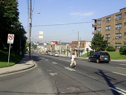
Keelesdale Address: Keele Street street in Toronto
Own work
Attractions near Keelesdale
Keele Street,TD Bank Financial Group,Timothy's World Coffee,1852 Keele Street,Miami Nails,Dollar Tree,2 Trethewey Drive,2690 Eglinton Avenue West,Keelesdale Station,A & G West Indies Food,York Village Butcher Shop & Delicatessen,Metro Pizza & Chicken,Wally's NFLD Products,Christ Embassy Church,M6M,El Nahual tacos,Eglinton Ave West at Keele St,66 Yarrow Rd,245 Bicknell Avenue,Warbucks, Harvey W ODHow to get to popular attractions in Toronto with public transit
Holiday Inn Express Toronto Downtown Hotel Toronto, Toronto,Victoria Street, Toronto,Lambton College Mississauga, Mississauga,2 Bloor Street East, Toronto,Shops At Don Mills, Toronto,Mattamy Athletic Centre, Toronto,U of T-Scarborough, Toronto,Costco Wholesale, Toronto,Scotiabank, Toronto,GO Bus Stop - Yonge Street And Innisfil Beach Rd, Innisfil,The Beaches, Toronto,Hwy 407 & Pine Valley dr., Vaughan,Toronto Congress Centre, Toronto,One Of A Kind Show, Toronto,GO Bus 40 Richmond Hill-Pearson, Richmond Hill,Seneca@York Campus, Toronto,Hart House Theatre, Toronto,Region of Waterloo International Airport (YKF), Woolwich,Bolton, Caledon,47 Sheppard Ave, TorontoGet around Toronto by public transit!
Traveling around Toronto has never been so easy. See step by step directions as you travel to any attraction, street or major public transit station. View bus and train schedules, arrival times, service alerts and detailed routes on a map, so you know exactly how to get to anywhere in Toronto.
When traveling to any destination around Toronto use Moovit's Live Directions with Get Off Notifications to know exactly where and how far to walk, how long to wait for your line, and how many stops are left. Moovit will alert you when it's time to get off — no need to constantly re-check whether yours is the next stop.
Wondering how to use public transit in Toronto or how to pay for public transit in Toronto? Moovit public transit app can help you navigate your way with public transit easily, and at minimum cost. It includes public transit fees, ticket prices, and costs. Looking for a map of Toronto public transit lines? Moovit public transit app shows all public transit maps in Toronto with all Bus, Train, Subway, Streetcar and Ferry routes and stops on an interactive map.
Toronto has 5 transit type(s), including: Bus, Train, Subway, Streetcar and Ferry, operated by several transit agencies, including TTC, TTC Streetcar, Toronto Subway, GO Transit Bus, GO Transit, Amtrak, York Region Transit, Grand River Transit, Guelph Transit, grt, Hamilton Street Railway, MiWay, Brampton Transit, Burlington Transit, Oakville Transit