Directions to Keep Randolph Beautiful with public transportation
The following transit lines have routes that pass near Keep Randolph Beautiful
 Bus: 12, 238, 240.
- Train: FALL RIVER/NEW BEDFORD.
How to get to Keep Randolph Beautiful by bus?
Click on the bus route to see step by step directions with maps, line arrival times and updated time schedules.
How to get to Keep Randolph Beautiful by train?
Click on the train route to see step by step directions with maps, line arrival times and updated time schedules.
Bus stops near Keep Randolph Beautiful
What are the closest stations to Keep Randolph Beautiful?
The closest stations to Keep Randolph Beautiful are:
- North Main St And Memorial Pkwy is 344 yards away, 5 min walk.
- N Main St Opp Memorial Pkwy is 359 yards away, 5 min walk.
Which bus lines stop near Keep Randolph Beautiful?
These bus lines stop near Keep Randolph Beautiful: 12, 238, 240.
Which train line stops near Keep Randolph Beautiful?
FALL RIVER/NEW BEDFORD (#1909 | Fall River)
What’s the nearest bus station to Keep Randolph Beautiful?
The nearest bus stations to Keep Randolph Beautiful are North Main St And Memorial Pkwy and N Main St Opp Memorial Pkwy. The closest one is a 5 min walk away.
What time is the first bus to Keep Randolph Beautiful?
The 240 is the first bus that goes to Keep Randolph Beautiful. It stops nearby at 4:40 AM.
What time is the last bus to Keep Randolph Beautiful?
The 240 is the last bus that goes to Keep Randolph Beautiful. It stops nearby at 12:42 AM.
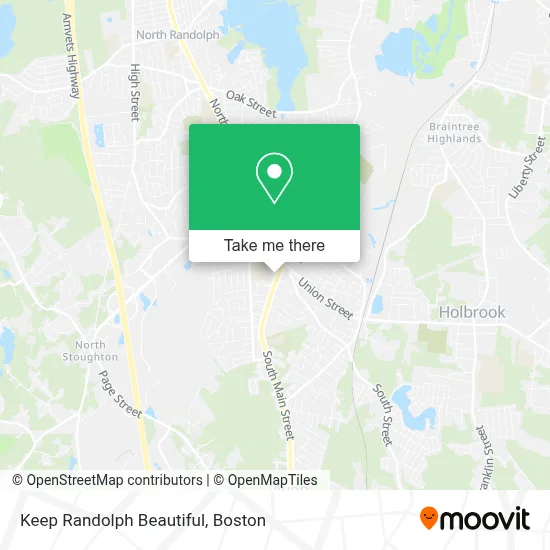
See Keep Randolph Beautiful on the map
Public Transportation to Keep Randolph Beautiful
Wondering how to get to Keep Randolph Beautiful? Moovit helps you find the best way to get to Keep Randolph Beautiful with step-by-step directions from the nearest public transit station.
Moovit provides free maps and live directions to help you navigate through your city. View schedules, routes, timetables, and find out how long does it take to get to Keep Randolph Beautiful in real time.
Looking for the nearest stop or station to Keep Randolph Beautiful? Check out this list of stops closest to your destination: North Main St And Memorial Pkwy; N Main St Opp Memorial Pkwy.
Bus: 12, 238, 240.Train: FALL RIVER/NEW BEDFORD.
Want to see if there’s another route that gets you there at an earlier time? Moovit helps you find alternative routes or times. Get directions from and directions to Keep Randolph Beautiful easily from the Moovit App or Website.
We make riding to Keep Randolph Beautiful easy, which is why over 1.7 million users, including users in Randolph, trust Moovit as the best app for public transit. You don’t need to download an individual bus app or train app, Moovit is your all-in-one transit app that helps you find the best bus time or train time available.
For information on prices of bus, train and subway, costs and ride fares to Keep Randolph Beautiful, please check the Moovit app.
Use the app to navigate to popular places including to the airport, hospital, stadium, grocery store, mall, coffee shop, school, college, and university.
Keep Randolph Beautiful Address: 41 S Main St street in Randolph
- Bank of Braintree,
- ATM,
- Atlantic Chimney,
- Milton Hospital,
- Eaton Painting & Repairs,
- Board of Health,
- Building Inspector,
- First Ucc Randolph God Squad,
- Randolph Fire,
- Randolph MA USA,
- Duct Man,
- Igbo House,
- Igbo Organization of New England,
- Harsfield Scott L, DMD,
- Crawford Square, Randolph,
- TMW- 1235ma,
- Yamiyaki,
- Teada Cafe,
- Kiss Her Boutique,
- Almighty Fitness Inc
Places Near Keep Randolph Beautiful
- Leader Bank Pavilion (Leader Bank Pavillion), Boston,
- Museum Of Science, Boston,
- Mgm Music Hall, Boston,
- Boston Common, Boston,
- Castle Island, Boston,
- House Of Blues, Boston,
- Boston Children's Hospital, Boston,
- Td Garden, Boston,
- Quincy Market, Boston,
- North End, Boston,
- Prudential Center, Boston,
- Cheers, Boston,
- Boston Convention & Exhibition Center, Boston,
- Wang Theater, Boston,
- Seaport District, Boston,
- Massachusetts General Hospital, Boston,
- Boston Medical Center, Boston,
- Isabella Stewart Gardner Museum, Boston,
- Faneuil Hall, Boston,
- Wilbur Theatre, Boston
How to get to popular places in Boston with public transit
Get around Randolph by public transit!
Traveling around Randolph has never been so easy. See step by step directions as you travel to any attraction, street or major public transit station. View bus and train schedules, arrival times, service alerts and detailed routes on a map, so you know exactly how to get to anywhere in Randolph.
When traveling to any destination around Randolph use Moovit's Live Directions with Get Off Notifications to know exactly where and how far to walk, how long to wait for your line, and how many stops are left. Moovit will alert you when it's time to get off — no need to constantly re-check whether yours is the next stop.
Wondering how to use public transit in Randolph or how to pay for public transit in Randolph? Moovit public transit app can help you navigate your way with public transit easily, and at minimum cost. It includes public transit fees, ticket prices, and costs. Looking for a map of Randolph public transit lines? Moovit public transit app shows all public transit maps in Randolph with all Bus, Train, Subway and Ferry routes and stops on an interactive map.
Boston has 4 transit type(s), including: Bus, Train, Subway and Ferry, operated by several transit agencies, including MBTA, Southeastern Regional Transit Authority, MetroWest Regional Transit Authority, Rhode Island Public Transit Authority, WRTA, Lowell Regional Transit Authority, Merrimack Valley Transit, Montachusett Regional Transit Authority, Cape Cod Regional Transit Authority, Brockton Area Transit Authority, Martha's Vineyard Transit Authority, the WAVE - Nantucket Regional Transit Authority, GATRA, Cape Ann Transportation Authority and Massport