See Kef Airport, Sandgerði, on the map
Directions to Kef Airport (Sandgerði) with public transportation
The following transit lines have routes that pass near Kef Airport
 Bus:
Bus:
How to get to Kef Airport by bus?
Click on the bus route to see step by step directions with maps, line arrival times and updated time schedules.
Bus stations near Kef Airport in Sandgerði
- Kef - Airport (Arrivals),17 min walk,
Bus lines to Kef Airport in Sandgerði
- 55,Fjörður,
What are the closest stations to Kef Airport?
The closest stations to Kef Airport are:
- Kef - Airport (Arrivals) is 1138 meters away, 17 min walk.
Which bus line stops near Kef Airport?
55
What time is the first bus to Kef Airport in Sandgerði?
The 55 is the first bus that goes to Kef Airport in Sandgerði. It stops nearby at 6:35 AM.
What time is the last bus to Kef Airport in Sandgerði?
The 55 is the last bus that goes to Kef Airport in Sandgerði. It stops nearby at 12:38 AM.
See Kef Airport, Sandgerði, on the map
Public Transit to Kef Airport in Sandgerði
Wondering how to get to Kef Airport in Sandgerði, Iceland? Moovit helps you find the best way to get to Kef Airport with step-by-step directions from the nearest public transit station.
Moovit provides free maps and live directions to help you navigate through your city. View schedules, routes, timetables, and find out how long does it take to get to Kef Airport in real time.
Looking for the nearest stop or station to Kef Airport? Check out this list of stops closest to your destination: Kef - Airport (Arrivals).
Bus:
Want to see if there’s another route that gets you there at an earlier time? Moovit helps you find alternative routes or times. Get directions from and directions to Kef Airport easily from the Moovit App or Website.
We make riding to Kef Airport easy, which is why over 1.5 million users, including users in Sandgerði, trust Moovit as the best app for public transit. You don’t need to download an individual bus app or train app, Moovit is your all-in-one transit app that helps you find the best bus time or train time available.
For information on prices of bus, costs and ride fares to Kef Airport, please check the Moovit app.
Use the app to navigate to popular places including to the airport, hospital, stadium, grocery store, mall, coffee shop, school, college, and university.
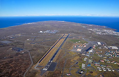
Kef Airport Address: Kjóavöllur street in Sandgerði
Attractions near Kef Airport
Keflavík-P1 Skammtímastæði,Keflavíkurflugvöllur P1 - Skammtímastæði,Airport Hotel Aurora Star,Europcar,SBARRO,Interrent Keflavík Airport,LOTUS Car Rental Iceland,Bílal Akureyrar Höldur-Return-Kef,Keflavik International Airport (KEF),66 North,Keflavik International Airport / Keflavíkurflugvöllur ,Icelandair Saga Lounge,Nearby Airports,Pure Food Hall,Aurora Hotel at Reykjavik Keflavik Airport Terminal KEF Keflavík,Thrifty Car Rental,Komur,Baggage Claim,Joe & the Juice,Iceland Private Taxi - AirportHow to get to popular attractions in Sandgerði with public transit
Ásbrú, Reykjanesbær,Gryfjan Vape Shop, Reykjavík,Hótel Vellir, Hafnarfjörður,Nova Kringlan, Reykjavík,Strætó Leið 2, Kópavogur,Árbær, Reykjavík,Igdlo Guesthouse, Reykjavík,University of Iceland (Háskóli Íslands), Reykjavík,Valhöll, Reykjavík,Keflavík, Reykjanesbær,Keflavik International Airport (KEF) (Keflavíkurflugvöllur), Sandgerði,Hjartagarðurinn, Reykjavík,Reykjavík Lights Hotel, Reykjavík,Brim Hotel, Reykjavík,Reykjavik Residence Hotel, Reykjavík,Ártúnsbrekka, Reykjavík,Silfurhlið, Reykjanesbær,RE Bus To Blue Lagoon, Reykjavík,Fjörður,SnæfellGet around Sandgerði by public transit!
Traveling around Sandgerði has never been so easy. See step by step directions as you travel to any attraction, street or major public transit station. View bus and train schedules, arrival times, service alerts and detailed routes on a map, so you know exactly how to get to anywhere in Sandgerði.
When traveling to any destination around Sandgerði use Moovit's Live Directions with Get Off Notifications to know exactly where and how far to walk, how long to wait for your line, and how many stops are left. Moovit will alert you when it's time to get off — no need to constantly re-check whether yours is the next stop.
Wondering how to use public transit in Sandgerði or how to pay for public transit in Sandgerði? Moovit public transit app can help you navigate your way with public transit easily, and at minimum cost. It includes public transit fees, ticket prices, and costs. Looking for a map of Sandgerði public transit lines? Moovit public transit app shows all public transit maps in Sandgerði with all bus routes and stops on an interactive map.
Sandgerði has 1 transit type(s), including: bus, operated by several transit agencies, including Strætó bs.