Directions to Kemayoran International Airport (Jakarta Pusat) with public transportation
The following transit lines have routes that pass near Kemayoran International Airport
How to get to Kemayoran International Airport by bus?
Click on the bus route to see step by step directions with maps, line arrival times and updated time schedules.
How to get to Kemayoran International Airport by train?
Click on the train route to see step by step directions with maps, line arrival times and updated time schedules.
Bus stations near Kemayoran International Airport in Jakarta Pusat
- Jalan Angkasa Bundaran Kemayoran,5 min walk,
- Mgk Kemayoran,5 min walk,
- DAMRI Kemayoran,7 min walk,
- Benyamin 2,8 min walk,
- Kemayoran,10 min walk,
Train stations near Kemayoran International Airport in Jakarta Pusat
- Kemayoran,18 min walk,
Bus lines to Kemayoran International Airport in Jakarta Pusat
- JAK33,Pulo Gadung,
- JAK120,Terminal Muara Angke,
- JAK76,ASMI 2,
- JAC KEMAYORAN,Pool DAMRI Kemayoran,
- M53,Pulo Gadung,
- 14,Jakarta International Stadium,
- 14B,Tanjung Priok,
- M14,Senen,
What are the closest stations to Kemayoran International Airport?
The closest stations to Kemayoran International Airport are:
- Jalan Angkasa Bundaran Kemayoran is 325 meters away, 5 min walk.
- Mgk Kemayoran is 330 meters away, 5 min walk.
- DAMRI Kemayoran is 467 meters away, 7 min walk.
- Benyamin 2 is 473 meters away, 8 min walk.
- Kemayoran is 673 meters away, 10 min walk.
Which bus lines stop near Kemayoran International Airport?
These bus lines stop near Kemayoran International Airport: 14, JAK120, JAK33, JAK76.
Which train line stops near Kemayoran International Airport?
LINGKAR CIKARANG LINE
What’s the nearest train station to Kemayoran International Airport in Jakarta Pusat?
The nearest train station to Kemayoran International Airport in Jakarta Pusat is Kemayoran. It’s a 18 min walk away.
What’s the nearest bus stop to Kemayoran International Airport in Jakarta Pusat?
The nearest bus stops to Kemayoran International Airport in Jakarta Pusat are Jalan Angkasa Bundaran Kemayoran and Mgk Kemayoran. The closest one is a 5 min walk away.
What time is the first train to Kemayoran International Airport in Jakarta Pusat?
The LINGKAR CIKARANG LINE is the first train that goes to Kemayoran International Airport in Jakarta Pusat. It stops nearby at 4:30 AM.
What time is the last train to Kemayoran International Airport in Jakarta Pusat?
The LINGKAR CIKARANG LINE is the last train that goes to Kemayoran International Airport in Jakarta Pusat. It stops nearby at 11:38 PM.
What time is the first bus to Kemayoran International Airport in Jakarta Pusat?
The M53 is the first bus that goes to Kemayoran International Airport in Jakarta Pusat. It stops nearby at 3:01 AM.
What time is the last bus to Kemayoran International Airport in Jakarta Pusat?
The M53 is the last bus that goes to Kemayoran International Airport in Jakarta Pusat. It stops nearby at 3:31 AM.
See Kemayoran International Airport, Jakarta Pusat, on the map
Public Transit to Kemayoran International Airport in Jakarta Pusat
Wondering how to get to Kemayoran International Airport in Jakarta Pusat, Indonesia? Moovit helps you find the best way to get to Kemayoran International Airport with step-by-step directions from the nearest public transit station.
Moovit provides free maps and live directions to help you navigate through your city. View schedules, routes, timetables, and find out how long does it take to get to Kemayoran International Airport in real time.
Looking for the nearest stop or station to Kemayoran International Airport? Check out this list of stops closest to your destination: Jalan Angkasa Bundaran Kemayoran; Mgk Kemayoran; DAMRI Kemayoran; Benyamin 2; Kemayoran.
Bus:14JAK120JAK33JAK76JAC KEMAYORANM5314BM14Train:LINGKAR CIKARANG LINE
Want to see if there’s another route that gets you there at an earlier time? Moovit helps you find alternative routes or times. Get directions from and directions to Kemayoran International Airport easily from the Moovit App or Website.
We make riding to Kemayoran International Airport easy, which is why over 1.5 million users, including users in Jakarta Pusat, trust Moovit as the best app for public transit. You don’t need to download an individual bus app or train app, Moovit is your all-in-one transit app that helps you find the best bus time or train time available.
For information on prices of bus and train, costs and ride fares to Kemayoran International Airport, please check the Moovit app.
Use the app to navigate to popular places including to the airport, hospital, stadium, grocery store, mall, coffee shop, school, college, and university.
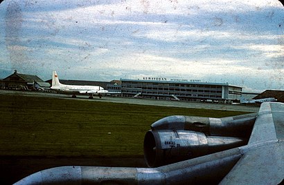
Kemayoran International Airport Address: Kemayoran International Airport, Jl. Angkasa Raya No.16, RW.10, Gn. Sahari Sel., Kemayoran, Kota Ja street in Jakarta Pusat
Attractions near Kemayoran International Airport
Pusat Pengelolaan Komplek Kemayoran (PPKK),Agen Majalah Hidayatullah,CV. Sampurna Part Niaga (Autovision),Barokah Jok,Rapi Auto Film,Puzzle Stiker,CV Berkat Karunia,CIMB Niaga,PT Duta Fuji Electric,One Stop Service,Garasi Mobil,Gambir Anom Mobil,Orin,Auto K-33,Alif Auto-Mega Glodok Kemayoran (MGK),PT Solusindo Mitra Sejahtera,PT Universal,PT Arka Jaya Diesel,WOM Finance Head Office - Mega Glodok Kemayoran Office Tower B,Surya Sumber Sejahtera, PTHow to get to popular attractions in Jakarta Pusat with public transit
Pondok Kemangi Restaurant, Tangerang,Griya Serpong Asri, Tangerang,PT. AIRFAST Indonesia, Kota Tangerang,Victoria River Park Residence, Tangerang,Puslitbang Keteknikan Kehutanan dan Pengolahan Hasil Hutan, Kota Bogor,Garuda Operation Center [GOC], Kota Tangerang,Perumahan Arcadia, Kota Tangerang,Kuntum farm field, Bogor,Ruko Tol Boulevard, Tangerang,Pos Polisi Lantas Gadog, Bogor,Pinang Ranti, Jakarta Timur,Pintu Tol Bitung, Kota Tangerang,Puri Depok Mas, Depok,Alfamart - The Green, Tangerang,SPBU TOTAL Bumi Serpong Damai (BSD), Tangerang,Kantor Pelayanan Pajak Pratama Ciawi, Kota Bogor,Auditorium Andi Hakim Nasution, Bogor,PT. Surya Toto Indonesia Tbk, Tangerang,RM Warung Jambu Ibu Nyai, Bogor,"KANTOR PELAYANAN PAJAK PRATAMA SERPONG" jl raya serpong sektor VIII blok 405 Bsd Tangsel, TangerangGet around Jakarta Pusat by public transit!
Traveling around Jakarta Pusat has never been so easy. See step by step directions as you travel to any attraction, street or major public transit station. View bus and train schedules, arrival times, service alerts and detailed routes on a map, so you know exactly how to get to anywhere in Jakarta Pusat.
When traveling to any destination around Jakarta Pusat use Moovit's Live Directions with Get Off Notifications to know exactly where and how far to walk, how long to wait for your line, and how many stops are left. Moovit will alert you when it's time to get off — no need to constantly re-check whether yours is the next stop.
Wondering how to use public transit in Jakarta Pusat or how to pay for public transit in Jakarta Pusat? Moovit public transit app can help you navigate your way with public transit easily, and at minimum cost. It includes public transit fees, ticket prices, and costs. Looking for a map of Jakarta Pusat public transit lines? Moovit public transit app shows all public transit maps in Jakarta Pusat with all bus or train routes and stops on an interactive map.
Jakarta Pusat has 2 transit type(s), including: bus or train, operated by several transit agencies, including MRT Jakarta, LRT Jakarta, LRT Jabodebek, PT. Kereta Commuter Indonesia, PT. KAI, KCIC, Transjakarta BRT, TransJakarta, Transjakarta Microbus, KWK (Koperasi Wahana Kalpika), PPD (Pengangkutan Penumpang Djakarta), Mayasari Bakti, Angkutan Tangerang, KOASI (Koperasi Angkutan Bekasi) and Angkutan Kota Depok