Directions to Kenilworth, Illinois with public transportation
The following transit lines have routes that pass near Kenilworth, Illinois
How to get to Kenilworth, Illinois by bus?
Click on the bus route to see step by step directions with maps, line arrival times and updated time schedules.
How to get to Kenilworth, Illinois by train?
Click on the train route to see step by step directions with maps, line arrival times and updated time schedules.
How to get to Kenilworth, Illinois by Chicago 'L'?
Click on the Chicago 'L' route to see step by step directions with maps, line arrival times and updated time schedules.
Bus stations near Kenilworth, Illinois
- Green Bay Rd & Kenilworth Ave,4 min walk,
- Sheridan / Melrose,12 min walk,
Train stations near Kenilworth, Illinois
- Wilmette,14 min walk,
Chicago 'l' stations near Kenilworth, Illinois
- Linden,26 min walk,
Bus lines to Kenilworth, Illinois
- 213,Highland Park Metra Station,
- 423,Harlem Ave & Bryn Mawr Ave (Harlem Blue Line),
What are the closest stations to Kenilworth, Illinois?
The closest stations to Kenilworth, Illinois are:
- Green Bay Rd & Kenilworth Ave is 262 yards away, 4 min walk.
- Sheridan / Melrose is 998 yards away, 12 min walk.
- Wilmette is 1130 yards away, 14 min walk.
- Linden is 2240 yards away, 26 min walk.
Which bus line stops near Kenilworth, Illinois?
213
Which train line stops near Kenilworth, Illinois?
UP-N
Which Chicago 'L' line stops near Kenilworth, Illinois?
PURPLE LINE
What’s the nearest Chicago 'L' station to Kenilworth, Illinois?
The nearest Chicago 'L' station to Kenilworth, Illinois is Linden. It’s a 26 min walk away.
What’s the nearest train station to Kenilworth, Illinois?
The nearest train station to Kenilworth, Illinois is Wilmette. It’s a 14 min walk away.
What’s the nearest bus stop to Kenilworth, Illinois?
The nearest bus stop to Kenilworth, Illinois is Green Bay Rd & Kenilworth Ave. It’s a 4 min walk away.
What time is the first Chicago 'L' to Kenilworth, Illinois?
The PURPLE LINE is the first Chicago 'L' that goes to Kenilworth, Illinois. It stops nearby at 4:40 AM.
What time is the last Chicago 'L' to Kenilworth, Illinois?
The PURPLE LINE is the last Chicago 'L' that goes to Kenilworth, Illinois. It stops nearby at 1:27 AM.
What time is the first train to Kenilworth, Illinois?
The UP-N is the first train that goes to Kenilworth, Illinois. It stops nearby at 4:43 AM.
What time is the last train to Kenilworth, Illinois?
The UP-N is the last train that goes to Kenilworth, Illinois. It stops nearby at 1:10 AM.
What time is the first bus to Kenilworth, Illinois?
The 213 is the first bus that goes to Kenilworth, Illinois. It stops nearby at 5:37 AM.
What time is the last bus to Kenilworth, Illinois?
The 213 is the last bus that goes to Kenilworth, Illinois. It stops nearby at 9:42 PM.
How much is the train fare to Kenilworth, Illinois?
The train fare to Kenilworth, Illinois costs about $3.75 - $6.75.
How much is the bus fare to Kenilworth, Illinois?
The bus fare to Kenilworth, Illinois costs about $2.00.
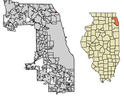
See Kenilworth, Illinois on the map
Public Transportation to Kenilworth, Illinois
Wondering how to get to Kenilworth, Illinois, United States? Moovit helps you find the best way to get to Kenilworth, Illinois with step-by-step directions from the nearest public transit station.
Moovit provides free maps and live directions to help you navigate through your city. View schedules, routes, timetables, and find out how long does it take to get to Kenilworth, Illinois in real time.
Looking for the nearest stop or station to Kenilworth, Illinois? Check out this list of stops closest to your destination: Green Bay Rd & Kenilworth Ave; Sheridan / Melrose; Wilmette; Linden.
Bus:213423Train:UP-NChicago 'L':PURPLE LINE
Want to see if there’s another route that gets you there at an earlier time? Moovit helps you find alternative routes or times. Get directions from and directions to Kenilworth, Illinois easily from the Moovit App or Website.
We make riding to Kenilworth, Illinois easy, which is why over 1.5 million users, including users in Kenilworth, trust Moovit as the best app for public transit. You don’t need to download an individual bus app or train app, Moovit is your all-in-one transit app that helps you find the best bus time or train time available.
For information on prices of bus, train and Chicago 'L', costs and ride fares to Kenilworth, Illinois, please check the Moovit app.
Use the app to navigate to popular places including to the airport, hospital, stadium, grocery store, mall, coffee shop, school, college, and university.
Kenilworth, Illinois Address: Cook, IL street in Kenilworth
Attractions near Kenilworth, Illinois
USPS,Tyler Garage Door Repair,Hightech - Garage - Door,Ej Title Company,Home Ice Advantage,New Trier Realty,Kenliworth Water Department,Amplify! Mobile Marketing,Bade Family,Julie Monnet - at Properties Christies International,John Lovestrand,Prescott Elementary School,Thomas Downing,Hiram Baldwin House,Aesthetic Skin - Winnetka,Williams McGuinness Studio,Exhibit Design Central,Family Matters Therapy,Drake Interiors, LTD.,Transition Life ConsultantsHow to get to popular attractions in Kenilworth with public transit
Presence Saint Joseph Hospital, Elgin, Elgin,Sabri Nihari, Chicago,Route 66 Raceway, Joliet,Jewel-Osco,I-88 @ Rt 59 Interchange, Naperville,Texas Roadhouse, Naperville,Metra - Vernon Hills, Vernon Hills,Holiday Inn Express & Suites Chicago O'Hare, Rosemont,Autobahn Country Club, Joliet,Metra/Amtrak - Homewood, Homewood,Manny's Cafeteria & Delicatessen, Chicago,Tri-Taylor Neighborhood, Chicago,Dark Matter Coffee, Chicago,Old Irving Park Neighborhood, Chicago,Al Bawadi Grill, Bridgeview,Chicago Marriott Naperville, Naperville,United Center, Chicago,Metra - Tinley Park / 80th Ave, Tinley Park,Viper, Gurnee,Harold Washington College, ChicagoGet around Kenilworth by public transit!
Traveling around Kenilworth has never been so easy. See step by step directions as you travel to any attraction, street or major public transit station. View bus and train schedules, arrival times, service alerts and detailed routes on a map, so you know exactly how to get to anywhere in Kenilworth.
When traveling to any destination around Kenilworth use Moovit's Live Directions with Get Off Notifications to know exactly where and how far to walk, how long to wait for your line, and how many stops are left. Moovit will alert you when it's time to get off — no need to constantly re-check whether yours is the next stop.
Wondering how to use public transit in Kenilworth or how to pay for public transit in Kenilworth? Moovit public transit app can help you navigate your way with public transit easily, and at minimum cost. It includes public transit fees, ticket prices, and costs. Looking for a map of Kenilworth public transit lines? Moovit public transit app shows all public transit maps in Kenilworth with all bus, train or Chicago 'L' routes and stops on an interactive map.
Kenilworth has 3 transit type(s), including: bus, train or Chicago 'L', operated by several transit agencies, including CTA 'L', Metra, Northern Indiana Commuter Transportation District, CTA, PACE, O'Hare International Airport Shuttle Bus, Gary Public Transit, Amtrak, River Valley Metro, Valpo Transit, DeKalb Public Transit, FlixBus-us, Greyhound-us, Van Galder (Coach USA) and Wisconsin Coach Lines