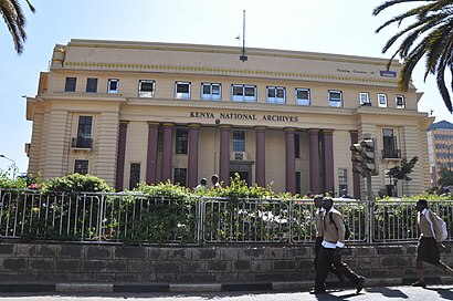
Directions to Kenya National Archives (Central) with public transportation
The following transit lines have routes that pass near Kenya National Archives
How to get to Kenya National Archives by bus?
Click on the bus route to see step by step directions with maps, line arrival times and updated time schedules.
Bus stops near Kenya National Archives in Central
- Town, 2 min walk,
- Commercial, 2 min walk,
- Townterminal, 3 min walk,
- Terminal Tusker, 4 min walk,
- Ronald Ngala/Tuskys, 4 min walk,
- Odeon, 5 min walk,
- Ambassadeur, 8 min walk,
- Kencom, 9 min walk,
- Odeon Terminal, 15 min walk,
Bus lines to Kenya National Archives in Central
- 7, Town,
- 33B, Baraka,
- 33C, Cabanas,
- 33FED, Posta,
- 33GTB, Gate B,
- 33IMR, Imara Daima,
- 33TP, Pipeline,
- 237, Thika,
- 46H, Huruma,
- 19CDC, Komarocks,
- 11A, Highridge,
- 11C, Pangani Terminus,
- 23KG, Kangemi,
- 30, Uthiru,
- 44G, Ku,
- 44Z, Ku,
- 48A, Lavington,
- 48B, Othaya Road,
- 48C, Yaya,
- 48O, Othaya Road,
What are the closest stations to Kenya National Archives?
The closest stations to Kenya National Archives are:
- Town is 69 meters away, 2 min walk.
- Commercial is 95 meters away, 2 min walk.
- Townterminal is 199 meters away, 3 min walk.
- Terminal Tusker is 228 meters away, 4 min walk.
- Ronald Ngala/Tuskys is 244 meters away, 4 min walk.
- Odeon is 319 meters away, 5 min walk.
- Ambassadeur is 553 meters away, 8 min walk.
- Kencom is 645 meters away, 9 min walk.
- Odeon Terminal is 1126 meters away, 15 min walk.
Which bus lines stop near Kenya National Archives?
These bus lines stop near Kenya National Archives: 105, 11F, 33B, 33IMR, 44G, 44Z, 46K, 48A.
What’s the nearest bus stop to Kenya National Archives in Central?
The nearest bus stops to Kenya National Archives in Central are Town and Commercial. The closest one is a 2 min walk away.
What time is the first bus to Kenya National Archives in Central?
The 33C is the first bus that goes to Kenya National Archives in Central. It stops nearby at 6:00 AM.
What time is the last bus to Kenya National Archives in Central?
The 24C is the last bus that goes to Kenya National Archives in Central. It stops nearby at 10:37 PM.
See Kenya National Archives, Central, on the map
Public Transit to Kenya National Archives in Central
Wondering how to get to Kenya National Archives in Central, Kenya? Moovit helps you find the best way to get to Kenya National Archives with step-by-step directions from the nearest public transit station.
Moovit provides free maps and live directions to help you navigate through your city. View schedules, routes, timetables, and find out how long does it take to get to Kenya National Archives in real time.
Looking for the nearest stop or station to Kenya National Archives? Check out this list of stops closest to your destination: Town; Commercial; Townterminal; Terminal Tusker; Ronald Ngala/Tuskys; Odeon; Ambassadeur; Kencom; Odeon Terminal.
Bus: 105, 11F, 33B, 33IMR, 44G, 44Z, 46K, 48A, 7, 33C, 33FED, 33GTB, 237, 46H, 19CDC, 11A, 11C, 23KG, 30.
Want to see if there’s another route that gets you there at an earlier time? Moovit helps you find alternative routes or times. Get directions from and directions to Kenya National Archives easily from the Moovit App or Website.
We make riding to Kenya National Archives easy, which is why over 1.5 million users, including users in Central, trust Moovit as the best app for public transit. You don’t need to download an individual bus app or train app, Moovit is your all-in-one transit app that helps you find the best bus time or train time available.
For information on prices of bus, costs and ride fares to Kenya National Archives, please check the Moovit app.
Use the app to navigate to popular places including to the airport, hospital, stadium, grocery store, mall, coffee shop, school, college, and university.
Kenya National Archives Address: Tom Mboya Street street in Central
Attractions near Kenya National Archives
Tom Mboya Street,Tuskys Magic NRB,Ambassador Bus Stage,Mfangano Lane,Tom Mboya Statue,Egerton University (Nairobi City Campus),Africa Nazarene University Town Campus,Altona Fish & Chips,Ambassador Hotel,BuruBuru stage,Embassava Stage,batis pub (former hornbill),Mr. Price - Moi Avenue,Tuskys Imara,Kiwi Shoe Shine Kenya Archives,Kenya National Archives Bus Stage,sky mall,Accra Plaza,Reina Rosary Hospital, Utwala,KCB Moi AvenueHow to get to popular attractions in Central with public transit
Mbagathi Way, Kibera,JKUAT KAREN CAMPUS, Kibera,Equity Centre, Parklands/Westlands,Masaai Lodge Junction, Kibera,International Arrivals, Embakasi,Athi River Town, Kathiani,Mlolongo, Kathiani,Goldengate Estate, Makadara,Caltex Donholm, Embakasi,University of Nairobi, Central,SkyLux Lounge, Parklands/Westlands,Naivas Supermarket - Westlands, Parklands/Westlands,Cabanas, Embakasi,Nairobi Java House, Makadara,Jonathan Ng'eno Estate, Kibera,Gateway Mall, Kathiani,Asmara Bar & Restaurant, Kasarani,Dagoretti Corner, Parklands/Westlands,KFC, Kibera,Tuskys Rongai, NgongGet around Nairobi by public transit!
Traveling around Nairobi has never been so easy. See step by step directions as you travel to any attraction, street or major public transit station. View bus and train schedules, arrival times, service alerts and detailed routes on a map, so you know exactly how to get to anywhere in Nairobi.
When traveling to any destination around Nairobi use Moovit's Live Directions with Get Off Notifications to know exactly where and how far to walk, how long to wait for your line, and how many stops are left. Moovit will alert you when it's time to get off — no need to constantly re-check whether yours is the next stop.
Wondering how to use public transit in Nairobi or how to pay for public transit in Nairobi? Moovit public transit app can help you navigate your way with public transit easily, and at minimum cost. It includes public transit fees, ticket prices, and costs. Looking for a map of Nairobi public transit lines? Moovit public transit app shows all public transit maps in Nairobi with all bus routes and stops on an interactive map.
Nairobi has 1 transit type(s), including: bus, operated by several transit agencies, including KBS