Directions to Kerry Callahan Boudoir (Boston) with public transportation
The following transit lines have routes that pass near Kerry Callahan Boudoir
 Bus: 30.
How to get to Kerry Callahan Boudoir by bus?
Click on the bus route to see step by step directions with maps, line arrival times and updated time schedules.
From Umass Memorial Medical Center, Worcester
60 minFrom Dcu Center, Worcester
32 minFrom Umass Memorial Medical Center - University Campus, Worcester
62 minFrom Saint Vincent Hospital at Worcester Medical Center, Worcester
36 minFrom Foxwoods, Worcester
26 minFrom Clinton, Massachusetts, Clinton
73 minFrom Palladium, Worcester
33 minFrom St Vincent Hospital TH Medical, Worcester
36 minFrom Quinsigamond Community College, Worcester
21 min
Bus stop near Kerry Callahan Boudoir in Boston
- West Boylston Walmart, 17 min walk,VIEW
Bus lines to Kerry Callahan Boudoir in Boston
- 30, West Boylston Walmart,VIEW
What are the closest stations to Kerry Callahan Boudoir?
The closest stations to Kerry Callahan Boudoir are:
- West Boylston Walmart is 1359 yards away, 17 min walk.
Which bus line stops near Kerry Callahan Boudoir?
30 (Central Hub→West Boylston Walmart)
What time is the first bus to Kerry Callahan Boudoir in Boston?
The 30 is the first bus that goes to Kerry Callahan Boudoir in Boston. It stops nearby at 6:17 AM.
What time is the last bus to Kerry Callahan Boudoir in Boston?
The 30 is the last bus that goes to Kerry Callahan Boudoir in Boston. It stops nearby at 10:23 PM.
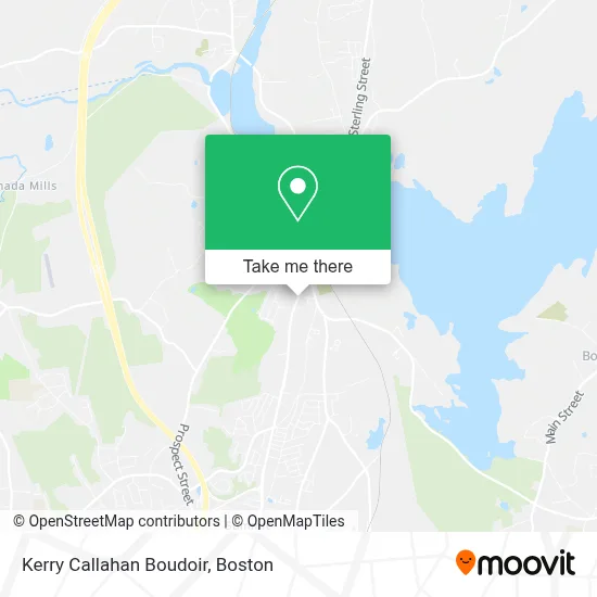
See Kerry Callahan Boudoir, Boston, on the map
Public Transit to Kerry Callahan Boudoir in Boston
Wondering how to get to Kerry Callahan Boudoir in Boston? Moovit helps you find the best way to get to Kerry Callahan Boudoir with step-by-step directions from the nearest public transit station.
Moovit provides free maps and live directions to help you navigate through your city. View schedules, routes, timetables, and find out how long does it take to get to Kerry Callahan Boudoir in real time.
Looking for the nearest stop or station to Kerry Callahan Boudoir? Check out this list of stops closest to your destination: West Boylston Walmart.
Bus: 30.
Want to see if there’s another route that gets you there at an earlier time? Moovit helps you find alternative routes or times. Get directions from and directions to Kerry Callahan Boudoir easily from the Moovit App or Website.
We make riding to Kerry Callahan Boudoir easy, which is why over 1.7 million users, including users in Boston, trust Moovit as the best app for public transit. You don’t need to download an individual bus app or train app, Moovit is your all-in-one transit app that helps you find the best bus time or train time available.
For information on prices of bus, costs and ride fares to Kerry Callahan Boudoir, please check the Moovit app.
Use the app to navigate to popular places including to the airport, hospital, stadium, grocery store, mall, coffee shop, school, college, and university.
Location: Boston
- Pro Home Buyer,
- Got Sauna,
- Ana & Sons Cleaning Services,
- ATM,
- Draught House,
- Escape Massage Center,
- FSP*Cante 67 W Boylsto,
- Dr. Tony Saito,
- Overton's,
- Neighborhood Garage Door Service,
- The Advocate,
- Tee's Deli & Catering,
- Truehome Roofing,
- Mothers and Company,
- Horan Cynthia Licsw,
- West Boylston Parks & Recreation,
- West Boylston Green Roofing,
- Sona Motor Inn,
- Injury Prevention Physical Therapy,
- Hemenway & Associates
Places Near Kerry Callahan Boudoir (Boston)
- Wang Theater, Boston,
- Massachusetts General Hospital, Boston,
- Cheers, Boston,
- Td Garden, Boston,
- Boston Medical Center, Boston,
- Quincy Market, Boston,
- North End, Boston,
- Seaport District, Boston,
- Faneuil Hall, Boston,
- Isabella Stewart Gardner Museum, Boston,
- Boston Convention & Exhibition Center, Boston,
- Museum Of Science, Boston,
- Boston Common, Boston,
- Leader Bank Pavilion (Leader Bank Pavillion), Boston,
- Wilbur Theatre, Boston,
- Mgm Music Hall, Boston,
- Prudential Center, Boston,
- Castle Island, Boston,
- House Of Blues, Boston,
- Boston Children's Hospital, Boston
How to get to popular places in Boston with public transit
Get around Boston by public transit!
Traveling around Boston has never been so easy. See step by step directions as you travel to any attraction, street or major public transit station. View bus and train schedules, arrival times, service alerts and detailed routes on a map, so you know exactly how to get to anywhere in Boston.
When traveling to any destination around Boston use Moovit's Live Directions with Get Off Notifications to know exactly where and how far to walk, how long to wait for your line, and how many stops are left. Moovit will alert you when it's time to get off — no need to constantly re-check whether yours is the next stop.
Wondering how to use public transit in Boston or how to pay for public transit in Boston? Moovit public transit app can help you navigate your way with public transit easily, and at minimum cost. It includes public transit fees, ticket prices, and costs. Looking for a map of Boston public transit lines? Moovit public transit app shows all public transit maps in Boston with all Bus, Train, Subway and Ferry routes and stops on an interactive map.
Boston has 4 transit type(s), including: Bus, Train, Subway and Ferry, operated by several transit agencies, including MBTA, Southeastern Regional Transit Authority, MetroWest Regional Transit Authority, Rhode Island Public Transit Authority, WRTA, Lowell Regional Transit Authority, Merrimack Valley Transit, Montachusett Regional Transit Authority, Cape Cod Regional Transit Authority, Brockton Area Transit Authority, Martha's Vineyard Transit Authority, the WAVE - Nantucket Regional Transit Authority, GATRA, Cape Ann Transportation Authority and Massport