See Kesselbrink, NRW (North Rhine-Westphalia), on the map
Directions to Kesselbrink (NRW (North Rhine-Westphalia)) with public transportation
The following transit lines have routes that pass near Kesselbrink
 Train:
 - Bus:
How to get to Kesselbrink by train?
Click on the train route to see step by step directions with maps, line arrival times and updated time schedules.
Bus stations near Kesselbrink in NRW (North Rhine-Westphalia)
- Bielefeld, Kesselbrink,1 min walk,
- Bielefeld, Kesselbrink/Skatepark,4 min walk,
- Bielefeld, Turnerstraße,5 min walk,
Light Rail stations near Kesselbrink in NRW (North Rhine-Westphalia)
- Bielefeld, Rathaus,2 min walk,
Bus lines to Kesselbrink in NRW (North Rhine-Westphalia)
- 21,Bielefeld, Bachstelzenweg,
- 23,Bielefeld, Radrennb./Ziegelstr,
- 24,Bielefeld, Sieker,
- 25,Bi-Heepen, Baumheide,
- 26,Bi-Gellershagen, Dürerstraße,
- 27,Bielefeld, Schildesche,
- 369,Bielefeld Hbf,
- N8,Spenge, Zob,
- N12,Bü-Ennigloh, Nord,
- 350,Bad Salzuflen, Zob 6,
- 351,Bielefeld Hbf Steig 9,
- 22,Bielefeld, Quelle Gesamtschule,
- 29,Bielefeld, Baderbach,
- N4,Bi-Heepen, Baumheide,
What are the closest stations to Kesselbrink?
The closest stations to Kesselbrink are:
- Bielefeld, Kesselbrink is 17 meters away, 1 min walk.
- Bielefeld, Rathaus is 138 meters away, 2 min walk.
- Bielefeld, Kesselbrink/Skatepark is 280 meters away, 4 min walk.
- Bielefeld, Turnerstraße is 350 meters away, 5 min walk.
Which train line stops near Kesselbrink?
RE6 (RRX)
Which bus line stops near Kesselbrink?
351
What’s the nearest light rail station to Kesselbrink in NRW (North Rhine-Westphalia)?
The nearest light rail station to Kesselbrink in NRW (North Rhine-Westphalia) is Bielefeld, Rathaus. It’s a 2 min walk away.
What’s the nearest bus stop to Kesselbrink in NRW (North Rhine-Westphalia)?
The nearest bus stop to Kesselbrink in NRW (North Rhine-Westphalia) is Bielefeld, Kesselbrink. It’s a 1 min walk away.
What time is the first light rail to Kesselbrink in NRW (North Rhine-Westphalia)?
The 1 is the first light rail that goes to Kesselbrink in NRW (North Rhine-Westphalia). It stops nearby at 8:18 AM.
What time is the last light rail to Kesselbrink in NRW (North Rhine-Westphalia)?
The 2 is the last light rail that goes to Kesselbrink in NRW (North Rhine-Westphalia). It stops nearby at 1:22 AM.
What time is the first bus to Kesselbrink in NRW (North Rhine-Westphalia)?
The N8 is the first bus that goes to Kesselbrink in NRW (North Rhine-Westphalia). It stops nearby at 3:06 AM.
What time is the last bus to Kesselbrink in NRW (North Rhine-Westphalia)?
The N8 is the last bus that goes to Kesselbrink in NRW (North Rhine-Westphalia). It stops nearby at 2:06 AM.
How much is the bus fare to Kesselbrink?
The bus fare to Kesselbrink costs about €1.91 - €5.15.
How much is the train fare to Kesselbrink?
The train fare to Kesselbrink costs about €2.45 - €14.87.
How much is the subway fare to Kesselbrink?
The subway fare to Kesselbrink costs about €1.91 - €5.69.
See Kesselbrink, NRW (North Rhine-Westphalia), on the map
Public Transit to Kesselbrink in NRW (North Rhine-Westphalia)
Wondering how to get to Kesselbrink in NRW (North Rhine-Westphalia), Germany? Moovit helps you find the best way to get to Kesselbrink with step-by-step directions from the nearest public transit station.
Moovit provides free maps and live directions to help you navigate through your city. View schedules, routes, timetables, and find out how long does it take to get to Kesselbrink in real time.
Looking for the nearest stop or station to Kesselbrink? Check out this list of stops closest to your destination: Bielefeld; Bielefeld; Bielefeld; Bielefeld.
Train:Bus:
Want to see if there’s another route that gets you there at an earlier time? Moovit helps you find alternative routes or times. Get directions from and directions to Kesselbrink easily from the Moovit App or Website.
We make riding to Kesselbrink easy, which is why over 1.5 million users, including users in NRW (North Rhine-Westphalia), trust Moovit as the best app for public transit. You don’t need to download an individual bus app or train app, Moovit is your all-in-one transit app that helps you find the best bus time or train time available.
For information on prices of train, bus and subway, costs and ride fares to Kesselbrink, please check the Moovit app.
Use the app to navigate to popular places including to the airport, hospital, stadium, grocery store, mall, coffee shop, school, college, and university.
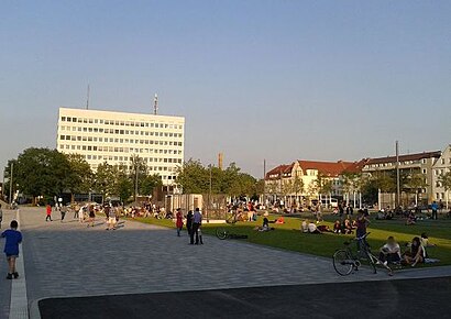
Kesselbrink Address: Friedrich-Verleger-Straße street in NRW (North Rhine-Westphalia)
Attractions near Kesselbrink
Siebrasse Ohg Küchentreff,Zum Kulmbacher,Berber Hamil,Ernährungsberatung Brinkhege,Gegenüber,Mutti's Bierstube,Tiefgarage Kesselbrink,Nostalgie,Parkscheinautomat,Drugstore,Verbraucherzentrale,Bike- & Skatepark Kesselbrink,Ann Nails,Calisthenics Park Kesselbrink,Pamukkale,Schimmack & Partner,Vialog,Hanadi Sweets,Hông Phat,Ewald RüdigerHow to get to popular attractions in NRW (North Rhine-Westphalia) with public transit
S Spich, Troisdorf,Rheinterrasse, Düsseldorf,Gleis 1, Bonn,Radio Bonn/Rhein-Sieg, Bonn,Marienburg, Köln,Luxor, Köln,Luegallee, Düsseldorf,Gustav-Stresemann-Institut, Bonn,Baumberg, Monheim Am Rhein,Hardtberg, Bonn,Lannesdorf, Bonn,Erlebnisbauernhof Gertrudenhof, Hürth,DKV Deutsche Krankenversicherung - Hauptverwaltung, Köln,Friedrich-Albert-Lange Gesamtschule (FALS), Solingen,Dortmund Hafen, Dortmund,ARAG, Düsseldorf,Asia 5 Sterne, Düsseldorf,Rheinfähre Königswinter - Bonn- Mehlem, Bonn,alpincenter Bottrop, Bottrop,H Robertstraße, BochumGet around NRW (North Rhine-Westphalia) by public transit!
Traveling around NRW (North Rhine-Westphalia) has never been so easy. See step by step directions as you travel to any attraction, street or major public transit station. View bus and train schedules, arrival times, service alerts and detailed routes on a map, so you know exactly how to get to anywhere in NRW (North Rhine-Westphalia).
When traveling to any destination around NRW (North Rhine-Westphalia) use Moovit's Live Directions with Get Off Notifications to know exactly where and how far to walk, how long to wait for your line, and how many stops are left. Moovit will alert you when it's time to get off — no need to constantly re-check whether yours is the next stop.
Wondering how to use public transit in NRW (North Rhine-Westphalia) or how to pay for public transit in NRW (North Rhine-Westphalia)? Moovit public transit app can help you navigate your way with public transit easily, and at minimum cost. It includes public transit fees, ticket prices, and costs. Looking for a map of NRW (North Rhine-Westphalia) public transit lines? Moovit public transit app shows all public transit maps in NRW (North Rhine-Westphalia) with all train, bus or subway routes and stops on an interactive map.
NRW (North Rhine-Westphalia) has 3 transit type(s), including: train, bus or subway, operated by several transit agencies, including KVB Kölner Verkehrs-Betriebe AG, Straßenbahn, Rheinbahn, DSW U-Bahn, DVG AG, KVB Kölner Verkehrs-Betriebe AG, S-Bahn, bvo, Rheinbahn, NWL, BOGESTRA U-Bahn, DVG AG, NordWestBahn, DVG AG and DB