Directions to Kew Management (Needham) with public transportation
The following transit lines have routes that pass near Kew Management
 Bus: 01, 59, NEEDHAM LINE SHUTTLE, NEEDHAM LINE SHUTTLE.
- Train: NEEDHAM.
- Subway: GREEN LINE D.
How to get to Kew Management by bus?
Click on the bus route to see step by step directions with maps, line arrival times and updated time schedules.
From the mall at rockingham park mall, Boston
71 minFrom Hampton Inn & Suites-Hampton Watertown Boston (Hampton Inn & Suites Watertown Boston), Watertown Town
51 minFrom The Monument, Boston
113 minFrom VA Hospital, Boston
105 minFrom Warren St, Boston
64 minFrom VFW Parkway, Boston
98 minFrom Showa Boston Institute, Boston
185 minFrom Forest Hills Station MBTA, Boston
123 minFrom Brookline High School (Brookline Town High School), Brookline
78 min
How to get to Kew Management by train?
Click on the train route to see step by step directions with maps, line arrival times and updated time schedules.
Bus stops near Kew Management in Needham
Subway station near Kew Management in Needham
- Eliot, 12 min walk,VIEW
Train station near Kew Management in Needham
- Hersey, 17 min walk,VIEW
Bus lines to Kew Management in Needham
What are the closest stations to Kew Management?
The closest stations to Kew Management are:
- Highland Ave @ May St is 313 yards away, 4 min walk.
- Needham Heights is 588 yards away, 7 min walk.
- Eliot is 944 yards away, 12 min walk.
- Hersey is 1452 yards away, 17 min walk.
Which bus lines stop near Kew Management?
These bus lines stop near Kew Management: 01, 59.
Which train line stops near Kew Management?
NEEDHAM (#625 | Needham Heights)
What’s the nearest subway station to Kew Management in Needham?
The nearest subway station to Kew Management in Needham is Eliot. It’s a 12 min walk away.
What’s the nearest train station to Kew Management in Needham?
The nearest train station to Kew Management in Needham is Hersey. It’s a 17 min walk away.
What’s the nearest bus station to Kew Management in Needham?
The nearest bus station to Kew Management in Needham is Highland Ave @ May St. It’s a 4 min walk away.
What time is the first subway to Kew Management in Needham?
The GREEN LINE D is the first subway that goes to Kew Management in Needham. It stops nearby at 4:48 AM.
What time is the last subway to Kew Management in Needham?
The GREEN LINE D is the last subway that goes to Kew Management in Needham. It stops nearby at 2:44 AM.
What time is the first train to Kew Management in Needham?
The NEEDHAM is the first train that goes to Kew Management in Needham. It stops nearby at 7:05 AM.
What time is the last train to Kew Management in Needham?
The NEEDHAM is the last train that goes to Kew Management in Needham. It stops nearby at 6:38 PM.
What time is the first bus to Kew Management in Needham?
The 59 is the first bus that goes to Kew Management in Needham. It stops nearby at 6:22 AM.
What time is the last bus to Kew Management in Needham?
The 59 is the last bus that goes to Kew Management in Needham. It stops nearby at 7:56 PM.
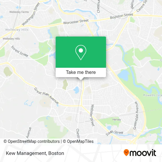
See Kew Management, Needham, on the map
Public Transit to Kew Management in Needham
Wondering how to get to Kew Management in Needham? Moovit helps you find the best way to get to Kew Management with step-by-step directions from the nearest public transit station.
Moovit provides free maps and live directions to help you navigate through your city. View schedules, routes, timetables, and find out how long does it take to get to Kew Management in real time.
Looking for the nearest stop or station to Kew Management? Check out this list of stops closest to your destination: Highland Ave @ May St; Needham Heights; Eliot; Hersey.
Bus: 01, 59, NEEDHAM LINE SHUTTLE, NEEDHAM LINE SHUTTLE.Train: NEEDHAM.Subway: GREEN LINE D.
Want to see if there’s another route that gets you there at an earlier time? Moovit helps you find alternative routes or times. Get directions from and directions to Kew Management easily from the Moovit App or Website.
We make riding to Kew Management easy, which is why over 1.7 million users, including users in Needham, trust Moovit as the best app for public transit. You don’t need to download an individual bus app or train app, Moovit is your all-in-one transit app that helps you find the best bus time or train time available.
For information on prices of bus, train and subway, costs and ride fares to Kew Management, please check the Moovit app.
Use the app to navigate to popular places including to the airport, hospital, stadium, grocery store, mall, coffee shop, school, college, and university.
Kew Management Address: 460 Hillside Ave street in Needham
- Studio Enée Architects,
- Early Intervention Program,
- Mosaic Psychiatric Care,
- Winged Heating & Cooling Repair,
- Daniel Melville MD,
- Beth Israel Deaconess Medical Center,
- Choice Surrogacy,
- Firstlight Home Care,
- Irs Help,
- Hillside Place,
- Van Dusen Nutrition,
- The Village Club,
- Hearing Armor,
- Auto Mechanic Near Me,
- Wellesley Family Care Associates,
- Lilly,
- Heafitz Development Co.,
- Me4sure,
- Souper Salad Corporation Office,
- Joslin Diabetes Center
Places Near Kew Management (Needham)
- Seaport District, Boston,
- House Of Blues, Boston,
- North End, Boston,
- Boston Medical Center, Boston,
- Boston Children's Hospital, Boston,
- Prudential Center, Boston,
- Cheers, Boston,
- Td Garden, Boston,
- Quincy Market, Boston,
- Boston Convention & Exhibition Center, Boston,
- Wilbur Theatre, Boston,
- Boston Common, Boston,
- Leader Bank Pavilion (Leader Bank Pavillion), Boston,
- Museum Of Science, Boston,
- Faneuil Hall, Boston,
- Wang Theater, Boston,
- Isabella Stewart Gardner Museum, Boston,
- Mgm Music Hall, Boston,
- Castle Island, Boston,
- Massachusetts General Hospital, Boston
How to get to popular places in Boston with public transit
Get around Needham by public transit!
Traveling around Needham has never been so easy. See step by step directions as you travel to any attraction, street or major public transit station. View bus and train schedules, arrival times, service alerts and detailed routes on a map, so you know exactly how to get to anywhere in Needham.
When traveling to any destination around Needham use Moovit's Live Directions with Get Off Notifications to know exactly where and how far to walk, how long to wait for your line, and how many stops are left. Moovit will alert you when it's time to get off — no need to constantly re-check whether yours is the next stop.
Wondering how to use public transit in Needham or how to pay for public transit in Needham? Moovit public transit app can help you navigate your way with public transit easily, and at minimum cost. It includes public transit fees, ticket prices, and costs. Looking for a map of Needham public transit lines? Moovit public transit app shows all public transit maps in Needham with all Bus, Train, Subway and Ferry routes and stops on an interactive map.
Boston has 4 transit type(s), including: Bus, Train, Subway and Ferry, operated by several transit agencies, including MBTA, Southeastern Regional Transit Authority, MetroWest Regional Transit Authority, Rhode Island Public Transit Authority, WRTA, Lowell Regional Transit Authority, Merrimack Valley Transit, Montachusett Regional Transit Authority, Cape Cod Regional Transit Authority, Brockton Area Transit Authority, Martha's Vineyard Transit Authority, the WAVE - Nantucket Regional Transit Authority, GATRA, Cape Ann Transportation Authority and Massport