How to get to Keyap Caddesi, 21 by bus?
Click on the bus route to see step by step directions with maps, line arrival times and updated time schedules.
From İKEA Kartal, Kartal
95 minFrom Maltepe Vapur İskelesi, Maltepe
102 minFrom Maltepe Cezaevi, Maltepe
73 minFrom Kartal Koşuyolu Kalp Hastanesi, Kartal
102 minFrom sultanbeyli, Sancaktepe
80 minFrom Palladium, Ataşehir
38 minFrom Yaprak Dökümü Evi, Beylerbeyi, Üsküdar
89 minFrom Kartal Koşuyolu Yüksek İhtisas Eğitim ve Araştırma Hastanesi, Kartal
102 minFrom Kalamış Sahili, Kadıköy
97 min
How to get to Keyap Caddesi, 21 by metro?
Click on the metro route to see step by step directions with maps, line arrival times and updated time schedules.
Dolmus & Minibus station near Keyap Caddesi, 21 in Ümraniye
- Modoko B Kapısı - Harem Peronlar Yönü, 3 min walk,VIEW
Bus stops near Keyap Caddesi, 21 in Ümraniye
Metro station near Keyap Caddesi, 21 in Ümraniye
- İmes, 10 min walk,VIEW
Bus lines to Keyap Caddesi, 21 in Ümraniye
- 14ES, Sarıgazi Garajı-Şehit Prof.Dr İlhan Varank Eğitim Ve Araştırma Hastanesi,VIEW
- 14YE, Sarıgazi Garajı-Yavuztürk Siteler,VIEW
- 15SD, Çifteçınarlar-Bayraktar Bulvarı,VIEW
- 20D, Rahmet Sokak-Kadıköy,VIEW
- 131T, Estergon Caddesi-Atatürk Mahallesi Peronlar,VIEW
- 131YS, İmes A Kapısı-Battalgazi Mahallesi,VIEW
- 320, Atatürk Bulvarı-Büyük Çamlıca Camii Peronlar,VIEW
- C70, Dudullu,VIEW
- 14A, Kadıköy-Özyeğin Üniversitesi Alt Kapı,VIEW
- 14AK, Özyeğin Üniversitesi Alt Kapı-Kadıköy,VIEW
- 14CE, Yeşiltepe Son Durak-Kadıköy,VIEW
- 14T, Kozyatağı Metro-Atatürk Mahallesi Peronlar,VIEW
- 14TM, Cevizli Peronlar-Tepeüstü,VIEW
- 14ÇK, Kadıköy-Şehit Şahinbey,VIEW
- 14ŞB, Kadıköy-Şehit Şahinbey,VIEW
- 19D, Estergon Caddesi-Bostancı Peronlar,VIEW
- 19ES, Kadıköy-Sarıgazi Garajı,VIEW
- 19S, Yenidoğan Peronlar-Kadıköy,VIEW
- 19SK, Kozyatağı Metro-Yenidoğan Peronlar,VIEW
- DS1, Dudullu Organize Sanayi Bölgesi - Dudullu Metro / Ring,VIEW
What are the closest stations to Keyap Caddesi, 21?
The closest stations to Keyap Caddesi, 21 are:
- Modoko B Kapısı - Harem Peronlar Yönü is 152 meters away, 3 min walk.
- Modoko Girişi - Ümraniye Yönü is 273 meters away, 4 min walk.
- İ.M.E.S. - Kadıköy Yönü is 463 meters away, 6 min walk.
- İmes A Kapısı - Yenidoğan Yönü is 498 meters away, 7 min walk.
- İmes A Kapısı - Kadıköy Yönü is 551 meters away, 8 min walk.
- İmes is 720 meters away, 10 min walk.
Which bus lines stop near Keyap Caddesi, 21?
These bus lines stop near Keyap Caddesi, 21: 131T, 14ES, 19A, 19S, 320.
Which metro line stops near Keyap Caddesi, 21?
M8 (Bostancı→Parseller)
What’s the nearest metro station to Keyap Caddesi, 21 in Ümraniye?
The nearest metro station to Keyap Caddesi, 21 in Ümraniye is İmes. It’s a 10 min walk away.
What’s the nearest bus station to Keyap Caddesi, 21 in Ümraniye?
The nearest bus station to Keyap Caddesi, 21 in Ümraniye is Modoko Girişi - Ümraniye Yönü. It’s a 4 min walk away.
What’s the nearest Dolmus & Minibus station to Keyap Caddesi, 21 in Ümraniye?
The nearest Dolmus & Minibus station to Keyap Caddesi, 21 in Ümraniye is Modoko B Kapısı - Harem Peronlar Yönü. It’s a 3 min walk away.
What time is the first metro to Keyap Caddesi, 21 in Ümraniye?
The M8 is the first metro that goes to Keyap Caddesi, 21 in Ümraniye. It stops nearby at 6:08 AM.
What time is the last metro to Keyap Caddesi, 21 in Ümraniye?
The M8 is the last metro that goes to Keyap Caddesi, 21 in Ümraniye. It stops nearby at 12:16 AM.
What time is the first bus to Keyap Caddesi, 21 in Ümraniye?
The 19S is the first bus that goes to Keyap Caddesi, 21 in Ümraniye. It stops nearby at 3:05 AM.
What time is the last bus to Keyap Caddesi, 21 in Ümraniye?
The 19S is the last bus that goes to Keyap Caddesi, 21 in Ümraniye. It stops nearby at 2:32 AM.
What time is the first Dolmus & Minibus to Keyap Caddesi, 21 in Ümraniye?
The C70 is the first Dolmus & Minibus that goes to Keyap Caddesi, 21 in Ümraniye. It stops nearby at 5:50 AM.
What time is the last Dolmus & Minibus to Keyap Caddesi, 21 in Ümraniye?
The C70 is the last Dolmus & Minibus that goes to Keyap Caddesi, 21 in Ümraniye. It stops nearby at 12:46 AM.
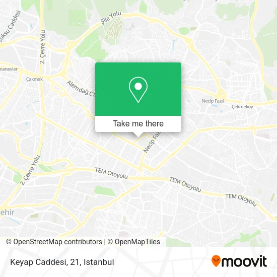
See Keyap Caddesi, 21, Ümraniye, on the map
Public Transit to Keyap Caddesi, 21 in Ümraniye
Wondering how to get to Keyap Caddesi, 21 in Ümraniye? Moovit helps you find the best way to get to Keyap Caddesi, 21 with step-by-step directions from the nearest public transit station.
Moovit provides free maps and live directions to help you navigate through your city. View schedules, routes, timetables, and find out how long does it take to get to Keyap Caddesi, 21 in real time.
Looking for the nearest stop or station to Keyap Caddesi, 21? Check out this list of stops closest to your destination: Modoko B Kapısı - Harem Peronlar Yönü; Modoko Girişi - Ümraniye Yönü; İ.M.E.S. - Kadıköy Yönü; İmes A Kapısı - Yenidoğan Yönü; İmes A Kapısı - Kadıköy Yönü; İmes.
Bus: 131T, 14ES, 19A, 19S, 320, 14YE, 15SD, 20D, C70, 14A, 14AK, 14CE, 14T, DS1, DS2, 14S, 19E, 19V.Metro: M8.Dolmus & Minibus: C311, 11P.
Want to see if there’s another route that gets you there at an earlier time? Moovit helps you find alternative routes or times. Get directions from and directions to Keyap Caddesi, 21 easily from the Moovit App or Website.
We make riding to Keyap Caddesi, 21 easy, which is why over 1.5 million users, including users in Ümraniye, trust Moovit as the best app for public transit. You don’t need to download an individual bus app or train app, Moovit is your all-in-one transit app that helps you find the best bus time or train time available.
For information on prices of bus, metro and Dolmus & Minibus, costs and ride fares to Keyap Caddesi, 21, please check the Moovit app.
Use the app to navigate to popular places including to the airport, hospital, stadium, grocery store, mall, coffee shop, school, college, and university.
Keyap Caddesi, 21 Address: 34775 Yukarı Dudullu, Istanbul street in Ümraniye
- Güney Tütün Mamülleri Dağıtım Pazarlama Sanayi ve TİC. A.Ş,
- Atel Teknoloji ve Savunma Sanayi A.Ş,
- Vizyon Reklam Dijital Baskı Merkezi,
- İstanbul Travma,
- NOM Elektrik Elektronik San. Tic. A.Ş.,
- EKİN SANAYİ SİTESİ,
- Botek Elektrik Elektronik,
- Türk Telekom Modoko Ofis,
- Cleanolife endüstriyel mutfak ve hijyen ürünleri a.ş.,
- AGM SİLAH SANAYİ,
- Bostancı Yolu Caddesi,
- Keyap Camii,
- Sasmen Mensucat A.Ş / Modoko,
- Hilti Teknik Servis,
- Keyap Çarşısı 83/B,
- ENDEKS BİLİŞİM SAN VE DIŞ TİC A.Ş.,
- Keyap Keresteciler Sitesi,
- Keyap Sitesi,
- Keyap Sanayi Sitesi,
- Altay Sokak
Places Near Keyap Caddesi, 21 (Ümraniye)
- Bakırköy Sosyete Pazarı, Bakirköy,
- Karaköy Genelevi, Karaköy, Beyoğlu,
- Başakşehir Çam Ve Sakura Şehir Hastanesi, Basaksehir,
- Tersane İstanbul, Beyoğlu,
- METROPOL IsTaNBuL, Ataşehir,
- Mehmet Emin Tokadî Hz. Türbesi, Fatih,
- 2 Nolu Minibüss, Beylikduzu,
- 41 Burda AVM, Kocaeli Merkezi,
- VİALAND AVM, Eyüp,
- Gebze Koop Durağı, Gebze,
- İstanbul,
- 212 AVM, Bagcilar,
- Hz. Yuşa Tepesi, Beykoz,
- Beylikdüzü - 4 Nolu Minibüs Hattı, Beylikduzu,
- İstinye Park, Sariyer,
- Mall Of İstanbul, Basaksehir,
- Topkule Kışlası 47.Komando Tugay Komutanlığı, Esenler,
- Hilltown AVM, Maltepe,
- Gebze-Harem Minibüs Hattı, Gebze,
- Şehit Prof. Dr. İlhan Varank Eğitim Ve Araştırma Hastanesi, Sancaktepe
How to get to popular places in Istanbul with public transit
Get around Ümraniye by public transit!
Traveling around Ümraniye has never been so easy. See step by step directions as you travel to any attraction, street or major public transit station. View bus and train schedules, arrival times, service alerts and detailed routes on a map, so you know exactly how to get to anywhere in Ümraniye.
When traveling to any destination around Ümraniye use Moovit's Live Directions with Get Off Notifications to know exactly where and how far to walk, how long to wait for your line, and how many stops are left. Moovit will alert you when it's time to get off — no need to constantly re-check whether yours is the next stop.
Wondering how to use public transit in Ümraniye or how to pay for public transit in Ümraniye? Moovit public transit app can help you navigate your way with public transit easily, and at minimum cost. It includes public transit fees, ticket prices, and costs. Looking for a map of Ümraniye public transit lines? Moovit public transit app shows all public transit maps in Ümraniye with all Bus, Train, Metro, Tram, Ferry, Metrobus and Dolmus & Minibus routes and stops on an interactive map.
Istanbul has 7 transit type(s), including: Bus, Train, Metro, Tram, Ferry, Metrobus and Dolmus & Minibus, operated by several transit agencies, including Marmaray, Metro İstanbul, Metrobüs, UAB, İETT, İETT ÇIFT KATLI HATLAR, İETT BÖLGESEL HATLAR, TCDD, Şehir Hatları, Dentur Avrasya, Beyden, Turyol, Mavi Marmara, Havaist and Prenstur
