Directions to Keyme Locksmiths (Boston) with public transportation
The following transit lines have routes that pass near Keyme Locksmiths
 Bus: 24, 240, 217, MATTAPAN LINE SHUTTLE, MATTAPAN LINE SHUTTLE.
- Train: FAIRMOUNT.
- Subway: MATTAPAN LINE.
How to get to Keyme Locksmiths by bus?
Click on the bus route to see step by step directions with maps, line arrival times and updated time schedules.
From Bell In Hand Tavern, Boston
75 minFrom Canopy-Boston, Boston
86 minFrom The Castle, Boston
76 minFrom MGH, Boston
75 minFrom Tatte Bakery & Cafe, Boston
73 minFrom Long Wharf Station, Boston
91 minFrom Park Street MBTA Station - Green & Red Line, Boston
67 minFrom Walmart, Quincy
71 minFrom Sudbury, Boston
75 minFrom Verb Hotel, Boston
65 min
How to get to Keyme Locksmiths by train?
Click on the train route to see step by step directions with maps, line arrival times and updated time schedules.
From Bell In Hand Tavern, Boston
57 minFrom Canopy-Boston, Boston
58 minFrom The Castle, Boston
70 minFrom MGH, Boston
64 minFrom Tatte Bakery & Cafe, Boston
64 minFrom Long Wharf Station, Boston
60 minFrom Park Street MBTA Station - Green & Red Line, Boston
55 minFrom Sudbury, Boston
61 minFrom Verb Hotel, Boston
66 min
How to get to Keyme Locksmiths by subway?
Click on the subway route to see step by step directions with maps, line arrival times and updated time schedules.
From Bell In Hand Tavern, Boston
51 minFrom Canopy-Boston, Boston
47 minFrom The Castle, Boston
60 minFrom MGH, Boston
50 minFrom Tatte Bakery & Cafe, Boston
48 minFrom Long Wharf Station, Boston
53 minFrom Park Street MBTA Station - Green & Red Line, Boston
39 minFrom Sudbury, Boston
47 minFrom Verb Hotel, Boston
63 min
Bus stops near Keyme Locksmiths in Boston
Subway station near Keyme Locksmiths in Boston
- Cedar Grove, 10 min walk,VIEW
Bus lines to Keyme Locksmiths in Boston
What are the closest stations to Keyme Locksmiths?
The closest stations to Keyme Locksmiths are:
- Adams St @ Eliot St is 103 yards away, 2 min walk.
- Dorchester Ave @ Washington St is 138 yards away, 2 min walk.
- Cedar Grove is 797 yards away, 10 min walk.
Which bus lines stop near Keyme Locksmiths?
These bus lines stop near Keyme Locksmiths: 24, 240.
Which train line stops near Keyme Locksmiths?
FAIRMOUNT (#1619 | Fairmount)
Which subway line stops near Keyme Locksmiths?
MATTAPAN LINE (Mattapan)
What’s the nearest subway station to Keyme Locksmiths in Boston?
The nearest subway station to Keyme Locksmiths in Boston is Cedar Grove. It’s a 10 min walk away.
What’s the nearest bus station to Keyme Locksmiths in Boston?
The nearest bus stations to Keyme Locksmiths in Boston are Adams St @ Eliot St and Dorchester Ave @ Washington St. The closest one is a 2 min walk away.
What time is the first subway to Keyme Locksmiths in Boston?
The MATTAPAN LINE is the first subway that goes to Keyme Locksmiths in Boston. It stops nearby at 5:02 AM.
What time is the last subway to Keyme Locksmiths in Boston?
The MATTAPAN LINE is the last subway that goes to Keyme Locksmiths in Boston. It stops nearby at 2:38 AM.
What time is the first bus to Keyme Locksmiths in Boston?
The 15 is the first bus that goes to Keyme Locksmiths in Boston. It stops nearby at 4:37 AM.
What time is the last bus to Keyme Locksmiths in Boston?
The 24 is the last bus that goes to Keyme Locksmiths in Boston. It stops nearby at 1:06 AM.
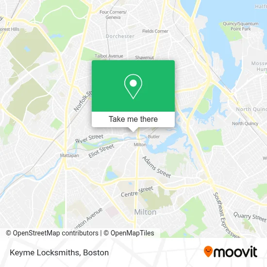
See Keyme Locksmiths, Boston, on the map
Public Transit to Keyme Locksmiths in Boston
Wondering how to get to Keyme Locksmiths in Boston? Moovit helps you find the best way to get to Keyme Locksmiths with step-by-step directions from the nearest public transit station.
Moovit provides free maps and live directions to help you navigate through your city. View schedules, routes, timetables, and find out how long does it take to get to Keyme Locksmiths in real time.
Looking for the nearest stop or station to Keyme Locksmiths? Check out this list of stops closest to your destination: Adams St @ Eliot St; Dorchester Ave @ Washington St; Cedar Grove.
Bus: 24, 240, 217, MATTAPAN LINE SHUTTLE, MATTAPAN LINE SHUTTLE, RED/MATTAPAN LINE SHUTTLE, 15, 12.Train: FAIRMOUNT.Subway: MATTAPAN LINE.
Want to see if there’s another route that gets you there at an earlier time? Moovit helps you find alternative routes or times. Get directions from and directions to Keyme Locksmiths easily from the Moovit App or Website.
We make riding to Keyme Locksmiths easy, which is why over 1.7 million users, including users in Boston, trust Moovit as the best app for public transit. You don’t need to download an individual bus app or train app, Moovit is your all-in-one transit app that helps you find the best bus time or train time available.
For information on prices of bus, subway and train, costs and ride fares to Keyme Locksmiths, please check the Moovit app.
Use the app to navigate to popular places including to the airport, hospital, stadium, grocery store, mall, coffee shop, school, college, and university.
Keyme Locksmiths Address: 4 River St street in Boston
- Star Market,
- Coinstar,
- American Locksmith,
- Boston Renaissance Charter Public School,
- STARBUCKS,
- International Brotherhood of Electrical Workers,
- Boston's Best Neighbor Award,
- Walter Baker Lofts,
- Boss Dream Boutique,
- Joy's Touch,
- Lower Mills,
- Playground at Dorchester Park,
- Schoolhouse at Lower Mills (Schoolhouses at Lower Mills Rentals),
- Saint John Paul II Catholic Academy,
- Muscle & Flow,
- DUNKIN',
- Oakley,
- Freeport Street Donuts,
- Sense Thai Massage and Bodywork,
- Adams Lower Mills
Places Near Keyme Locksmiths (Boston)
- Boston Medical Center, Boston,
- Prudential Center, Boston,
- House Of Blues, Boston,
- Quincy Market, Boston,
- Boston Common, Boston,
- Museum Of Science, Boston,
- Isabella Stewart Gardner Museum, Boston,
- Seaport District, Boston,
- Leader Bank Pavilion (Leader Bank Pavillion), Boston,
- Castle Island, Boston,
- North End, Boston,
- Boston Children's Hospital, Boston,
- Boston Convention & Exhibition Center, Boston,
- Massachusetts General Hospital, Boston,
- Wilbur Theatre, Boston,
- Faneuil Hall, Boston,
- Cheers, Boston,
- Mgm Music Hall, Boston,
- Wang Theater, Boston,
- Td Garden, Boston
How to get to popular places in Boston with public transit
Get around Boston by public transit!
Traveling around Boston has never been so easy. See step by step directions as you travel to any attraction, street or major public transit station. View bus and train schedules, arrival times, service alerts and detailed routes on a map, so you know exactly how to get to anywhere in Boston.
When traveling to any destination around Boston use Moovit's Live Directions with Get Off Notifications to know exactly where and how far to walk, how long to wait for your line, and how many stops are left. Moovit will alert you when it's time to get off — no need to constantly re-check whether yours is the next stop.
Wondering how to use public transit in Boston or how to pay for public transit in Boston? Moovit public transit app can help you navigate your way with public transit easily, and at minimum cost. It includes public transit fees, ticket prices, and costs. Looking for a map of Boston public transit lines? Moovit public transit app shows all public transit maps in Boston with all Bus, Train, Subway and Ferry routes and stops on an interactive map.
Boston has 4 transit type(s), including: Bus, Train, Subway and Ferry, operated by several transit agencies, including MBTA, Southeastern Regional Transit Authority, MetroWest Regional Transit Authority, Rhode Island Public Transit Authority, WRTA, Lowell Regional Transit Authority, Merrimack Valley Transit, Montachusett Regional Transit Authority, Cape Cod Regional Transit Authority, Brockton Area Transit Authority, Martha's Vineyard Transit Authority, the WAVE - Nantucket Regional Transit Authority, GATRA, Cape Ann Transportation Authority and Massport