Directions to Keyme Locksmiths (Waltham) with public transportation
The following transit lines have routes that pass near Keyme Locksmiths
 Bus: 558, 70, 556.
- Train: FITCHBURG, FRAMINGHAM/WORCESTER.
How to get to Keyme Locksmiths by bus?
Click on the bus route to see step by step directions with maps, line arrival times and updated time schedules.
From Assembly Row, Somerville
85 minFrom Brookline, MA, Brookline
68 minFrom Inman Square, Cambridge
62 minFrom Harvard Business School, Boston
47 minFrom Beth Israel Deaconess Medical Center, Boston
78 minFrom 98 Binney St, Boston
79 minFrom Tufts University, Medford
75 minFrom Apple Cinemas, Cambridge
72 minFrom Mission Hill, Boston
74 min
How to get to Keyme Locksmiths by train?
Click on the train route to see step by step directions with maps, line arrival times and updated time schedules.
Bus stops near Keyme Locksmiths in Waltham
Train stations near Keyme Locksmiths in Waltham
What are the closest stations to Keyme Locksmiths?
The closest stations to Keyme Locksmiths are:
- River St @ Willow St is 144 yards away, 2 min walk.
- High St @ Cedar St is 761 yards away, 9 min walk.
- Brandeis/Roberts is 2009 yards away, 24 min walk.
- Newtonville is 4514 yards away, 53 min walk.
Which bus lines stop near Keyme Locksmiths?
These bus lines stop near Keyme Locksmiths: 558, 70.
Which train lines stop near Keyme Locksmiths?
These train lines stop near Keyme Locksmiths: FITCHBURG, FRAMINGHAM/WORCESTER.
What’s the nearest train station to Keyme Locksmiths in Waltham?
The nearest train station to Keyme Locksmiths in Waltham is Brandeis/Roberts. It’s a 24 min walk away.
What’s the nearest bus station to Keyme Locksmiths in Waltham?
The nearest bus station to Keyme Locksmiths in Waltham is River St @ Willow St. It’s a 2 min walk away.
What time is the first train to Keyme Locksmiths in Waltham?
The FRAMINGHAM/WORCESTER is the first train that goes to Keyme Locksmiths in Waltham. It stops nearby at 5:22 AM.
What time is the last train to Keyme Locksmiths in Waltham?
The FRAMINGHAM/WORCESTER is the last train that goes to Keyme Locksmiths in Waltham. It stops nearby at 12:20 AM.
What time is the first bus to Keyme Locksmiths in Waltham?
The 556 is the first bus that goes to Keyme Locksmiths in Waltham. It stops nearby at 6:22 AM.
What time is the last bus to Keyme Locksmiths in Waltham?
The 556 is the last bus that goes to Keyme Locksmiths in Waltham. It stops nearby at 7:58 PM.
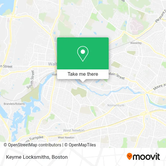
See Keyme Locksmiths, Waltham, on the map
Public Transit to Keyme Locksmiths in Waltham
Wondering how to get to Keyme Locksmiths in Waltham? Moovit helps you find the best way to get to Keyme Locksmiths with step-by-step directions from the nearest public transit station.
Moovit provides free maps and live directions to help you navigate through your city. View schedules, routes, timetables, and find out how long does it take to get to Keyme Locksmiths in real time.
Looking for the nearest stop or station to Keyme Locksmiths? Check out this list of stops closest to your destination: River St @ Willow St; High St @ Cedar St; Brandeis/Roberts; Newtonville.
Bus: 558, 70, 556.Train: FITCHBURG, FRAMINGHAM/WORCESTER.
Want to see if there’s another route that gets you there at an earlier time? Moovit helps you find alternative routes or times. Get directions from and directions to Keyme Locksmiths easily from the Moovit App or Website.
We make riding to Keyme Locksmiths easy, which is why over 1.7 million users, including users in Waltham, trust Moovit as the best app for public transit. You don’t need to download an individual bus app or train app, Moovit is your all-in-one transit app that helps you find the best bus time or train time available.
For information on prices of bus, train and subway, costs and ride fares to Keyme Locksmiths, please check the Moovit app.
Use the app to navigate to popular places including to the airport, hospital, stadium, grocery store, mall, coffee shop, school, college, and university.
Keyme Locksmiths Address: 130 River St street in Waltham
- Coinstar - Bitcoin ATM,
- Amazon Locker-Yacin,
- Taqueria El Amigo (Taqueria El Mariachi),
- Conservatory of Esthetics & Bioelements,
- Cims,
- Carolina Court,
- Emergency Locksmith,
- Kingswood Masonry & Roofing,
- Newtonville Camera, Inc.,
- Driverspace,
- Descar,
- Procuts,
- The Team Featured Properties Property Search,
- Novatio Engineering,
- Extra Space Storage,
- Relocate Moving Company,
- The New York Mta,
- Bj's Wholesale Club,
- Coconut Beauty Club,
- AT&T
Places Near Keyme Locksmiths (Waltham)
- Prudential Center, Boston,
- Wilbur Theatre, Boston,
- Mgm Music Hall, Boston,
- North End, Boston,
- Td Garden, Boston,
- Boston Children's Hospital, Boston,
- Seaport District, Boston,
- Cheers, Boston,
- Castle Island, Boston,
- Boston Convention & Exhibition Center, Boston,
- Massachusetts General Hospital, Boston,
- House Of Blues, Boston,
- Isabella Stewart Gardner Museum, Boston,
- Boston Common, Boston,
- Wang Theater, Boston,
- Boston Medical Center, Boston,
- Leader Bank Pavilion (Leader Bank Pavillion), Boston,
- Faneuil Hall, Boston,
- Museum Of Science, Boston,
- Quincy Market, Boston
How to get to popular places in Boston with public transit
Get around Waltham by public transit!
Traveling around Waltham has never been so easy. See step by step directions as you travel to any attraction, street or major public transit station. View bus and train schedules, arrival times, service alerts and detailed routes on a map, so you know exactly how to get to anywhere in Waltham.
When traveling to any destination around Waltham use Moovit's Live Directions with Get Off Notifications to know exactly where and how far to walk, how long to wait for your line, and how many stops are left. Moovit will alert you when it's time to get off — no need to constantly re-check whether yours is the next stop.
Wondering how to use public transit in Waltham or how to pay for public transit in Waltham? Moovit public transit app can help you navigate your way with public transit easily, and at minimum cost. It includes public transit fees, ticket prices, and costs. Looking for a map of Waltham public transit lines? Moovit public transit app shows all public transit maps in Waltham with all Bus, Train, Subway and Ferry routes and stops on an interactive map.
Boston has 4 transit type(s), including: Bus, Train, Subway and Ferry, operated by several transit agencies, including MBTA, Southeastern Regional Transit Authority, MetroWest Regional Transit Authority, Rhode Island Public Transit Authority, WRTA, Lowell Regional Transit Authority, Merrimack Valley Transit, Montachusett Regional Transit Authority, Cape Cod Regional Transit Authority, Brockton Area Transit Authority, Martha's Vineyard Transit Authority, the WAVE - Nantucket Regional Transit Authority, GATRA, Cape Ann Transportation Authority and Massport