Directions to Keyme Locksmiths (Boston) with public transportation
The following transit lines have routes that pass near Keyme Locksmiths
 Bus: 19, 501, 57, 66, GREEN LINE B SHUTTLE.
- Train: FRAMINGHAM/WORCESTER.
- Subway: GREEN LINE B.
How to get to Keyme Locksmiths by bus?
Click on the bus route to see step by step directions with maps, line arrival times and updated time schedules.
From Castle Island, Boston
74 minFrom Homewood Suites by Hilton Boston Logan Airport Chelsea, Chelsea
76 minFrom Boston Scientific, Quincy
157 minFrom New England Law | Boston, Boston
23 minFrom Marina Bay, Quincy
156 minFrom Lower Mills, Boston
82 minFrom Holiday Inn Express Boston, Boston
66 minFrom Haymarket, Boston, Boston
64 minFrom VA Hospital, Boston
63 minFrom I-95 / Route 128 & Route 16 Interchange (Exit 21), Newton
87 min
How to get to Keyme Locksmiths by train?
Click on the train route to see step by step directions with maps, line arrival times and updated time schedules.
How to get to Keyme Locksmiths by subway?
Click on the subway route to see step by step directions with maps, line arrival times and updated time schedules.
Subway station near Keyme Locksmiths in Boston
- Harvard Ave., 1 min walk,VIEW
Bus stops near Keyme Locksmiths in Boston
Bus lines to Keyme Locksmiths in Boston
- 66, Nubian Via Allston,VIEW
- GREEN LINE B SHUTTLE, Boston College - Blandford Street,VIEW
- GREEN LINE B SHUTTLE, Boston College - Back Bay (Shuttle),VIEW
- GREEN LINE B SHUTTLE, Washington Street - Kenmore,VIEW
- GREEN LINE B SHUTTLE, Washington Street - Blandford Street,VIEW
- GREEN LINE B SHUTTLE, Boston College - Babcock Street,VIEW
- GREEN LINE B SHUTTLE, Boston College - Packard's Corner,VIEW
- SHUTTLE, Boston College - Kenmore (Shuttle),VIEW
- 57, Oak Square,VIEW
What are the closest stations to Keyme Locksmiths?
The closest stations to Keyme Locksmiths are:
- Harvard Ave. is 43 yards away, 1 min walk.
- Harvard Ave @ Commonwealth Ave is 48 yards away, 1 min walk.
- Harvard Avenue - Commonwealth Ave @ Harvard Ave is 51 yards away, 1 min walk.
- Brighton Ave @ Harvard Ave is 359 yards away, 5 min walk.
Which bus lines stop near Keyme Locksmiths?
These bus lines stop near Keyme Locksmiths: 19, 501, 57, 66.
Which train line stops near Keyme Locksmiths?
FRAMINGHAM/WORCESTER (#521 | Worcester)
Which subway line stops near Keyme Locksmiths?
GREEN LINE B (Boston College)
What’s the nearest subway station to Keyme Locksmiths in Boston?
The nearest subway station to Keyme Locksmiths in Boston is Harvard Ave.. It’s a 1 min walk away.
What’s the nearest bus station to Keyme Locksmiths in Boston?
The nearest bus stations to Keyme Locksmiths in Boston are Harvard Ave @ Commonwealth Ave and Harvard Avenue - Commonwealth Ave @ Harvard Ave. The closest one is a 1 min walk away.
What time is the first subway to Keyme Locksmiths in Boston?
The GREEN LINE B is the first subway that goes to Keyme Locksmiths in Boston. It stops nearby at 5:12 AM.
What time is the last subway to Keyme Locksmiths in Boston?
The GREEN LINE B is the last subway that goes to Keyme Locksmiths in Boston. It stops nearby at 2:28 AM.
What time is the first bus to Keyme Locksmiths in Boston?
The 57 is the first bus that goes to Keyme Locksmiths in Boston. It stops nearby at 4:40 AM.
What time is the last bus to Keyme Locksmiths in Boston?
The 66 is the last bus that goes to Keyme Locksmiths in Boston. It stops nearby at 2:23 AM.
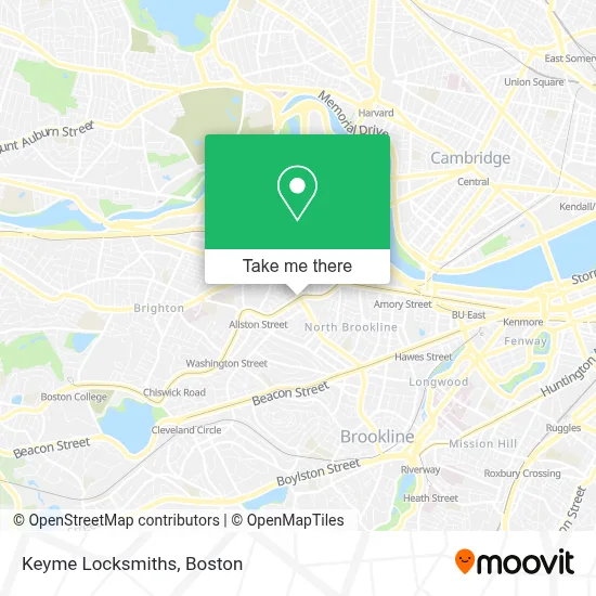
See Keyme Locksmiths, Boston, on the map
Public Transit to Keyme Locksmiths in Boston
Wondering how to get to Keyme Locksmiths in Boston? Moovit helps you find the best way to get to Keyme Locksmiths with step-by-step directions from the nearest public transit station.
Moovit provides free maps and live directions to help you navigate through your city. View schedules, routes, timetables, and find out how long does it take to get to Keyme Locksmiths in real time.
Looking for the nearest stop or station to Keyme Locksmiths? Check out this list of stops closest to your destination: Harvard Ave.; Harvard Ave @ Commonwealth Ave; Harvard Avenue - Commonwealth Ave @ Harvard Ave; Brighton Ave @ Harvard Ave.
Bus: 19, 501, 57, 66, GREEN LINE B SHUTTLE, GREEN LINE B SHUTTLE, GREEN LINE B SHUTTLE, GREEN LINE B SHUTTLE, GREEN LINE B SHUTTLE.Train: FRAMINGHAM/WORCESTER.Subway: GREEN LINE B.
Want to see if there’s another route that gets you there at an earlier time? Moovit helps you find alternative routes or times. Get directions from and directions to Keyme Locksmiths easily from the Moovit App or Website.
We make riding to Keyme Locksmiths easy, which is why over 1.7 million users, including users in Boston, trust Moovit as the best app for public transit. You don’t need to download an individual bus app or train app, Moovit is your all-in-one transit app that helps you find the best bus time or train time available.
For information on prices of subway, bus, train and ferry, costs and ride fares to Keyme Locksmiths, please check the Moovit app.
Use the app to navigate to popular places including to the airport, hospital, stadium, grocery store, mall, coffee shop, school, college, and university.
Keyme Locksmiths Address: 1227 Commonwealth Ave street in Boston
- Allston,
- Navy Federal Credit Union,
- Habibi's Lounge (Habibis Hookah Bar),
- Volmer's Hair Salon (Volmmer's Hair Cutting),
- Buffalo Exchange,
- Ritual Arts,
- Bluebikes - Harvard Ave at Brainerd Rd,
- Vip Barber Shop,
- Regeneration Tattoo (Regeneration Records & Tattoo),
- Do Plus Hair Salon,
- LAND ROVER Boston,
- 2 Feneno ter Parking,
- Pineapple Kiss,
- Moon Flower House,
- Urban Renewals,
- Meet Fresh,
- Shibuyala,
- White Horse Tavern,
- Herb Chambers BMW of Boston,
- August's Cocktail Catering
Places Near Keyme Locksmiths (Boston)
- Seaport District, Boston,
- Museum Of Science, Boston,
- Faneuil Hall, Boston,
- Boston Common, Boston,
- Boston Convention & Exhibition Center, Boston,
- Boston Children's Hospital, Boston,
- Leader Bank Pavilion (Leader Bank Pavillion), Boston,
- Td Garden, Boston,
- Wilbur Theatre, Boston,
- House Of Blues, Boston,
- Isabella Stewart Gardner Museum, Boston,
- Wang Theater, Boston,
- Massachusetts General Hospital, Boston,
- Castle Island, Boston,
- Cheers, Boston,
- Boston Medical Center, Boston,
- Prudential Center, Boston,
- Quincy Market, Boston,
- North End, Boston,
- Mgm Music Hall, Boston
How to get to popular places in Boston with public transit
Get around Boston by public transit!
Traveling around Boston has never been so easy. See step by step directions as you travel to any attraction, street or major public transit station. View bus and train schedules, arrival times, service alerts and detailed routes on a map, so you know exactly how to get to anywhere in Boston.
When traveling to any destination around Boston use Moovit's Live Directions with Get Off Notifications to know exactly where and how far to walk, how long to wait for your line, and how many stops are left. Moovit will alert you when it's time to get off — no need to constantly re-check whether yours is the next stop.
Wondering how to use public transit in Boston or how to pay for public transit in Boston? Moovit public transit app can help you navigate your way with public transit easily, and at minimum cost. It includes public transit fees, ticket prices, and costs. Looking for a map of Boston public transit lines? Moovit public transit app shows all public transit maps in Boston with all Bus, Train, Subway and Ferry routes and stops on an interactive map.
Boston has 4 transit type(s), including: Bus, Train, Subway and Ferry, operated by several transit agencies, including MBTA, Southeastern Regional Transit Authority, MetroWest Regional Transit Authority, Rhode Island Public Transit Authority, WRTA, Lowell Regional Transit Authority, Merrimack Valley Transit, Montachusett Regional Transit Authority, Cape Cod Regional Transit Authority, Brockton Area Transit Authority, Martha's Vineyard Transit Authority, the WAVE - Nantucket Regional Transit Authority, GATRA, Cape Ann Transportation Authority and Massport