Directions to Keyme Locksmiths (Indianapolis City (Balance)) with public transportation
The following transit lines have routes that pass near Keyme Locksmiths
 Bus: 16.
How to get to Keyme Locksmiths by bus?
Click on the bus route to see step by step directions with maps, line arrival times and updated time schedules.
From Schools-Public, Beech Grove
31 minFrom FedEx, Indianapolis City (Balance)
40 minFrom Scott's Candy Shop, Indianapolis City (Balance)
44 minFrom I-465 / I-65 Interchange, Indianapolis City (Balance)
45 minFrom Five Star Hand Car Wash, Indianapolis City (Balance)
20 minFrom Uab Recycling LLC, Indianapolis City (Balance)
40 minFrom Halloween City, Indianapolis City (Balance)
75 minFrom Trinity Insurance Agency LLC, Indianapolis City (Balance)
96 min
Bus stop near Keyme Locksmiths in Indianapolis City (Balance)
- Emerson Ave & Noggle Way, 5 min walk,VIEW
Bus lines to Keyme Locksmiths in Indianapolis City (Balance)
- 16, County Line Rd,VIEW
What are the closest stations to Keyme Locksmiths?
The closest stations to Keyme Locksmiths are:
- Emerson Ave & Noggle Way is 395 yards away, 5 min walk.
Which bus line stops near Keyme Locksmiths?
16 (County Line Rd)
What’s the nearest bus station to Keyme Locksmiths in Indianapolis City (Balance)?
The nearest bus station to Keyme Locksmiths in Indianapolis City (Balance) is Emerson Ave & Noggle Way. It’s a 5 min walk away.
What time is the first bus to Keyme Locksmiths in Indianapolis City (Balance)?
The 16 is the first bus that goes to Keyme Locksmiths in Indianapolis City (Balance). It stops nearby at 4:47 AM.
What time is the last bus to Keyme Locksmiths in Indianapolis City (Balance)?
The 16 is the last bus that goes to Keyme Locksmiths in Indianapolis City (Balance). It stops nearby at 10:18 PM.
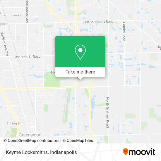
See Keyme Locksmiths, Indianapolis City (Balance), on the map
Public Transit to Keyme Locksmiths in Indianapolis City (Balance)
Wondering how to get to Keyme Locksmiths in Indianapolis City (Balance)? Moovit helps you find the best way to get to Keyme Locksmiths with step-by-step directions from the nearest public transit station.
Moovit provides free maps and live directions to help you navigate through your city. View schedules, routes, timetables, and find out how long does it take to get to Keyme Locksmiths in real time.
Looking for the nearest stop or station to Keyme Locksmiths? Check out this list of stops closest to your destination: Emerson Ave & Noggle Way.
Bus: 16.
Want to see if there’s another route that gets you there at an earlier time? Moovit helps you find alternative routes or times. Get directions from and directions to Keyme Locksmiths easily from the Moovit App or Website.
We make riding to Keyme Locksmiths easy, which is why over 1.5 million users, including users in Indianapolis City (Balance), trust Moovit as the best app for public transit. You don’t need to download an individual bus app or train app, Moovit is your all-in-one transit app that helps you find the best bus time or train time available.
For information on prices of bus, costs and ride fares to Keyme Locksmiths, please check the Moovit app.
Use the app to navigate to popular places including to the airport, hospital, stadium, grocery store, mall, coffee shop, school, college, and university.
Keyme Locksmiths Address: 8745 S Emerson Ave street in Indianapolis City (Balance)
- Western Union,
- Kroger Money,
- The Little Clinic,
- Kroger #894,
- Atm Kroger,
- Prime Plumber Indianapolis & Sewer Cleaning,
- Hampton Inn & Suites by Hilton Indianapolis South Greenwood,
- Hampton Inn And Suites,
- Residence Inn,
- Freddy's Frozen Custard & Steakburger,
- Hyderabad House,
- Blue Rhino Propane Exchange,
- Dr. Daniel Wendorff & Associates,
- Schumacher Homes Of Indianapolis, In,
- Hilton Garden Inn Indianapolis South,
- Sleep Center at Furniture Fair,
- 5255 Noggle Way,
- Chicken Salad Chick,
- LENS CRAFTERS,
- Bibibop Asian Grill
Places Near Keyme Locksmiths (Indianapolis City (Balance))
- Train Ride At Castleton Mall, Indianapolis City (Balance),
- Indianapolis Motor Speedway, Speedway,
- Jersey Barn, Indianapolis City (Balance),
- I-465 / I-65 Interchange, Indianapolis City (Balance),
- St. Vincent Hospital - Indianapolis, Indianapolis City (Balance),
- Indianapolis Airport Zone 2, Indianapolis City (Balance),
- Plainfield, IN, Plainfield,
- Indiana, Indianapolis City (Balance),
- THE BALT, Indianapolis City (Balance),
- Methodist Hospital of Indianapolis, Indianapolis City (Balance),
- St. Vincent entrance #1, Indianapolis City (Balance),
- Castleton Square Mall, Indianapolis,
- Cotter's Massage Parlor With Happy Endings, Indianapolis City (Balance),
- Indiana Convention Center, Indianapolis City (Balance),
- Eskenazi Hospital, Indianapolis City (Balance),
- Lilly Corporate Center (Eli Lilly & Co), Indianapolis City (Balance),
- Lucas Oil Stadium, Indianapolis City (Balance),
- Gainbridge Fieldhouse, Indianapolis City (Balance),
- 119 W 19th St Parking, Indianapolis City (Balance),
- I U Health Methodist Hospital, Indianapolis City (Balance)
How to get to popular places in Indianapolis with public transit
Get around Indianapolis City (Balance) by public transit!
Traveling around Indianapolis City (Balance) has never been so easy. See step by step directions as you travel to any attraction, street or major public transit station. View bus and train schedules, arrival times, service alerts and detailed routes on a map, so you know exactly how to get to anywhere in Indianapolis City (Balance).
When traveling to any destination around Indianapolis City (Balance) use Moovit's Live Directions with Get Off Notifications to know exactly where and how far to walk, how long to wait for your line, and how many stops are left. Moovit will alert you when it's time to get off — no need to constantly re-check whether yours is the next stop.
Wondering how to use public transit in Indianapolis City (Balance) or how to pay for public transit in Indianapolis City (Balance)? Moovit public transit app can help you navigate your way with public transit easily, and at minimum cost. It includes public transit fees, ticket prices, and costs. Looking for a map of Indianapolis City (Balance) public transit lines? Moovit public transit app shows all public transit maps in Indianapolis City (Balance) with all bus routes and stops on an interactive map.
Indianapolis has 1 transit type(s), including: bus, operated by several transit agencies, including IndyGo, FlixBus-us and Greyhound-us