Directions to Keys-For-Kids With Marina (Newton) with public transportation
The following transit lines have routes that pass near Keys-For-Kids With Marina
 Bus: 553, 556, 59, 554.
- Train: FRAMINGHAM/WORCESTER.
- Subway: GREEN LINE D, GREEN LINE B.
How to get to Keys-For-Kids With Marina by bus?
Click on the bus route to see step by step directions with maps, line arrival times and updated time schedules.
From Boston Temple, Boston
60 minFrom Copley MBTA Station, Boston
33 minFrom Westin Copley Place Hotel Boston, Boston
33 minFrom Massachusetts College Of Pharmacy And Health Science, Boston
50 minFrom Saltie Girl, Boston
51 minFrom Old South Church, Boston
34 minFrom Mount Auburn, Cambridge
37 minFrom Boston Marathon Finish Line, Boston
34 minFrom James P. Kelleher Rose Garden, Boston
51 minFrom Boston Public Library, Boston
34 min
How to get to Keys-For-Kids With Marina by train?
Click on the train route to see step by step directions with maps, line arrival times and updated time schedules.
From Boston Temple, Boston
30 minFrom Copley MBTA Station, Boston
34 minFrom Westin Copley Place Hotel Boston, Boston
33 minFrom Massachusetts College Of Pharmacy And Health Science, Boston
126 minFrom Saltie Girl, Boston
31 minFrom Old South Church, Boston
35 minFrom Boston Marathon Finish Line, Boston
34 minFrom James P. Kelleher Rose Garden, Boston
35 minFrom Boston Public Library, Boston
34 min
How to get to Keys-For-Kids With Marina by subway?
Click on the subway route to see step by step directions with maps, line arrival times and updated time schedules.
From Boston Temple, Boston
66 minFrom Copley MBTA Station, Boston
64 minFrom Westin Copley Place Hotel Boston, Boston
67 minFrom Massachusetts College Of Pharmacy And Health Science, Boston
82 minFrom Saltie Girl, Boston
58 minFrom Old South Church, Boston
65 minFrom Boston Marathon Finish Line, Boston
65 minFrom James P. Kelleher Rose Garden, Boston
70 minFrom Boston Public Library, Boston
65 min
Bus stops near Keys-For-Kids With Marina in Newton
Train station near Keys-For-Kids With Marina in Newton
- Newtonville, 2 min walk,VIEW
Subway stations near Keys-For-Kids With Marina in Newton
Bus lines to Keys-For-Kids With Marina in Newton
What are the closest stations to Keys-For-Kids With Marina?
The closest stations to Keys-For-Kids With Marina are:
- Washington St @ Lewis Terr is 62 yards away, 1 min walk.
- Walnut St @ Newtonville Ave is 75 yards away, 2 min walk.
- Newtonville is 116 yards away, 2 min walk.
- Newton Highlands is 758 yards away, 9 min walk.
- Boston College is 2747 yards away, 32 min walk.
Which bus lines stop near Keys-For-Kids With Marina?
These bus lines stop near Keys-For-Kids With Marina: 553, 556, 59.
Which train line stops near Keys-For-Kids With Marina?
FRAMINGHAM/WORCESTER (#521 | Worcester)
Which subway line stops near Keys-For-Kids With Marina?
GREEN LINE D (Riverside)
What’s the nearest subway station to Keys-For-Kids With Marina in Newton?
The nearest subway station to Keys-For-Kids With Marina in Newton is Newton Highlands. It’s a 9 min walk away.
What’s the nearest train station to Keys-For-Kids With Marina in Newton?
The nearest train station to Keys-For-Kids With Marina in Newton is Newtonville. It’s a 2 min walk away.
What’s the nearest bus station to Keys-For-Kids With Marina in Newton?
The nearest bus station to Keys-For-Kids With Marina in Newton is Washington St @ Lewis Terr. It’s a 1 min walk away.
What time is the first subway to Keys-For-Kids With Marina in Newton?
The GREEN LINE D is the first subway that goes to Keys-For-Kids With Marina in Newton. It stops nearby at 4:52 AM.
What time is the last subway to Keys-For-Kids With Marina in Newton?
The GREEN LINE B is the last subway that goes to Keys-For-Kids With Marina in Newton. It stops nearby at 2:39 AM.
What time is the first train to Keys-For-Kids With Marina in Newton?
The FRAMINGHAM/WORCESTER is the first train that goes to Keys-For-Kids With Marina in Newton. It stops nearby at 5:22 AM.
What time is the last train to Keys-For-Kids With Marina in Newton?
The FRAMINGHAM/WORCESTER is the last train that goes to Keys-For-Kids With Marina in Newton. It stops nearby at 12:20 AM.
What time is the first bus to Keys-For-Kids With Marina in Newton?
The 554 is the first bus that goes to Keys-For-Kids With Marina in Newton. It stops nearby at 6:02 AM.
What time is the last bus to Keys-For-Kids With Marina in Newton?
The 553 is the last bus that goes to Keys-For-Kids With Marina in Newton. It stops nearby at 9:09 PM.
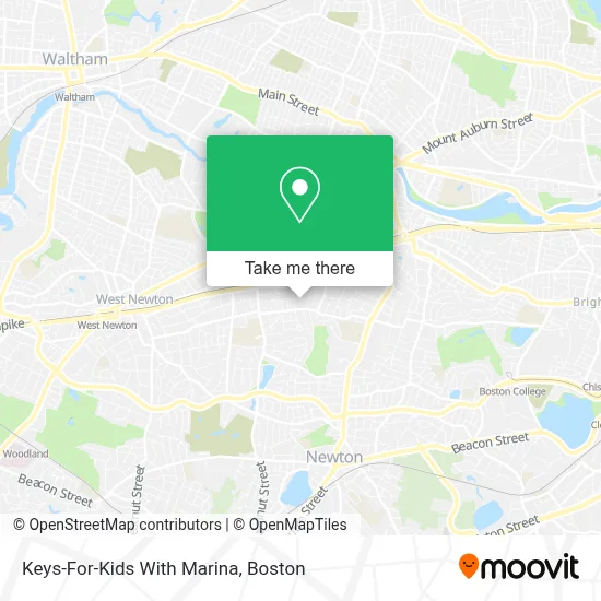
See Keys-For-Kids With Marina, Newton, on the map
Public Transit to Keys-For-Kids With Marina in Newton
Wondering how to get to Keys-For-Kids With Marina in Newton? Moovit helps you find the best way to get to Keys-For-Kids With Marina with step-by-step directions from the nearest public transit station.
Moovit provides free maps and live directions to help you navigate through your city. View schedules, routes, timetables, and find out how long does it take to get to Keys-For-Kids With Marina in real time.
Looking for the nearest stop or station to Keys-For-Kids With Marina? Check out this list of stops closest to your destination: Washington St @ Lewis Terr; Walnut St @ Newtonville Ave; Newtonville; Newton Highlands; Boston College.
Bus: 553, 556, 59, 554.Train: FRAMINGHAM/WORCESTER.Subway: GREEN LINE D, GREEN LINE B.
Want to see if there’s another route that gets you there at an earlier time? Moovit helps you find alternative routes or times. Get directions from and directions to Keys-For-Kids With Marina easily from the Moovit App or Website.
We make riding to Keys-For-Kids With Marina easy, which is why over 1.7 million users, including users in Newton, trust Moovit as the best app for public transit. You don’t need to download an individual bus app or train app, Moovit is your all-in-one transit app that helps you find the best bus time or train time available.
For information on prices of train, bus and subway, costs and ride fares to Keys-For-Kids With Marina, please check the Moovit app.
Use the app to navigate to popular places including to the airport, hospital, stadium, grocery store, mall, coffee shop, school, college, and university.
Keys-For-Kids With Marina Address: 27 Clarendon St street in Newton
- Newtonville,
- Cradles To Crayons,
- Harvard St / Washington St,
- Community and Personal Awareness,
- Prince Edw V,
- Lug Away Junk Removal,
- Cabot's Ice Cream & Restaurant,
- Newtonville 25 Commercial Locksmith,
- Locks 4 You,
- Emily Lapolice, Licsw, Ryt,
- Lumaé Skin & Bodyworks,
- Mochiko Hawaiian,
- Peak Vision Care,
- Optical Shop at the Brook House,
- Otto,
- Cellular Solutions,
- Laura Pelton-Sweet, Counselor,
- Healing Center,
- VIP Skin Lab,
- Massachusetts Health Council
Places Near Keys-For-Kids With Marina (Newton)
- Seaport District, Boston,
- Museum Of Science, Boston,
- Faneuil Hall, Boston,
- Boston Common, Boston,
- Boston Convention & Exhibition Center, Boston,
- Boston Children's Hospital, Boston,
- Leader Bank Pavilion (Leader Bank Pavillion), Boston,
- Td Garden, Boston,
- Wilbur Theatre, Boston,
- House Of Blues, Boston,
- Isabella Stewart Gardner Museum, Boston,
- Wang Theater, Boston,
- Massachusetts General Hospital, Boston,
- Castle Island, Boston,
- Cheers, Boston,
- Boston Medical Center, Boston,
- Prudential Center, Boston,
- Quincy Market, Boston,
- North End, Boston,
- Mgm Music Hall, Boston
How to get to popular places in Boston with public transit
Get around Newton by public transit!
Traveling around Newton has never been so easy. See step by step directions as you travel to any attraction, street or major public transit station. View bus and train schedules, arrival times, service alerts and detailed routes on a map, so you know exactly how to get to anywhere in Newton.
When traveling to any destination around Newton use Moovit's Live Directions with Get Off Notifications to know exactly where and how far to walk, how long to wait for your line, and how many stops are left. Moovit will alert you when it's time to get off — no need to constantly re-check whether yours is the next stop.
Wondering how to use public transit in Newton or how to pay for public transit in Newton? Moovit public transit app can help you navigate your way with public transit easily, and at minimum cost. It includes public transit fees, ticket prices, and costs. Looking for a map of Newton public transit lines? Moovit public transit app shows all public transit maps in Newton with all Bus, Train, Subway and Ferry routes and stops on an interactive map.
Boston has 4 transit type(s), including: Bus, Train, Subway and Ferry, operated by several transit agencies, including MBTA, Southeastern Regional Transit Authority, MetroWest Regional Transit Authority, Rhode Island Public Transit Authority, WRTA, Lowell Regional Transit Authority, Merrimack Valley Transit, Montachusett Regional Transit Authority, Cape Cod Regional Transit Authority, Brockton Area Transit Authority, Martha's Vineyard Transit Authority, the WAVE - Nantucket Regional Transit Authority, GATRA, Cape Ann Transportation Authority and Massport