How to get to Kiley & O'Toole Insurance, Inc. by bus?
Click on the bus route to see step by step directions with maps, line arrival times and updated time schedules.
From 7F Everett Street, Revere
77 minFrom Quincy, MA, Quincy
92 minFrom Brighton Music Hall, Boston
63 minFrom West Roxbury, Boston
61 minFrom Quincy Center Station, Quincy
96 minFrom Malden, MA, Malden
82 minFrom Forest Hills Station MBTA, Boston
45 minFrom Qea, Quincy
79 minFrom The Mall At Chestnut Hill, Newton
82 minFrom Boston Landing Station, Boston
75 min
How to get to Kiley & O'Toole Insurance, Inc. by train?
Click on the train route to see step by step directions with maps, line arrival times and updated time schedules.
How to get to Kiley & O'Toole Insurance, Inc. by subway?
Click on the subway route to see step by step directions with maps, line arrival times and updated time schedules.
From 7F Everett Street, Revere
52 minFrom Quincy, MA, Quincy
32 minFrom Brighton Music Hall, Boston
55 minFrom Quincy Center Station, Quincy
25 minFrom Malden, MA, Malden
44 minFrom Forest Hills Station MBTA, Boston
34 minFrom Qea, Quincy
29 minFrom The Mall At Chestnut Hill, Newton
76 minFrom Boston Landing Station, Boston
71 min
Bus stops near Kiley & O'Toole Insurance, Inc. in Boston
Subway stations near Kiley & O'Toole Insurance, Inc. in Boston
Train stations near Kiley & O'Toole Insurance, Inc. in Boston
Bus lines to Kiley & O'Toole Insurance, Inc. in Boston
What are the closest stations to Kiley & O'Toole Insurance, Inc.?
The closest stations to Kiley & O'Toole Insurance, Inc. are:
- Dorchester St @ Old Colony Ave is 183 yards away, 3 min walk.
- W 7th St @ D St is 377 yards away, 5 min walk.
- Tufts Medical Center is 1010 yards away, 13 min walk.
- Broadway is 1131 yards away, 14 min walk.
- Newmarket is 1182 yards away, 15 min walk.
- Jfk/Umass is 1269 yards away, 15 min walk.
Which bus lines stop near Kiley & O'Toole Insurance, Inc.?
These bus lines stop near Kiley & O'Toole Insurance, Inc.: 11, 16, 17, 18, 9, CT3.
Which train lines stop near Kiley & O'Toole Insurance, Inc.?
These train lines stop near Kiley & O'Toole Insurance, Inc.: FRAMINGHAM/WORCESTER, GREENBUSH, KINGSTON, NEEDHAM.
Which subway line stops near Kiley & O'Toole Insurance, Inc.?
RED LINE (Ashmont/Braintree)
What’s the nearest subway station to Kiley & O'Toole Insurance, Inc. in Boston?
The nearest subway station to Kiley & O'Toole Insurance, Inc. in Boston is Tufts Medical Center. It’s a 13 min walk away.
What’s the nearest train station to Kiley & O'Toole Insurance, Inc. in Boston?
The nearest train stations to Kiley & O'Toole Insurance, Inc. in Boston are Newmarket and Jfk/Umass. The closest one is a 15 min walk away.
What’s the nearest bus station to Kiley & O'Toole Insurance, Inc. in Boston?
The nearest bus station to Kiley & O'Toole Insurance, Inc. in Boston is Dorchester St @ Old Colony Ave. It’s a 3 min walk away.
What time is the first subway to Kiley & O'Toole Insurance, Inc. in Boston?
The RED LINE is the first subway that goes to Kiley & O'Toole Insurance, Inc. in Boston. It stops nearby at 5:23 AM.
What time is the last subway to Kiley & O'Toole Insurance, Inc. in Boston?
The RED LINE is the last subway that goes to Kiley & O'Toole Insurance, Inc. in Boston. It stops nearby at 1:55 AM.
What time is the first train to Kiley & O'Toole Insurance, Inc. in Boston?
The FAIRMOUNT is the first train that goes to Kiley & O'Toole Insurance, Inc. in Boston. It stops nearby at 4:49 AM.
What time is the last train to Kiley & O'Toole Insurance, Inc. in Boston?
The FAIRMOUNT is the last train that goes to Kiley & O'Toole Insurance, Inc. in Boston. It stops nearby at 11:55 PM.
What time is the first bus to Kiley & O'Toole Insurance, Inc. in Boston?
The 10 is the first bus that goes to Kiley & O'Toole Insurance, Inc. in Boston. It stops nearby at 4:56 AM.
What time is the last bus to Kiley & O'Toole Insurance, Inc. in Boston?
The 10 is the last bus that goes to Kiley & O'Toole Insurance, Inc. in Boston. It stops nearby at 1:33 AM.
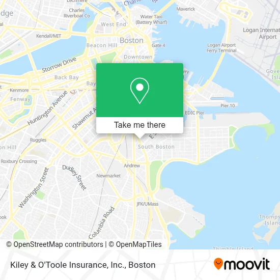
See Kiley & O'Toole Insurance, Inc., Boston, on the map
Public Transit to Kiley & O'Toole Insurance, Inc. in Boston
Wondering how to get to Kiley & O'Toole Insurance, Inc. in Boston? Moovit helps you find the best way to get to Kiley & O'Toole Insurance, Inc. with step-by-step directions from the nearest public transit station.
Moovit provides free maps and live directions to help you navigate through your city. View schedules, routes, timetables, and find out how long does it take to get to Kiley & O'Toole Insurance, Inc. in real time.
Looking for the nearest stop or station to Kiley & O'Toole Insurance, Inc.? Check out this list of stops closest to your destination: Dorchester St @ Old Colony Ave; W 7th St @ D St; Tufts Medical Center; Broadway; Newmarket; Jfk/Umass.
Bus: 11, 16, 17, 18, 9, CT3, 10.Train: FRAMINGHAM/WORCESTER, GREENBUSH, KINGSTON, NEEDHAM, FAIRMOUNT, FRANKLIN/FOXBORO, PROVIDENCE/STOUGHTON, FALL RIVER/NEW BEDFORD.Subway: RED LINE, ORANGE LINE.
Want to see if there’s another route that gets you there at an earlier time? Moovit helps you find alternative routes or times. Get directions from and directions to Kiley & O'Toole Insurance, Inc. easily from the Moovit App or Website.
We make riding to Kiley & O'Toole Insurance, Inc. easy, which is why over 1.7 million users, including users in Boston, trust Moovit as the best app for public transit. You don’t need to download an individual bus app or train app, Moovit is your all-in-one transit app that helps you find the best bus time or train time available.
For information on prices of bus, subway and train, costs and ride fares to Kiley & O'Toole Insurance, Inc., please check the Moovit app.
Use the app to navigate to popular places including to the airport, hospital, stadium, grocery store, mall, coffee shop, school, college, and university.
Kiley & O'Toole Insurance, Inc. Address: 138 Old Colony Ave street in Boston
- Kiley and O'Toole Insurance,
- 8kun W 8th St,
- D Street Projects,
- Dunkin',
- Tufts Medical Center South Boston Behavioral Health,
- Coop's Microcreamery,
- Shy Bird,
- #100,
- Castle Island Brewing Company,
- Castle Island Brewing,
- Greater Boston Gun Safety School (Greater Boston Airsoft),
- Stadium,
- 18x9 W 5th St,
- Condon James Elementary School,
- Catholic Charities,
- Columbus Park / Andrew Square,
- ATM Fast,
- Realty Assets,
- Martha Clarke Astrology,
- Casper Funeral Home (Casper Funeral & Cremation Services)
Places Near Kiley & O'Toole Insurance, Inc. (Boston)
- Boston Common, Boston,
- Boston Medical Center, Boston,
- Td Garden, Boston,
- Seaport District, Boston,
- Massachusetts General Hospital, Boston,
- Castle Island, Boston,
- Museum Of Science, Boston,
- Boston Children's Hospital, Boston,
- Wilbur Theatre, Boston,
- Quincy Market, Boston,
- Cheers, Boston,
- House Of Blues, Boston,
- Wang Theater, Boston,
- Leader Bank Pavilion (Leader Bank Pavillion), Boston,
- Mgm Music Hall, Boston,
- Prudential Center, Boston,
- Isabella Stewart Gardner Museum, Boston,
- North End, Boston,
- Faneuil Hall, Boston,
- Boston Convention & Exhibition Center, Boston
How to get to popular places in Boston with public transit
Get around Boston by public transit!
Traveling around Boston has never been so easy. See step by step directions as you travel to any attraction, street or major public transit station. View bus and train schedules, arrival times, service alerts and detailed routes on a map, so you know exactly how to get to anywhere in Boston.
When traveling to any destination around Boston use Moovit's Live Directions with Get Off Notifications to know exactly where and how far to walk, how long to wait for your line, and how many stops are left. Moovit will alert you when it's time to get off — no need to constantly re-check whether yours is the next stop.
Wondering how to use public transit in Boston or how to pay for public transit in Boston? Moovit public transit app can help you navigate your way with public transit easily, and at minimum cost. It includes public transit fees, ticket prices, and costs. Looking for a map of Boston public transit lines? Moovit public transit app shows all public transit maps in Boston with all Bus, Train, Subway and Ferry routes and stops on an interactive map.
Boston has 4 transit type(s), including: Bus, Train, Subway and Ferry, operated by several transit agencies, including MBTA, Southeastern Regional Transit Authority, MetroWest Regional Transit Authority, Rhode Island Public Transit Authority, WRTA, Lowell Regional Transit Authority, Merrimack Valley Transit, Montachusett Regional Transit Authority, Cape Cod Regional Transit Authority, Brockton Area Transit Authority, Martha's Vineyard Transit Authority, the WAVE - Nantucket Regional Transit Authority, GATRA, Cape Ann Transportation Authority and Massport