Directions to King Arthur (Chelsea) with public transportation
The following transit lines have routes that pass near King Arthur
 Bus: 104, 105, 109, 111, SL3.
- Train: NEWBURYPORT/ROCKPORT.
- Subway: ORANGE LINE.
How to get to King Arthur by bus?
Click on the bus route to see step by step directions with maps, line arrival times and updated time schedules.
From Jamaica Pond, Boston
105 minFrom VA Medical Center, Boston (Jamaica Plain), Boston
87 minFrom the mall at rockingham park mall, Boston
80 minFrom Jamaica Plain, Boston
103 minFrom Omni Hotel Seaport (2021), Boston
46 minFrom Harvard Business School, Boston
60 minFrom Franklin Park, Boston
100 minFrom Washington St, Boston
97 minFrom Wang Theater, Boston
57 minFrom 31 St. James Street, Boston
62 min
How to get to King Arthur by train?
Click on the train route to see step by step directions with maps, line arrival times and updated time schedules.
How to get to King Arthur by subway?
Click on the subway route to see step by step directions with maps, line arrival times and updated time schedules.
From Jamaica Pond, Boston
79 minFrom VA Medical Center, Boston (Jamaica Plain), Boston
84 minFrom the mall at rockingham park mall, Boston
95 minFrom Jamaica Plain, Boston
71 minFrom Omni Hotel Seaport (2021), Boston
71 minFrom Harvard Business School, Boston
83 minFrom Franklin Park, Boston
76 minFrom Washington St, Boston
71 minFrom Wang Theater, Boston
54 minFrom 31 St. James Street, Boston
61 min
Bus stops near King Arthur in Chelsea
Train station near King Arthur in Chelsea
- Chelsea, 26 min walk,VIEW
Subway station near King Arthur in Chelsea
- Wellington, 41 min walk,VIEW
Bus lines to King Arthur in Chelsea
What are the closest stations to King Arthur?
The closest stations to King Arthur are:
- Second St Opp Carter St is 166 yards away, 3 min walk.
- Hanover Everett is 266 yards away, 4 min walk.
- Spruce St @ Williams St is 795 yards away, 10 min walk.
- Chelsea is 1976 yards away, 26 min walk.
- Wellington is 3435 yards away, 41 min walk.
Which bus lines stop near King Arthur?
These bus lines stop near King Arthur: 104, 105, 109, 111, SL3.
Which train line stops near King Arthur?
NEWBURYPORT/ROCKPORT (#125 | Newburyport)
Which subway line stops near King Arthur?
ORANGE LINE (Oak Grove)
What’s the nearest train station to King Arthur in Chelsea?
The nearest train station to King Arthur in Chelsea is Chelsea. It’s a 26 min walk away.
What’s the nearest bus station to King Arthur in Chelsea?
The nearest bus station to King Arthur in Chelsea is Second St Opp Carter St. It’s a 3 min walk away.
What time is the first subway to King Arthur in Chelsea?
The ORANGE LINE is the first subway that goes to King Arthur in Chelsea. It stops nearby at 5:19 AM.
What time is the last subway to King Arthur in Chelsea?
The ORANGE LINE is the last subway that goes to King Arthur in Chelsea. It stops nearby at 1:53 AM.
What time is the first train to King Arthur in Chelsea?
The NEWBURYPORT/ROCKPORT is the first train that goes to King Arthur in Chelsea. It stops nearby at 5:40 AM.
What time is the last train to King Arthur in Chelsea?
The NEWBURYPORT/ROCKPORT is the last train that goes to King Arthur in Chelsea. It stops nearby at 12:06 AM.
What time is the first bus to King Arthur in Chelsea?
The 104 is the first bus that goes to King Arthur in Chelsea. It stops nearby at 4:38 AM.
What time is the last bus to King Arthur in Chelsea?
The 104 is the last bus that goes to King Arthur in Chelsea. It stops nearby at 1:26 AM.
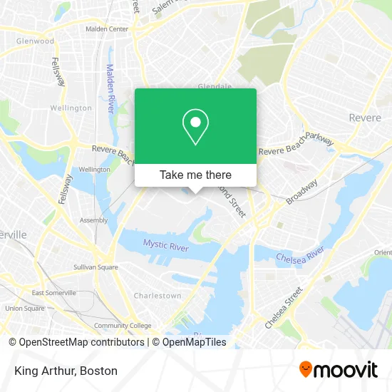
See King Arthur, Chelsea, on the map
Public Transit to King Arthur in Chelsea
Wondering how to get to King Arthur in Chelsea? Moovit helps you find the best way to get to King Arthur with step-by-step directions from the nearest public transit station.
Moovit provides free maps and live directions to help you navigate through your city. View schedules, routes, timetables, and find out how long does it take to get to King Arthur in real time.
Looking for the nearest stop or station to King Arthur? Check out this list of stops closest to your destination: Second St Opp Carter St; Hanover Everett; Spruce St @ Williams St; Chelsea; Wellington.
Bus: 104, 105, 109, 111, SL3, LOWER MYSTIC LINK, 112.Train: NEWBURYPORT/ROCKPORT.Subway: ORANGE LINE.
Want to see if there’s another route that gets you there at an earlier time? Moovit helps you find alternative routes or times. Get directions from and directions to King Arthur easily from the Moovit App or Website.
We make riding to King Arthur easy, which is why over 1.7 million users, including users in Chelsea, trust Moovit as the best app for public transit. You don’t need to download an individual bus app or train app, Moovit is your all-in-one transit app that helps you find the best bus time or train time available.
For information on prices of bus, subway and train, costs and ride fares to King Arthur, please check the Moovit app.
Use the app to navigate to popular places including to the airport, hospital, stadium, grocery store, mall, coffee shop, school, college, and university.
King Arthur Address: 200 Beacham St street in Chelsea
- Craft Massachusetts,
- Stardust Video,
- Archie & Sons Dismantling,
- Cupp & Cupp Corporation,
- New England Flower Exchange (Boston Flower Exchange),
- Extra Space Storage,
- Arsenal Consulting,
- Home,
- 2nd St,
- Desimones Auto Solutions,
- DTZ,
- Hampton Inn Boston Logan Airport Chelsea,
- Alaadeen Produce & Specialty Foods,
- Admirals Hill,
- Hourihane Cormier & Associates,
- TSR,
- Popeyes Louisiana Kitchen (Popeyes Famous Fried Chicken),
- Phunk Phenomenon,
- A G Quealy Towing,
- Sparkling Image Car Wash
Places Near King Arthur (Chelsea)
- House Of Blues, Boston,
- Wang Theater, Boston,
- Boston Common, Boston,
- Cheers, Boston,
- Boston Children's Hospital, Boston,
- Boston Convention & Exhibition Center, Boston,
- Wilbur Theatre, Boston,
- Massachusetts General Hospital, Boston,
- Mgm Music Hall, Boston,
- North End, Boston,
- Castle Island, Boston,
- Td Garden, Boston,
- Boston Medical Center, Boston,
- Museum Of Science, Boston,
- Prudential Center, Boston,
- Quincy Market, Boston,
- Seaport District, Boston,
- Isabella Stewart Gardner Museum, Boston,
- Leader Bank Pavilion (Leader Bank Pavillion), Boston,
- Faneuil Hall, Boston
How to get to popular places in Boston with public transit
Get around Chelsea by public transit!
Traveling around Chelsea has never been so easy. See step by step directions as you travel to any attraction, street or major public transit station. View bus and train schedules, arrival times, service alerts and detailed routes on a map, so you know exactly how to get to anywhere in Chelsea.
When traveling to any destination around Chelsea use Moovit's Live Directions with Get Off Notifications to know exactly where and how far to walk, how long to wait for your line, and how many stops are left. Moovit will alert you when it's time to get off — no need to constantly re-check whether yours is the next stop.
Wondering how to use public transit in Chelsea or how to pay for public transit in Chelsea? Moovit public transit app can help you navigate your way with public transit easily, and at minimum cost. It includes public transit fees, ticket prices, and costs. Looking for a map of Chelsea public transit lines? Moovit public transit app shows all public transit maps in Chelsea with all Bus, Train, Subway and Ferry routes and stops on an interactive map.
Boston has 4 transit type(s), including: Bus, Train, Subway and Ferry, operated by several transit agencies, including MBTA, Southeastern Regional Transit Authority, MetroWest Regional Transit Authority, Rhode Island Public Transit Authority, WRTA, Lowell Regional Transit Authority, Merrimack Valley Transit, Montachusett Regional Transit Authority, Cape Cod Regional Transit Authority, Brockton Area Transit Authority, Martha's Vineyard Transit Authority, the WAVE - Nantucket Regional Transit Authority, GATRA, Cape Ann Transportation Authority and Massport