See King College Prep, Chicago, on the map
Directions to King College Prep (Chicago) with public transportation
The following transit lines have routes that pass near King College Prep
 Bus:
Bus: - Train:
- Chicago 'L':
How to get to King College Prep by bus?
Click on the bus route to see step by step directions with maps, line arrival times and updated time schedules.
How to get to King College Prep by train?
Click on the train route to see step by step directions with maps, line arrival times and updated time schedules.
How to get to King College Prep by Chicago 'L'?
Click on the Chicago 'L' route to see step by step directions with maps, line arrival times and updated time schedules.
Bus stations near King College Prep in Chicago
- 43rd Street & Ellis (East),4 min walk,
Bus lines to King College Prep in Chicago
- 43,42nd Street & Halsted (West),
What are the closest stations to King College Prep?
The closest stations to King College Prep are:
- 43rd Street & Ellis (East) is 314 yards away, 4 min walk.
Which bus lines stop near King College Prep?
These bus lines stop near King College Prep: 4, 43, 47.
Which train line stops near King College Prep?
ME
Which Chicago 'L' line stops near King College Prep?
GREEN LINE
What’s the nearest bus stop to King College Prep in Chicago?
The nearest bus stop to King College Prep in Chicago is 43rd Street & Ellis (East). It’s a 4 min walk away.
See King College Prep, Chicago, on the map
Public Transit to King College Prep in Chicago
Wondering how to get to King College Prep in Chicago, United States? Moovit helps you find the best way to get to King College Prep with step-by-step directions from the nearest public transit station.
Moovit provides free maps and live directions to help you navigate through your city. View schedules, routes, timetables, and find out how long does it take to get to King College Prep in real time.
Looking for the nearest stop or station to King College Prep? Check out this list of stops closest to your destination: 43rd Street & Ellis (East).
Bus:Train:Chicago 'L':
Want to see if there’s another route that gets you there at an earlier time? Moovit helps you find alternative routes or times. Get directions from and directions to King College Prep easily from the Moovit App or Website.
We make riding to King College Prep easy, which is why over 1.5 million users, including users in Chicago, trust Moovit as the best app for public transit. You don’t need to download an individual bus app or train app, Moovit is your all-in-one transit app that helps you find the best bus time or train time available.
For information on prices of bus, Chicago 'L' and train, costs and ride fares to King College Prep, please check the Moovit app.
Use the app to navigate to popular places including to the airport, hospital, stadium, grocery store, mall, coffee shop, school, college, and university.
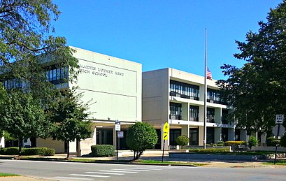
King College Prep Address: South Drexel Boulevard street in Chicago
Attractions near King College Prep
King College Prep High School,Dr Martin Luther Jr College Prep HS,Martin Luther King College Prep,Kenwood Zoo,S Drexel Blvd,Avenue Care Center,4380 S Ellis Ave,Advance Center,Avenue Care Nursing Rehibilitation,The Estates of Hyde Park,North Kenwood neighborhood, Chicago,Adams Electrical Services,4442 South Berkeley Avenue,4442 S Berkeley Ave,Gent Headquarters-Hyde Park,4354 South Drexel Boulevard,Eubanks Pope Development Company,4354 S Drexel Blvd,North Kenwood Landmark District,Tailored BeginningsHow to get to popular attractions in Chicago with public transit
120 S. LaSalle St., Chicago,Woodfield Mall, Schaumburg,Jewel-Osco,Hala Kahiki Tiki Bar & Lounge, River Grove,Palos Heights, IL,Old Irving Park Neighborhood, Chicago,Sabri Nihari, Chicago,Route 66 Raceway, Joliet,Metra - Lake Forest, Lake Forest,Garrett Popcorn Shops, Chicago,Saint Xavier University (Warde Academic Center), Chicago,Intersection of Algonquin Road & Illinois Route 53, Rolling Meadows,Lockport, IL, Lockport,Qdoba Mexican Grill, Chicago,Garfield Ridge, Chicago,Jamba Juice ORD - Chicago O'Hare Airport - Terminal 1, Chicago,Zurich North America, Schaumburg,Barack Obama House, Chicago,I-88 @ Rt 59 Interchange, Naperville,The Original Pancake House, ChicagoGet around Chicago by public transit!
Traveling around Chicago has never been so easy. See step by step directions as you travel to any attraction, street or major public transit station. View bus and train schedules, arrival times, service alerts and detailed routes on a map, so you know exactly how to get to anywhere in Chicago.
When traveling to any destination around Chicago use Moovit's Live Directions with Get Off Notifications to know exactly where and how far to walk, how long to wait for your line, and how many stops are left. Moovit will alert you when it's time to get off — no need to constantly re-check whether yours is the next stop.
Wondering how to use public transit in Chicago or how to pay for public transit in Chicago? Moovit public transit app can help you navigate your way with public transit easily, and at minimum cost. It includes public transit fees, ticket prices, and costs. Looking for a map of Chicago public transit lines? Moovit public transit app shows all public transit maps in Chicago with all bus, Chicago 'L' or train routes and stops on an interactive map.
Chicago has 3 transit type(s), including: bus, Chicago 'L' or train, operated by several transit agencies, including CTA 'L', Metra, Northern Indiana Commuter Transportation District, CTA, PACE, O'Hare International Airport Shuttle Bus, Gary Public Transit, Amtrak, River Valley Metro, Valpo Transit, DeKalb Public Transit, FlixBus-us, Greyhound-us, Van Galder (Coach USA) and Wisconsin Coach Lines