King Drive & 82nd Street (North) stop - Thursday schedule
| Line | Direction | Time |
|---|---|---|
| 3 | Fairbanks & Huron (South) | 5:00 AM |
| 3 | Fairbanks & Huron (South) | 5:07 AM |
| 3 | Fairbanks & Huron (South) | 5:15 AM |
| 3 | Fairbanks & Huron (South) | 5:22 AM |
| 3 | Fairbanks & Huron (South) | 5:30 AM |
| 3 | Fairbanks & Huron (South) | 5:37 AM |
| 3 | Fairbanks & Huron (South) | 5:45 AM |
| 3 | Fairbanks & Huron (South) | 5:52 AM |
| 3 | Fairbanks & Huron (South) | 6:00 AM |
| 3 | Fairbanks & Huron (South) | 6:07 AM |
| 3 | Fairbanks & Huron (South) | 6:15 AM |
| 3 | Fairbanks & Huron (South) | 6:22 AM |
| 3 | Fairbanks & Huron (South) | 6:30 AM |
| 3 | Fairbanks & Huron (South) | 6:37 AM |
| 3 | Fairbanks & Huron (South) | 6:45 AM |
| 3 | Fairbanks & Huron (South) | 6:52 AM |
| 3 | Fairbanks & Huron (South) | 6:59 AM |
| 3 | Fairbanks & Huron (South) | 7:06 AM |
| 3 | Fairbanks & Huron (South) | 7:13 AM |
| 3 | Fairbanks & Huron (South) | 7:20 AM |
| 3 | Fairbanks & Huron (South) | 7:27 AM |
| 3 | Fairbanks & Huron (South) | 7:33 AM |
| 3 | Fairbanks & Huron (South) | 7:39 AM |
| 3 | Fairbanks & Huron (South) | 7:45 AM |
| 3 | Fairbanks & Huron (South) | 7:51 AM |
Directions to King Drive & 82nd Street (North) stop (Chicago) with public transit
The following transit lines have routes that pass near King Drive & 82nd Street (North)
 Bus: 3, 79.
- Train: ME, RI.
- Chicago 'L': RED LINE.
How to get to King Drive & 82nd Street (North) stop by bus?
Click on the bus route to see step by step directions with maps, line arrival times and updated time schedules.
How to get to King Drive & 82nd Street (North) stop by train?
Click on the train route to see step by step directions with maps, line arrival times and updated time schedules.
How to get to King Drive & 82nd Street (North) stop by Chicago 'L'?
Click on the Chicago 'L' route to see step by step directions with maps, line arrival times and updated time schedules.
Bus stops near King Drive & 82nd Street (North) stop in Chicago
- King Drive & 82nd Street (South), 1 min walk,
- 79th Street & King Drive (East), 8 min walk,
Chicago 'L' stations near King Drive & 82nd Street (North) station in Chicago
- 79th, 19 min walk,
Train stations near King Drive & 82nd Street (North) station in Chicago
- 83rd St. (Avalonpark), 20 min walk,
Bus lines to King Drive & 82nd Street (North) stop in Chicago
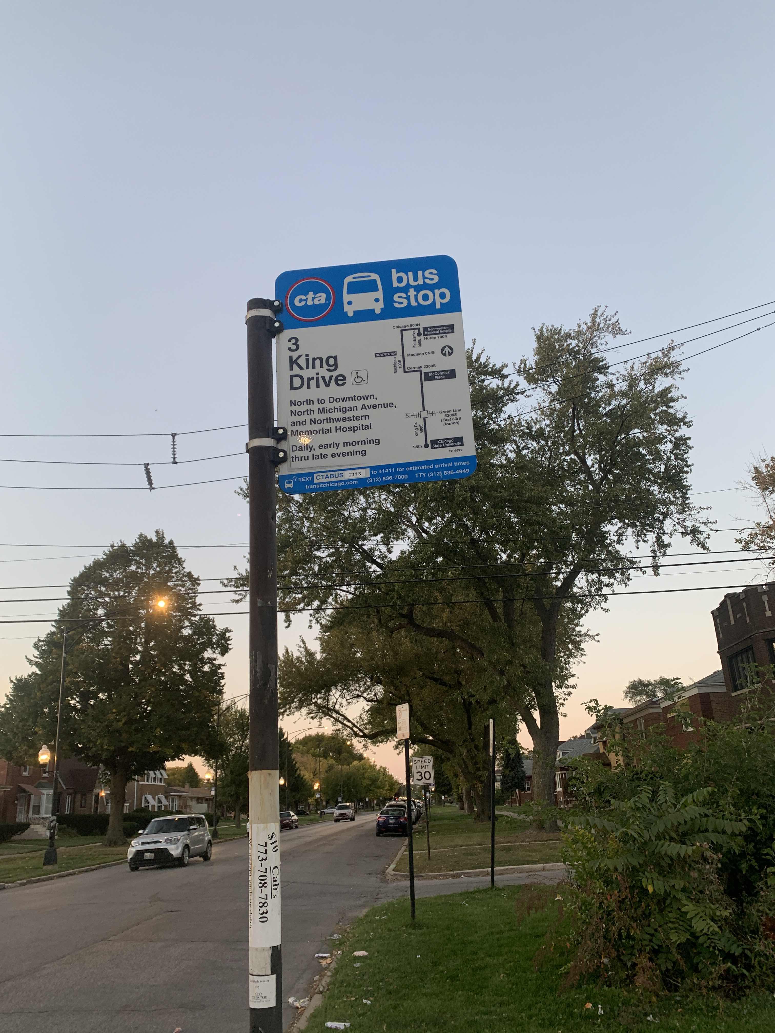
- 3, Fairbanks & Huron (South),
- 79, 79th Street & Western Terminal (East),
What are the closest stations to King Drive & 82nd Street (North)?
The closest stations to King Drive & 82nd Street (North) are:
- King Drive & 82nd Street (South) is 48 yards away, 1 min walk.
- 79th Street & King Drive (East) is 652 yards away, 8 min walk.
- 79th is 1601 yards away, 19 min walk.
- 83rd St. (Avalonpark) is 1667 yards away, 20 min walk.
Which bus line stops near King Drive & 82nd Street (North)?
3 (Fairbanks & Huron (South))
Which train lines stop near King Drive & 82nd Street (North)?
These train lines stop near King Drive & 82nd Street (North): ME, RI.
Which Chicago 'L' line stops near King Drive & 82nd Street (North)?
RED LINE (95th/Dan Ryan)
What’s the nearest Chicago 'L' station to King Drive & 82nd Street (North) in Chicago?
The nearest Chicago 'L' station to King Drive & 82nd Street (North) in Chicago is 79th. It’s a 19 min walk away.
What’s the nearest train station to King Drive & 82nd Street (North) in Chicago?
The nearest train station to King Drive & 82nd Street (North) in Chicago is 83rd St. (Avalonpark). It’s a 20 min walk away.
What’s the nearest bus station to King Drive & 82nd Street (North) in Chicago?
The nearest bus station to King Drive & 82nd Street (North) in Chicago is King Drive & 82nd Street (South). It’s a 1 min walk away.
What time is the first Chicago 'L' to King Drive & 82nd Street (North) in Chicago?
The RED LINE is the first Chicago 'L' that goes to King Drive & 82nd Street (North) in Chicago. It stops nearby at 3:00 AM.
What time is the last Chicago 'L' to King Drive & 82nd Street (North) in Chicago?
The RED LINE is the last Chicago 'L' that goes to King Drive & 82nd Street (North) in Chicago. It stops nearby at 12:54 AM.
What time is the first train to King Drive & 82nd Street (North) in Chicago?
The ME is the first train that goes to King Drive & 82nd Street (North) in Chicago. It stops nearby at 5:00 AM.
What time is the last train to King Drive & 82nd Street (North) in Chicago?
The ME is the last train that goes to King Drive & 82nd Street (North) in Chicago. It stops nearby at 1:15 AM.
What time is the first bus to King Drive & 82nd Street (North) in Chicago?
The 79 is the first bus that goes to King Drive & 82nd Street (North) in Chicago. It stops nearby at 3:01 AM.
What time is the last bus to King Drive & 82nd Street (North) in Chicago?
The 3 is the last bus that goes to King Drive & 82nd Street (North) in Chicago. It stops nearby at 12:46 AM.
King Drive & 82nd Street (North) station
 Taken by Anonymous
See King Drive & 82nd Street (North) stop, Chicago, on the map
Public transit to King Drive & 82nd Street (North) stop (ID: 2118) in Chicago
Looking for directions to King Drive & 82nd Street (North) in Chicago, United States?
Download the Moovit App to find the current schedule and step-by-step directions for Bus, Chicago 'L' or Train routes that pass through King Drive & 82nd Street (North).
Looking for the nearest stops closest to King Drive & 82nd Street (North) ? Check out this list of closest stops to your destination: King Drive & 82nd Street (South); 79th Street & King Drive (East); 79th; 83rd St. (Avalonpark).
Bus: 3, 79.Train: ME, RI.Chicago 'L': RED LINE.
We make riding on public transit to King Drive & 82nd Street (North) easy, which is why over 1.5 million users, including users in Chicago trust Moovit as the best app for public transit.
Use the app to navigate to popular places including to the airport, hospital, stadium, grocery store, mall, coffee shop, school, college, and university.
King Drive & 82nd Street (North) stop’s code is 2118
The first line to this stop is 3, at 5:00 AM, and the last line is 3 at 4:51 AM.
408 East 82nd Street, South Side, Chicago, IL, USA
This stop serves CTA’s lines
- King Drive & 82nd Street (South),
- 79th Street & King Drive (East)
Bus stops near King Drive & 82nd Street (North) stop
- 79th
Chicago 'L' station near King Drive & 82nd Street (North) station
- 83rd St. (Avalonpark)
Train station near King Drive & 82nd Street (North) station
- River Rd & Bryn Mawr Ave,
- Hawthorn Mall,
- Evanston (Davis St.),
- Davis Purple Line Station (South),
- La Grange Rd & 143rd St,
- Diversey & Clark/Broadway (West),
- Illinois Route 59 & Montgomery Rd/83rd St,
- Fashion Outlets Of Chicago,
- River Oaks Dr & River Oaks Mall Entrance East,
- Division & Pulaski (East),
- 79th Street & King Drive (West),
- Route 45 & Casey Rd,
- 63rd Street & King Drive (Green Line) (East),
- Armitage & Kedzie (East),
- North Ave & 25th Ave,
- 106th Street & Ewing (West),
- California & Granville (South),
- Wellington (Brown/Purple),
- Sedgwick,
- Adams/Wabash
Popular public transit stations in Chicago
Get around Chicago by public transit!
Traveling around Chicago has never been so easy. See step by step directions as you travel to any attraction, street or major public transit station. View bus and train schedules, arrival times, service alerts and detailed routes on a map, so you know exactly how to get to anywhere in Chicago.
When traveling to any destination around Chicago use Moovit's Live Directions with Get Off Notifications to know exactly where and how far to walk, how long to wait for your line, and how many stops are left. Moovit will alert you when it's time to get off — no need to constantly re-check whether yours is the next stop.
Wondering how to use public transit in Chicago or how to pay for public transit in Chicago? Moovit public transit app can help you navigate your way with public transit easily, and at minimum cost. It includes public transit fees, ticket prices, and costs. Looking for a map of Chicago public transit lines? Moovit public transit app shows all public transit maps in Chicago with all Bus, Train and Chicago 'L' routes and stops on an interactive map.
Chicago has 3 transit type(s), including: Bus, Train and Chicago 'L', operated by several transit agencies, including CTA 'L', Metra, Northern Indiana Commuter Transportation District, CTA, PACE, O'Hare International Airport Shuttle Bus, Gary Public Transit, Amtrak, River Valley Metro, Valpo Transit, DeKalb Public Transit, FlixBus-us, Greyhound-us, Van Galder (Coach USA) and Wisconsin Coach Lines