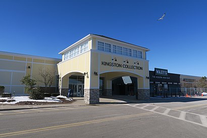
Kingston Collection stop - Thursday schedule
| Line | Direction | Time |
|---|---|---|
| SAIL | Kingston Collection | 7:10 AM |
| FREEDOM LINK | Industrial Park | 7:20 AM |
| LIBERTY LINK | Plymouth Center | 7:30 AM |
| SAIL | Stop And Shop/Kohl's | 7:30 AM |
| SAIL | Kingston Collection | 8:15 AM |
| FREEDOM LINK | Industrial Park | 8:20 AM |
| LIBERTY LINK | Plymouth Center | 8:30 AM |
| SAIL | Stop And Shop/Kohl's | 8:30 AM |
| FREEDOM LINK | Industrial Park | 9:15 AM |
| SAIL | Kingston Collection | 9:20 AM |
| LIBERTY LINK | Plymouth Center | 9:30 AM |
| SAIL | Stop And Shop/Kohl's | 9:30 AM |
| FREEDOM LINK | Industrial Park | 10:20 AM |
| SAIL | Kingston Collection | 10:20 AM |
| LIBERTY LINK | Plymouth Center | 10:30 AM |
| SAIL | Stop And Shop/Kohl's | 10:30 AM |
| FREEDOM LINK | Industrial Park | 11:15 AM |
| SAIL | Kingston Collection | 11:20 AM |
| LIBERTY LINK | Plymouth Center | 11:30 AM |
| SAIL | Stop And Shop/Kohl's | 11:30 AM |
| FREEDOM LINK | Industrial Park | 12:15 PM |
| SAIL | Kingston Collection | 12:20 PM |
| LIBERTY LINK | Plymouth Center | 12:30 PM |
| SAIL | Stop And Shop/Kohl's | 12:30 PM |
| FREEDOM LINK | Industrial Park | 1:20 PM |
See Kingston Collection, Boston, on the map
Directions to Kingston Collection (Boston) with public transportation
The following transit lines have routes that pass near Kingston Collection
 Bus:
Bus: - Train:
How to get to Kingston Collection by train?
Click on the train route to see step by step directions with maps, line arrival times and updated time schedules.
Train stations near Kingston Collection in Boston
- Kingston,56 min walk,
What are the closest stations to Kingston Collection?
The closest stations to Kingston Collection are:
- Kingston is 4803 yards away, 56 min walk.
Which bus line stops near Kingston Collection?
FREEDOM LINK
Which train line stops near Kingston Collection?
KINGSTON
What time is the first train to Kingston Collection in Boston?
The KINGSTON is the first train that goes to Kingston Collection in Boston. It stops nearby at 5:30 AM.
What time is the last train to Kingston Collection in Boston?
The KINGSTON is the last train that goes to Kingston Collection in Boston. It stops nearby at 12:58 AM.
How much is the bus fare to Kingston Collection?
The bus fare to Kingston Collection costs about $1.50 - $1.70.
How much is the subway fare to Kingston Collection?
The subway fare to Kingston Collection costs about $2.40.
How much is the train fare to Kingston Collection?
The train fare to Kingston Collection costs about $2.40 - $12.25.
See Kingston Collection, Boston, on the map
Public transit to Kingston Collection stop (ID: 1255) in Boston
Looking for directions to Kingston Collection in Boston, United States?
Download the Moovit App to find the current schedule and step-by-step directions for Train, Bus or Subway routes that pass through Kingston Collection.
Looking for the nearest stops closest to Kingston Collection ? Check out this list of closest stops to your destination: Kingston.
Bus:Train:
We make riding on public transit to Kingston Collection easy, which is why over 1.5 million users, including users in Boston trust Moovit as the best app for public transit.
Use the app to navigate to popular places including to the airport, hospital, stadium, grocery store, mall, coffee shop, school, college, and university.
Kingston Collection stop’s code is 1255
The first line to this stop is SAIL, at 7:10 AM, and the last line is SAIL at 6:35 PM.
This stop serves GATRA’s lines
Train station near Kingston Collection
KingstonPopular public transit stations in Boston
W Broadway @ E St,East Junior High School,Belmont St @ Cushing St,Dedham Mall @ Stop & Shop,Washington St @ Forest Hills St,Packards Corner,Columbia Rd @ Quincy St,East St And Plain St,Dalton St @ Belvidere St,Government Center,Hyde Park Ave @ American Legion Hwy,Blue Hill Ave @ American Legion Hwy,Residence Inn,Park Street,Warren St @ Waverly St,150 Quarry St,Main St @ Washington St,Logan Airport Terminal A,Pearl St @ Williams St,Washington St @ W Newton StGet around Boston by public transit!
Traveling around Boston has never been so easy. See step by step directions as you travel to any attraction, street or major public transit station. View bus and train schedules, arrival times, service alerts and detailed routes on a map, so you know exactly how to get to anywhere in Boston.
When traveling to any destination around Boston use Moovit's Live Directions with Get Off Notifications to know exactly where and how far to walk, how long to wait for your line, and how many stops are left. Moovit will alert you when it's time to get off — no need to constantly re-check whether yours is the next stop.
Wondering how to use public transit in Boston or how to pay for public transit in Boston? Moovit public transit app can help you navigate your way with public transit easily, and at minimum cost. It includes public transit fees, ticket prices, and costs. Looking for a map of Boston public transit lines? Moovit public transit app shows all public transit maps in Boston with all train, bus or subway routes and stops on an interactive map.
Boston has 3 transit type(s), including: train, bus or subway, operated by several transit agencies, including MBTA, MBTA, MBTA, Southeastern Regional Transit Authority, MetroWest Regional Transit Authority, Rhode Island Public Transit Authority, WRTA, Lowell Regional Transit Authority, Merrimack Valley Transit, Montachusett Regional Transit Authority, Cape Cod Regional Transit Authority, Brockton Area Transit Authority, Cape Cod Regional Transit Authority, Martha's Vineyard Transit Authority and the WAVE - Nantucket Regional Transit Authority