Directions to Kirin Produce Co., Inc. (Boston) with public transportation
The following transit lines have routes that pass near Kirin Produce Co., Inc.
 Bus: 1, 10, 16, 8, CT3.
- Train: FAIRMOUNT, FRANKLIN/FOXBORO, PROVIDENCE/STOUGHTON, FALL RIVER/NEW BEDFORD, GREENBUSH.
- Subway: RED LINE.
How to get to Kirin Produce Co., Inc. by bus?
Click on the bus route to see step by step directions with maps, line arrival times and updated time schedules.
From MBTA Suffolk Downs Station, Boston
80 minFrom Quincy Center Station, Quincy
95 minFrom Homewood Suites by Hilton Boston Logan Airport Chelsea, Chelsea
75 minFrom Quincy, MA, Quincy
96 minFrom Granite Links Golf Club at Quarry Hills, Quincy
92 minFrom Regina Pizzeria, Boston
54 minFrom Qea, Quincy
83 minFrom Newton, MA, Newton
74 minFrom Hyatt Place Medford, Medford
62 minFrom Ac Hotel Cambridge, Cambridge
86 min
How to get to Kirin Produce Co., Inc. by train?
Click on the train route to see step by step directions with maps, line arrival times and updated time schedules.
How to get to Kirin Produce Co., Inc. by subway?
Click on the subway route to see step by step directions with maps, line arrival times and updated time schedules.
Bus stops near Kirin Produce Co., Inc. in Boston
Subway station near Kirin Produce Co., Inc. in Boston
- Broadway, 8 min walk,VIEW
Train stations near Kirin Produce Co., Inc. in Boston
Bus lines to Kirin Produce Co., Inc. in Boston
- 8, Kenmore via South Bay Center - Harbor Point via South Bay Center,VIEW
- 10, Arlington via South Bay Center - City Point via South Bay Center,VIEW
- 16, Andrew via South Bay Center - Forest Hills via South Bay Center,VIEW
- CT3, Avenue Louis Pasteur (Limited Stops),VIEW
- 9, City Point,VIEW
- 171, Logan Airport Via Andrew,VIEW
- FAIRMOUNT LINE SHUTTLE, South Station (Shuttle),VIEW
What are the closest stations to Kirin Produce Co., Inc.?
The closest stations to Kirin Produce Co., Inc. are:
- South Bay Mall @ Marshalls is 91 yards away, 2 min walk.
- Massachusetts Ave Opp Magazine St is 521 yards away, 7 min walk.
- Theo Glynn Way @ Newmarket Sq is 531 yards away, 7 min walk.
- Broadway is 668 yards away, 8 min walk.
- Newmarket Sq @ Massachusetts Ave1024 is 768 yards away, 10 min walk.
- Newmarket is 793 yards away, 10 min walk.
- Jfk/Umass is 897 yards away, 11 min walk.
Which bus lines stop near Kirin Produce Co., Inc.?
These bus lines stop near Kirin Produce Co., Inc.: 1, 10, 16, 8.
Which train line stops near Kirin Produce Co., Inc.?
FAIRMOUNT (#1619 | Fairmount)
Which subway line stops near Kirin Produce Co., Inc.?
RED LINE (Ashmont/Braintree)
What’s the nearest subway station to Kirin Produce Co., Inc. in Boston?
The nearest subway station to Kirin Produce Co., Inc. in Boston is Broadway. It’s a 8 min walk away.
What’s the nearest train station to Kirin Produce Co., Inc. in Boston?
The nearest train station to Kirin Produce Co., Inc. in Boston is Newmarket. It’s a 10 min walk away.
What’s the nearest bus station to Kirin Produce Co., Inc. in Boston?
The nearest bus station to Kirin Produce Co., Inc. in Boston is South Bay Mall @ Marshalls. It’s a 2 min walk away.
What time is the first subway to Kirin Produce Co., Inc. in Boston?
The RED LINE is the first subway that goes to Kirin Produce Co., Inc. in Boston. It stops nearby at 5:23 AM.
What time is the last subway to Kirin Produce Co., Inc. in Boston?
The RED LINE is the last subway that goes to Kirin Produce Co., Inc. in Boston. It stops nearby at 1:55 AM.
What time is the first train to Kirin Produce Co., Inc. in Boston?
The FAIRMOUNT is the first train that goes to Kirin Produce Co., Inc. in Boston. It stops nearby at 4:47 AM.
What time is the last train to Kirin Produce Co., Inc. in Boston?
The FAIRMOUNT is the last train that goes to Kirin Produce Co., Inc. in Boston. It stops nearby at 11:57 PM.
What time is the first bus to Kirin Produce Co., Inc. in Boston?
The 171 is the first bus that goes to Kirin Produce Co., Inc. in Boston. It stops nearby at 3:56 AM.
What time is the last bus to Kirin Produce Co., Inc. in Boston?
The 10 is the last bus that goes to Kirin Produce Co., Inc. in Boston. It stops nearby at 1:29 AM.
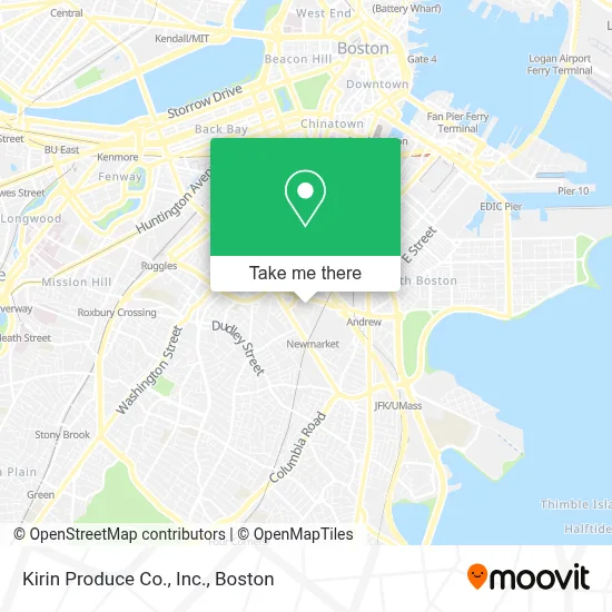
See Kirin Produce Co., Inc., Boston, on the map
Public Transit to Kirin Produce Co., Inc. in Boston
Wondering how to get to Kirin Produce Co., Inc. in Boston? Moovit helps you find the best way to get to Kirin Produce Co., Inc. with step-by-step directions from the nearest public transit station.
Moovit provides free maps and live directions to help you navigate through your city. View schedules, routes, timetables, and find out how long does it take to get to Kirin Produce Co., Inc. in real time.
Looking for the nearest stop or station to Kirin Produce Co., Inc.? Check out this list of stops closest to your destination: South Bay Mall @ Marshalls; Massachusetts Ave Opp Magazine St; Theo Glynn Way @ Newmarket Sq; Broadway; Newmarket Sq @ Massachusetts Ave1024; Newmarket; Jfk/Umass.
Bus: 1, 10, 16, 8, CT3, 9, 171.Train: FAIRMOUNT, FRANKLIN/FOXBORO, PROVIDENCE/STOUGHTON, FALL RIVER/NEW BEDFORD, GREENBUSH, KINGSTON.Subway: RED LINE.
Want to see if there’s another route that gets you there at an earlier time? Moovit helps you find alternative routes or times. Get directions from and directions to Kirin Produce Co., Inc. easily from the Moovit App or Website.
We make riding to Kirin Produce Co., Inc. easy, which is why over 1.7 million users, including users in Boston, trust Moovit as the best app for public transit. You don’t need to download an individual bus app or train app, Moovit is your all-in-one transit app that helps you find the best bus time or train time available.
For information on prices of bus, subway and train, costs and ride fares to Kirin Produce Co., Inc., please check the Moovit app.
Use the app to navigate to popular places including to the airport, hospital, stadium, grocery store, mall, coffee shop, school, college, and university.
Kirin Produce Co., Inc. Address: 131 Newmarket Sq street in Boston
- Ching Change,
- Green Flash Boston,
- Boston Salads & Provisions,
- Pier Fish Co,
- The Record Co.,
- CUBESMART,
- Mbta Transit Police Headquarters,
- The Phoenix - Massachusetts,
- La Alianza Hispana,
- MBTA Mobility Center,
- Boston Latin HS,
- U-Haul Moving & Storage at Mass Ave Boston,
- Board of Appeal,
- Government Offices City Finance Offices,
- Commercial Air Conditioning,
- Cavalier Coach Corporation,
- Carter's,
- Mcdonald's,
- 1010 MASS AVE,
- STARBUCKS
Places Near Kirin Produce Co., Inc. (Boston)
- Wilbur Theatre, Boston,
- Cheers, Boston,
- Isabella Stewart Gardner Museum, Boston,
- Seaport District, Boston,
- Mgm Music Hall, Boston,
- Quincy Market, Boston,
- Wang Theater, Boston,
- Leader Bank Pavilion (Leader Bank Pavillion), Boston,
- Td Garden, Boston,
- Boston Medical Center, Boston,
- House Of Blues, Boston,
- Boston Children's Hospital, Boston,
- Faneuil Hall, Boston,
- Museum Of Science, Boston,
- Boston Common, Boston,
- Boston Convention & Exhibition Center, Boston,
- Castle Island, Boston,
- North End, Boston,
- Prudential Center, Boston,
- Massachusetts General Hospital, Boston
How to get to popular places in Boston with public transit
Get around Boston by public transit!
Traveling around Boston has never been so easy. See step by step directions as you travel to any attraction, street or major public transit station. View bus and train schedules, arrival times, service alerts and detailed routes on a map, so you know exactly how to get to anywhere in Boston.
When traveling to any destination around Boston use Moovit's Live Directions with Get Off Notifications to know exactly where and how far to walk, how long to wait for your line, and how many stops are left. Moovit will alert you when it's time to get off — no need to constantly re-check whether yours is the next stop.
Wondering how to use public transit in Boston or how to pay for public transit in Boston? Moovit public transit app can help you navigate your way with public transit easily, and at minimum cost. It includes public transit fees, ticket prices, and costs. Looking for a map of Boston public transit lines? Moovit public transit app shows all public transit maps in Boston with all Bus, Train, Subway and Ferry routes and stops on an interactive map.
Boston has 4 transit type(s), including: Bus, Train, Subway and Ferry, operated by several transit agencies, including MBTA, Southeastern Regional Transit Authority, MetroWest Regional Transit Authority, Rhode Island Public Transit Authority, WRTA, Lowell Regional Transit Authority, Merrimack Valley Transit, Montachusett Regional Transit Authority, Cape Cod Regional Transit Authority, Brockton Area Transit Authority, Martha's Vineyard Transit Authority, the WAVE - Nantucket Regional Transit Authority, GATRA, Cape Ann Transportation Authority and Massport