Directions to Kismet Commerce (Newton) with public transportation
The following transit lines have routes that pass near Kismet Commerce
 Bus: 505, 553, 554, 558.
- Train: FRAMINGHAM/WORCESTER, FITCHBURG.
- Subway: GREEN LINE D.
How to get to Kismet Commerce by bus?
Click on the bus route to see step by step directions with maps, line arrival times and updated time schedules.
From Skating Club Of Boston, Boston
67 minFrom Alumni Stadium, Boston
59 minFrom DoubleTree Suites by Hilton Hotel Boston - Cambridge, Boston
77 minFrom West Roxbury VA Medical Center, Boston
69 minFrom Prometric Testing Center, Boston
62 minFrom Wachusett mountain, Boston
79 minFrom West Roxbury, Boston
76 minFrom Agganis Arena, Boston
62 minFrom Scullers Jazz Club, Boston
78 minFrom Takeda, Lexington
57 min
How to get to Kismet Commerce by train?
Click on the train route to see step by step directions with maps, line arrival times and updated time schedules.
How to get to Kismet Commerce by subway?
Click on the subway route to see step by step directions with maps, line arrival times and updated time schedules.
Bus stops near Kismet Commerce in Newton
Subway station near Kismet Commerce in Newton
- Woodland, 34 min walk,VIEW
Train stations near Kismet Commerce in Newton
What are the closest stations to Kismet Commerce?
The closest stations to Kismet Commerce are:
- Commonwealth Ave Opp Pamela Ct is 439 yards away, 6 min walk.
- Lexington St @ Auburndale Ave is 557 yards away, 7 min walk.
- Woodland is 2849 yards away, 34 min walk.
- Brandeis/Roberts is 3214 yards away, 38 min walk.
- West Newton is 5102 yards away, 60 min walk.
Which bus lines stop near Kismet Commerce?
These bus lines stop near Kismet Commerce: 505, 553, 554, 558.
Which train line stops near Kismet Commerce?
FRAMINGHAM/WORCESTER (#521 | Worcester)
Which subway line stops near Kismet Commerce?
GREEN LINE D (Riverside)
What’s the nearest bus station to Kismet Commerce in Newton?
The nearest bus station to Kismet Commerce in Newton is Commonwealth Ave Opp Pamela Ct. It’s a 6 min walk away.
What time is the first subway to Kismet Commerce in Newton?
The GREEN LINE D is the first subway that goes to Kismet Commerce in Newton. It stops nearby at 4:45 AM.
What time is the last subway to Kismet Commerce in Newton?
The GREEN LINE D is the last subway that goes to Kismet Commerce in Newton. It stops nearby at 2:48 AM.
What time is the first train to Kismet Commerce in Newton?
The FRAMINGHAM/WORCESTER is the first train that goes to Kismet Commerce in Newton. It stops nearby at 5:19 AM.
What time is the last train to Kismet Commerce in Newton?
The FRAMINGHAM/WORCESTER is the last train that goes to Kismet Commerce in Newton. It stops nearby at 12:22 AM.
What time is the first bus to Kismet Commerce in Newton?
The 505 is the first bus that goes to Kismet Commerce in Newton. It stops nearby at 6:02 AM.
What time is the last bus to Kismet Commerce in Newton?
The 505 is the last bus that goes to Kismet Commerce in Newton. It stops nearby at 7:42 PM.
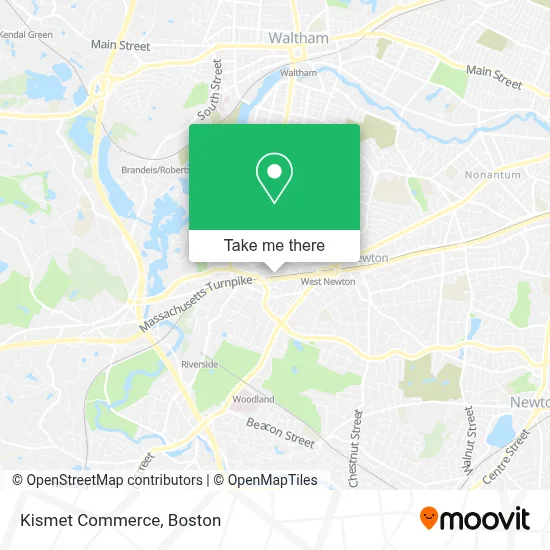
See Kismet Commerce, Newton, on the map
Public Transit to Kismet Commerce in Newton
Wondering how to get to Kismet Commerce in Newton? Moovit helps you find the best way to get to Kismet Commerce with step-by-step directions from the nearest public transit station.
Moovit provides free maps and live directions to help you navigate through your city. View schedules, routes, timetables, and find out how long does it take to get to Kismet Commerce in real time.
Looking for the nearest stop or station to Kismet Commerce? Check out this list of stops closest to your destination: Commonwealth Ave Opp Pamela Ct; Lexington St @ Auburndale Ave; Woodland; Brandeis/Roberts; West Newton.
Bus: 505, 553, 554, 558.Train: FRAMINGHAM/WORCESTER, FITCHBURG.Subway: GREEN LINE D.
Want to see if there’s another route that gets you there at an earlier time? Moovit helps you find alternative routes or times. Get directions from and directions to Kismet Commerce easily from the Moovit App or Website.
We make riding to Kismet Commerce easy, which is why over 1.7 million users, including users in Newton, trust Moovit as the best app for public transit. You don’t need to download an individual bus app or train app, Moovit is your all-in-one transit app that helps you find the best bus time or train time available.
For information on prices of bus, train and subway, costs and ride fares to Kismet Commerce, please check the Moovit app.
Use the app to navigate to popular places including to the airport, hospital, stadium, grocery store, mall, coffee shop, school, college, and university.
Kismet Commerce Address: 77 Rowe St street in Newton
- Mystic Valley Traders,
- FedEx,
- Siemens AG,
- The Reverend Louis E. Ford Playground,
- Friends of Nahanton Park,
- Cabem Technologies,
- Competency Manager,
- Care Solutions Personnel,
- Axerra Networks,
- Piece by Piece Moving & Storage,
- Raquel's Daycare,
- West Newton,
- MBTA Bus Route 505,
- Norumbega Securities Services,
- Blast Fitness,
- Holway Early Childhood Centers at Lasell University,
- Auburn St & Washington St,
- Abbie L D'Amico - Financial Advisor Ameriprise Financial Services,
- Blackline Retail Group, LLC,
- Lexington St House Lockout
Places Near Kismet Commerce (Newton)
- Boston Children's Hospital, Boston,
- Prudential Center, Boston,
- Faneuil Hall, Boston,
- Cheers, Boston,
- Castle Island, Boston,
- North End, Boston,
- Wilbur Theatre, Boston,
- Massachusetts General Hospital, Boston,
- Boston Common, Boston,
- House Of Blues, Boston,
- Boston Medical Center, Boston,
- Wang Theater, Boston,
- Mgm Music Hall, Boston,
- Museum Of Science, Boston,
- Seaport District, Boston,
- Boston Convention & Exhibition Center, Boston,
- Td Garden, Boston,
- Quincy Market, Boston,
- Isabella Stewart Gardner Museum, Boston,
- Leader Bank Pavilion (Leader Bank Pavillion), Boston
How to get to popular places in Boston with public transit
Get around Newton by public transit!
Traveling around Newton has never been so easy. See step by step directions as you travel to any attraction, street or major public transit station. View bus and train schedules, arrival times, service alerts and detailed routes on a map, so you know exactly how to get to anywhere in Newton.
When traveling to any destination around Newton use Moovit's Live Directions with Get Off Notifications to know exactly where and how far to walk, how long to wait for your line, and how many stops are left. Moovit will alert you when it's time to get off — no need to constantly re-check whether yours is the next stop.
Wondering how to use public transit in Newton or how to pay for public transit in Newton? Moovit public transit app can help you navigate your way with public transit easily, and at minimum cost. It includes public transit fees, ticket prices, and costs. Looking for a map of Newton public transit lines? Moovit public transit app shows all public transit maps in Newton with all Bus, Train, Subway and Ferry routes and stops on an interactive map.
Boston has 4 transit type(s), including: Bus, Train, Subway and Ferry, operated by several transit agencies, including MBTA, Southeastern Regional Transit Authority, MetroWest Regional Transit Authority, Rhode Island Public Transit Authority, WRTA, Lowell Regional Transit Authority, Merrimack Valley Transit, Montachusett Regional Transit Authority, Cape Cod Regional Transit Authority, Brockton Area Transit Authority, Martha's Vineyard Transit Authority, the WAVE - Nantucket Regional Transit Authority, GATRA, Cape Ann Transportation Authority and Massport