How to get to Kith and Kin by bus?
Click on the bus route to see step by step directions with maps, line arrival times and updated time schedules.
From Chevy Chase Metro Plaza, Washington
69 minFrom Embassy Suites at the Chevy Chase Pavilion, Washington
72 minFrom Hampton Inn & Suites Alexandria Old Town Area South, Fairfax County
56 minFrom Barcelona Wine Bar, Washington
57 minFrom The Cheesecake Factory, Washington
72 minFrom Hyatt Place-Arlington Courthouse Plaza (Hyatt Place Arlington/Courthouse Plaza), Arlington County
60 minFrom Arlington, VA, Arlington County
58 minFrom Smithsonian National Zoological Park, Washington
41 minFrom Ming Li's Happy Endings Massage Parlor, Washington
61 minFrom The Capital Wheel at the National Harbor, Prince George's County
47 min
How to get to Kith and Kin by metro?
Click on the metro route to see step by step directions with maps, line arrival times and updated time schedules.
From Chevy Chase Metro Plaza, Washington
39 minFrom Embassy Suites at the Chevy Chase Pavilion, Washington
38 minFrom Hampton Inn & Suites Alexandria Old Town Area South, Fairfax County
62 minFrom Barcelona Wine Bar, Washington
53 minFrom The Cheesecake Factory, Washington
38 minFrom Hyatt Place-Arlington Courthouse Plaza (Hyatt Place Arlington/Courthouse Plaza), Arlington County
37 minFrom Arlington, VA, Arlington County
35 minFrom Smithsonian National Zoological Park, Washington
38 minFrom Ming Li's Happy Endings Massage Parlor, Washington
54 min
Bus stops near Kith and Kin in Washington
- Maine Av Sw+9 St SW, 2 min walk,VIEW
- Maine Ave Sw & 7th St Sw, 4 min walk,VIEW
- 7th St & I St Sw, 6 min walk,VIEW
- M St @ 6th St SW, 9 min walk,VIEW
- SW E St & SW 7th St, 9 min walk,VIEW
- 7th St & D E Sts SW Mid Nb, 10 min walk,VIEW
- 7th St & E St (1st Stop), 10 min walk,VIEW
- 7th St & D & E Sts SW Mid Sb, 10 min walk,VIEW
Metro stations near Kith and Kin in Washington
Bus lines to Kith and Kin in Washington
- A40, West To Skyline City,VIEW
- D50, North To 14+Colorado Av,VIEW
- C11, South To National Harbor,VIEW
- C55, East To Buzzard Point,VIEW
- 563, Pentagon / Neabsco Garage,VIEW
- 612, Gainesville - Xfer at Pentagon To Woodbridge/Spotsy,VIEW
- 612-WAR, Pentagon / Gainesville / Warrenton,VIEW
- 923, Pentagon / L'Enfant / Navy Yard,VIEW
- 943, 543 - L'Enfant Plaza - Washington, Dc,VIEW
- 953, 234 Lot / Montclair,VIEW
- 610, 610/4 Washington Dc,VIEW
- 640, 640/7 Waldorf,VIEW
- 650, 650/2 Washington Dc,VIEW
- 705, 705/9 Washington Dc,VIEW
- D40, 7 St-Georgia Av,VIEW
- D60, 16 St,VIEW
- 620, 620/12 Waldorf,VIEW
- 715, 715/7 California,VIEW
What are the closest stations to Kith and Kin?
The closest stations to Kith and Kin are:
- Maine Av Sw+9 St SW is 100 yards away, 2 min walk.
- Maine Ave Sw & 7th St Sw is 287 yards away, 4 min walk.
- Smithsonian Metrorail is 346 yards away, 5 min walk.
- 7th St & I St Sw is 447 yards away, 6 min walk.
- M St @ 6th St SW is 700 yards away, 9 min walk.
- SW E St & SW 7th St is 729 yards away, 9 min walk.
- 7th St & D E Sts SW Mid Nb is 748 yards away, 10 min walk.
- 7th St & E St (1st Stop) is 759 yards away, 10 min walk.
- 7th St & D & E Sts SW Mid Sb is 764 yards away, 10 min walk.
- Waterfront is 891 yards away, 11 min walk.
- L'Enfant Plaza is 1259 yards away, 15 min walk.
Which bus lines stop near Kith and Kin?
These bus lines stop near Kith and Kin: 640, D50.
Which metro lines stop near Kith and Kin?
These metro lines stop near Kith and Kin: GREEN, ORANGE, YELLOW.
What’s the nearest metro station to Kith and Kin in Washington?
The nearest metro station to Kith and Kin in Washington is Smithsonian Metrorail. It’s a 5 min walk away.
What’s the nearest bus station to Kith and Kin in Washington?
The nearest bus station to Kith and Kin in Washington is Maine Av Sw+9 St SW. It’s a 2 min walk away.
What time is the first metro to Kith and Kin in Washington?
The BLUE is the first metro that goes to Kith and Kin in Washington. It stops nearby at 5:16 AM.
What time is the last metro to Kith and Kin in Washington?
The GREEN is the last metro that goes to Kith and Kin in Washington. It stops nearby at 12:16 AM.
What time is the first train to Kith and Kin in Washington?
The MANASSAS LINE is the first train that goes to Kith and Kin in Washington. It stops nearby at 6:12 AM.
What time is the last train to Kith and Kin in Washington?
The MANASSAS LINE is the last train that goes to Kith and Kin in Washington. It stops nearby at 7:08 PM.
What time is the first bus to Kith and Kin in Washington?
The C11 is the first bus that goes to Kith and Kin in Washington. It stops nearby at 3:00 AM.
What time is the last bus to Kith and Kin in Washington?
The D50 is the last bus that goes to Kith and Kin in Washington. It stops nearby at 3:33 AM.
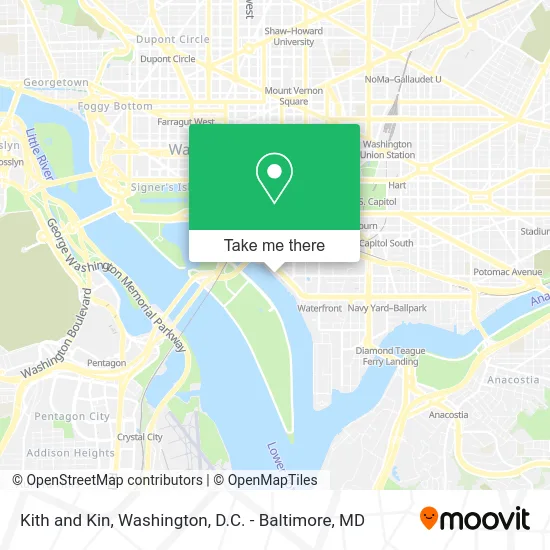
See Kith and Kin, Washington, on the map
Public Transit to Kith and Kin in Washington
Wondering how to get to Kith and Kin in Washington? Moovit helps you find the best way to get to Kith and Kin with step-by-step directions from the nearest public transit station.
Moovit provides free maps and live directions to help you navigate through your city. View schedules, routes, timetables, and find out how long does it take to get to Kith and Kin in real time.
Looking for the nearest stop or station to Kith and Kin? Check out this list of stops closest to your destination: Maine Av Sw+9 St SW; Maine Ave Sw & 7th St Sw; Smithsonian Metrorail; 7th St & I St Sw; M St @ 6th St SW; SW E St & SW 7th St; 7th St & D E Sts SW Mid Nb; 7th St & E St (1st Stop); 7th St & D & E Sts SW Mid Sb; Waterfront; L'Enfant Plaza.
Bus: 640, D50, A40, C11, C55.Metro: GREEN, ORANGE, YELLOW, BLUE, SILVER, FREDERICKSBURG LINE, MANASSAS LINE.
Want to see if there’s another route that gets you there at an earlier time? Moovit helps you find alternative routes or times. Get directions from and directions to Kith and Kin easily from the Moovit App or Website.
We make riding to Kith and Kin easy, which is why over 1.5 million users, including users in Washington, trust Moovit as the best app for public transit. You don’t need to download an individual bus app or train app, Moovit is your all-in-one transit app that helps you find the best bus time or train time available.
For information on prices of bus and metro, costs and ride fares to Kith and Kin, please check the Moovit app.
Use the app to navigate to popular places including to the airport, hospital, stadium, grocery store, mall, coffee shop, school, college, and university.
Kith and Kin Address: 801 Wharf St SW street in Washington
- Kinfolk Southern Kitchen,
- InterContinental Washington D C The Wharf an IHG Hotel,
- Anybill,
- Fabiani & Company,
- The Wharf Garage 1 (Colonial Parking Lot 882),
- FedEx,
- Gaffar Chowdhury - District Wealth Strategies,
- Noble Team DMV-the Noble Team with Exp Realty,
- Riley Legal,
- Free Estimate Carpet Cleaning,
- MLB Assembly,
- District Pier at the Wharf,
- La Vie,
- Surfside,
- Press,
- Lot 893 - Wharf Restaurant,
- The Wharf,
- Del Mar,
- District Sq SW (district wharf),
- Intercontinental Hotel-the Wharf
Places Near Kith and Kin (Washington)
- M&T Bank Stadium, Baltimore,
- Rock Creek Tennis Center, Washington,
- PG Mall, Prince George's County,
- Warner Theatre, Washington,
- National Mall, Washington,
- Sibley Memorial Hospital, Washington,
- Museum Of The Bible, Washington,
- Camden Yards, Baltimore,
- National Zoo, Washington,
- Marriott Marquis Washington, DC, Washington,
- National Museum of African American History and Culture, Washington,
- Westfield Montgomery Mall, Montgomery County,
- Pennsylvania Ave NW (3rd st and pennsylvania), Washington,
- Capital One Arena, Washington,
- Georgetown, Washington,
- Washington DC VA Medical Center, Washington,
- Amazon Hq2, Arlington County,
- Basilica of the National Shrine, Washington,
- The Anthem, Washington,
- Washington National Cathedral, Washington
How to get to popular places in Washington, D.C. - Baltimore, MD with public transit
Get around Washington by public transit!
Traveling around Washington has never been so easy. See step by step directions as you travel to any attraction, street or major public transit station. View bus and train schedules, arrival times, service alerts and detailed routes on a map, so you know exactly how to get to anywhere in Washington.
When traveling to any destination around Washington use Moovit's Live Directions with Get Off Notifications to know exactly where and how far to walk, how long to wait for your line, and how many stops are left. Moovit will alert you when it's time to get off — no need to constantly re-check whether yours is the next stop.
Wondering how to use public transit in Washington or how to pay for public transit in Washington? Moovit public transit app can help you navigate your way with public transit easily, and at minimum cost. It includes public transit fees, ticket prices, and costs. Looking for a map of Washington public transit lines? Moovit public transit app shows all public transit maps in Washington with all Bus, Train, Metro, Light Rail and Ferry routes and stops on an interactive map.
Washington, D.C. - Baltimore, MD has 5 transit type(s), including: Bus, Train, Metro, Light Rail and Ferry, operated by several transit agencies, including WMATA, Montgomery County Ride On, Fairfax Connector, TheBus, PRTC, DASH - Alexandria, Arlington Transit (ART), RTA of Central Maryland, MDOT MTA, MDOT MTA Light RailLink, MDOT MTA Commuter Bus, MDOT MTA Local Bus, FXBGO!, Virginia Railway Express (VRE) and MARC