How to get to MLB Assembly by bus?
Click on the bus route to see step by step directions with maps, line arrival times and updated time schedules.
From Saint John Paul II National Shrine, Washington
70 minFrom Embassy Suites at the Chevy Chase Pavilion, Washington
73 minFrom Chevy Chase Metro Plaza, Washington
69 minFrom Courtyard Alexandria Pentagon South, Alexandria
46 minFrom Walmart, Washington
82 minFrom Washington Yu Ying Public Charter School, Washington
67 minFrom Avalon Theatre, Washington
62 minFrom Hampton Inn & Suites Alexandria Old Town Area South, Fairfax County
57 minFrom The Cheesecake Factory, Washington
72 minFrom MedStar Georgetown University Hospital, Washington
53 min
How to get to MLB Assembly by metro?
Click on the metro route to see step by step directions with maps, line arrival times and updated time schedules.
From Saint John Paul II National Shrine, Washington
48 minFrom Embassy Suites at the Chevy Chase Pavilion, Washington
37 minFrom Chevy Chase Metro Plaza, Washington
39 minFrom Walmart, Washington
44 minFrom Washington Yu Ying Public Charter School, Washington
49 minFrom Avalon Theatre, Washington
51 minFrom Hampton Inn & Suites Alexandria Old Town Area South, Fairfax County
61 minFrom The Cheesecake Factory, Washington
37 min
Bus stops near MLB Assembly in Washington
- Maine Av Sw+9 St SW, 2 min walk,VIEW
- Maine Ave Sw & 7th St Sw, 5 min walk,VIEW
- 7 St Sw+G St SW, 6 min walk,VIEW
- SW E St & SW 7th St, 9 min walk,VIEW
- 7th St & D E Sts SW Mid Nb, 9 min walk,VIEW
- 7th St & E St (1st Stop), 9 min walk,VIEW
- 7th St & D & E Sts SW Mid Sb, 9 min walk,VIEW
- D St @ 9th St SW, 10 min walk,VIEW
Metro stations near MLB Assembly in Washington
Bus lines to MLB Assembly in Washington
- A40, West To Skyline City,VIEW
- D50, North To 14+Colorado Av,VIEW
- C11, South To National Harbor,VIEW
- C55, East To Buzzard Point,VIEW
- 563, Pentagon / Neabsco Garage,VIEW
- 612, Gainesville - Xfer at Pentagon To Woodbridge/Spotsy,VIEW
- 612-WAR, Pentagon / Gainesville / Warrenton,VIEW
- 923, Pentagon / L'Enfant / Navy Yard,VIEW
- 943, 543 - L'Enfant Plaza - Washington, Dc,VIEW
- 953, 234 Lot / Montclair,VIEW
- 610, 610/4 Washington Dc,VIEW
- 640, 640/7 Waldorf,VIEW
- 650, 650/2 Washington Dc,VIEW
- 705, 705/9 Washington Dc,VIEW
- D40, 7 St-Georgia Av,VIEW
- D60, 16 St,VIEW
- 620, 620/12 Waldorf,VIEW
- 715, 715/7 California,VIEW
- 697, 697 Stringfellow Rd P & R,VIEW
What are the closest stations to MLB Assembly?
The closest stations to MLB Assembly are:
- Maine Av Sw+9 St SW is 128 yards away, 2 min walk.
- Maine Ave Sw & 7th St Sw is 373 yards away, 5 min walk.
- Federal Triangle Metro Station is 430 yards away, 6 min walk.
- 7 St Sw+G St SW is 442 yards away, 6 min walk.
- SW E St & SW 7th St is 692 yards away, 9 min walk.
- 7th St & D E Sts SW Mid Nb is 712 yards away, 9 min walk.
- 7th St & E St (1st Stop) is 722 yards away, 9 min walk.
- 7th St & D & E Sts SW Mid Sb is 727 yards away, 9 min walk.
- D St @ 9th St SW is 784 yards away, 10 min walk.
- L'Enfant Plaza is 897 yards away, 11 min walk.
Which bus lines stop near MLB Assembly?
These bus lines stop near MLB Assembly: C55, D50.
Which metro lines stop near MLB Assembly?
These metro lines stop near MLB Assembly: GREEN, YELLOW.
What’s the nearest metro station to MLB Assembly in Washington?
The nearest metro station to MLB Assembly in Washington is Federal Triangle Metro Station. It’s a 6 min walk away.
What’s the nearest bus station to MLB Assembly in Washington?
The nearest bus station to MLB Assembly in Washington is Maine Av Sw+9 St SW. It’s a 2 min walk away.
What time is the first metro to MLB Assembly in Washington?
The BLUE is the first metro that goes to MLB Assembly in Washington. It stops nearby at 5:16 AM.
What time is the last metro to MLB Assembly in Washington?
The GREEN is the last metro that goes to MLB Assembly in Washington. It stops nearby at 12:16 AM.
What time is the first train to MLB Assembly in Washington?
The MANASSAS LINE is the first train that goes to MLB Assembly in Washington. It stops nearby at 6:12 AM.
What time is the last train to MLB Assembly in Washington?
The MANASSAS LINE is the last train that goes to MLB Assembly in Washington. It stops nearby at 7:08 PM.
What time is the first bus to MLB Assembly in Washington?
The C11 is the first bus that goes to MLB Assembly in Washington. It stops nearby at 3:00 AM.
What time is the last bus to MLB Assembly in Washington?
The D50 is the last bus that goes to MLB Assembly in Washington. It stops nearby at 3:33 AM.
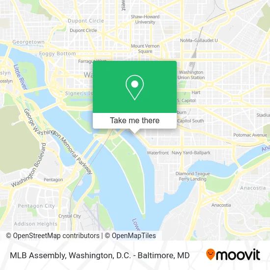
See MLB Assembly, Washington, on the map
Public Transit to MLB Assembly in Washington
Wondering how to get to MLB Assembly in Washington? Moovit helps you find the best way to get to MLB Assembly with step-by-step directions from the nearest public transit station.
Moovit provides free maps and live directions to help you navigate through your city. View schedules, routes, timetables, and find out how long does it take to get to MLB Assembly in real time.
Looking for the nearest stop or station to MLB Assembly? Check out this list of stops closest to your destination: Maine Av Sw+9 St SW; Maine Ave Sw & 7th St Sw; Federal Triangle Metro Station; 7 St Sw+G St SW; SW E St & SW 7th St; 7th St & D E Sts SW Mid Nb; 7th St & E St (1st Stop); 7th St & D & E Sts SW Mid Sb; D St @ 9th St SW; L'Enfant Plaza.
Bus: C55, D50, A40, C11, 563, 612, 612-WAR, 923, 943.Metro: GREEN, YELLOW, BLUE, ORANGE, SILVER, FREDERICKSBURG LINE, MANASSAS LINE.
Want to see if there’s another route that gets you there at an earlier time? Moovit helps you find alternative routes or times. Get directions from and directions to MLB Assembly easily from the Moovit App or Website.
We make riding to MLB Assembly easy, which is why over 1.5 million users, including users in Washington, trust Moovit as the best app for public transit. You don’t need to download an individual bus app or train app, Moovit is your all-in-one transit app that helps you find the best bus time or train time available.
For information on prices of bus and metro, costs and ride fares to MLB Assembly, please check the Moovit app.
Use the app to navigate to popular places including to the airport, hospital, stadium, grocery store, mall, coffee shop, school, college, and university.
MLB Assembly Address: 101 District Sq SW Washington, DC 20024 street in Washington
- District Pier at the Wharf,
- The Wharf,
- Nara-Ya,
- Spliff Nation Dispensary,
- La Vie,
- Mi Vida,
- District Sq SW (district wharf),
- Surfside,
- Lip Lab,
- Marquee Bar,
- Hyatt House Washington DC The Wharf,
- InterContinental Washington D C The Wharf an IHG Hotel,
- Shop Made in DC - Wharf,
- The Anthem music venue,
- Kinfolk Southern Kitchen,
- Kith and Kin,
- City Cruises Alexandria the Wharf Water Taxi,
- Brighton DC,
- HB Wharf,
- The InterContinental Washington D.C. – The Wharf
Places Near MLB Assembly (Washington)
- Sibley Memorial Hospital, Washington,
- Westfield Montgomery Mall, Montgomery County,
- M&T Bank Stadium, Baltimore,
- National Zoo, Washington,
- Camden Yards, Baltimore,
- The Anthem, Washington,
- National Museum of African American History and Culture, Washington,
- PG Mall, Prince George's County,
- Georgetown, Washington,
- Museum Of The Bible, Washington,
- Pennsylvania Ave NW (3rd st and pennsylvania), Washington,
- Rock Creek Tennis Center, Washington,
- Washington National Cathedral, Washington,
- Warner Theatre, Washington,
- Marriott Marquis Washington, DC, Washington,
- National Mall, Washington,
- Capital One Arena, Washington,
- Basilica of the National Shrine, Washington,
- Washington DC VA Medical Center, Washington,
- Amazon Hq2, Arlington County
How to get to popular places in Washington, D.C. - Baltimore, MD with public transit
Get around Washington by public transit!
Traveling around Washington has never been so easy. See step by step directions as you travel to any attraction, street or major public transit station. View bus and train schedules, arrival times, service alerts and detailed routes on a map, so you know exactly how to get to anywhere in Washington.
When traveling to any destination around Washington use Moovit's Live Directions with Get Off Notifications to know exactly where and how far to walk, how long to wait for your line, and how many stops are left. Moovit will alert you when it's time to get off — no need to constantly re-check whether yours is the next stop.
Wondering how to use public transit in Washington or how to pay for public transit in Washington? Moovit public transit app can help you navigate your way with public transit easily, and at minimum cost. It includes public transit fees, ticket prices, and costs. Looking for a map of Washington public transit lines? Moovit public transit app shows all public transit maps in Washington with all Bus, Train, Metro, Light Rail and Ferry routes and stops on an interactive map.
Washington, D.C. - Baltimore, MD has 5 transit type(s), including: Bus, Train, Metro, Light Rail and Ferry, operated by several transit agencies, including WMATA, Montgomery County Ride On, Fairfax Connector, TheBus, PRTC, DASH - Alexandria, Arlington Transit (ART), RTA of Central Maryland, MDOT MTA, MDOT MTA Light RailLink, MDOT MTA Commuter Bus, MDOT MTA Local Bus, FXBGO!, Virginia Railway Express (VRE) and MARC