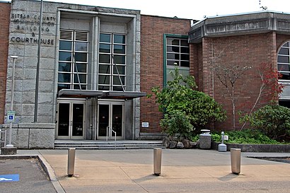
Directions to Kitsap Coonty (Seattle - Tacoma, WA) with public transportation
The following transit lines have routes that pass near Kitsap Coonty
Bus stations near Kitsap Coonty in Seattle - Tacoma, WA
- Central Valley At Green Hill Ct,3 min walk,
Bus lines to Kitsap Coonty in Seattle - Tacoma, WA
- 217,Bremerton Transportation Center (BTC),
What are the closest stations to Kitsap Coonty?
The closest stations to Kitsap Coonty are:
- Central Valley At Green Hill Ct is 227 yards away, 3 min walk.
Which bus line stops near Kitsap Coonty?
13
What’s the nearest bus stop to Kitsap Coonty in Seattle - Tacoma, WA?
The nearest bus stop to Kitsap Coonty in Seattle - Tacoma, WA is Central Valley At Green Hill Ct. It’s a 3 min walk away.
See Kitsap Coonty, Seattle - Tacoma, WA, on the map
Public Transit to Kitsap Coonty in Seattle - Tacoma, WA
Wondering how to get to Kitsap Coonty in Seattle - Tacoma, WA, United States? Moovit helps you find the best way to get to Kitsap Coonty with step-by-step directions from the nearest public transit station.
Moovit provides free maps and live directions to help you navigate through your city. View schedules, routes, timetables, and find out how long does it take to get to Kitsap Coonty in real time.
Looking for the nearest stop or station to Kitsap Coonty? Check out this list of stops closest to your destination: Central Valley At Green Hill Ct.
Bus:13217
Want to see if there’s another route that gets you there at an earlier time? Moovit helps you find alternative routes or times. Get directions from and directions to Kitsap Coonty easily from the Moovit App or Website.
We make riding to Kitsap Coonty easy, which is why over 1.5 million users, including users in Seattle - Tacoma, WA, trust Moovit as the best app for public transit. You don’t need to download an individual bus app or train app, Moovit is your all-in-one transit app that helps you find the best bus time or train time available.
For information on prices of bus and ferry, costs and ride fares to Kitsap Coonty, please check the Moovit app.
Use the app to navigate to popular places including to the airport, hospital, stadium, grocery store, mall, coffee shop, school, college, and university.
Location: Seattle - Tacoma, WA
Attractions near Kitsap Coonty
Kantono Kitsap,키트삽 군,Comté de Kitsap,Condado han Kitsap,Comitatul Kitsap,Contea di Kitsap,Округ Китсап,Kitsap Kūn,کٹسیپ کاؤنٹی,1,কিটসাপ কাউন্টি,キトサップ郡,Kitsap megye,基沙普縣,مقاطعة كيتساب,Quận Kitsap,Kitsap konderria,کٹسیپ کاؤنٹی، واشنگٹن,شهرستان کیتساپ، واشینگتن,КитсапHow to get to popular attractions in Seattle - Tacoma, WA with public transit
PCC Community Markets - Edmonds, Edmonds,VA Hospital American Lake, North Fort Lewis,Tacoma Dome - Transit Center, Tacoma,Hotel Murano, Tacoma,Shoreline Community College, Shoreline,Washington State Capital Campus, Olympia,Safeway, Seattle,Bellevue College, Bellevue,Clinton Ferry Terminal, Clinton,Fremont Troll, Seattle,Amc Pacific Place 11, Seattle,Boeing Flight Test & Delivery Center, Seattle,Boeing, 40-88, Everett,Costco Wholesale, Federal Way,I-5,City of Auburn, Auburn,Safeway, Issaquah,Crossroads Bellevue, Bellevue,Phinney Ridge Neighborhood, Seattle,Marketplace At Factoria, BellevueGet around Seattle - Tacoma, WA by public transit!
Traveling around Seattle - Tacoma, WA has never been so easy. See step by step directions as you travel to any attraction, street or major public transit station. View bus and train schedules, arrival times, service alerts and detailed routes on a map, so you know exactly how to get to anywhere in Seattle - Tacoma, WA.
When traveling to any destination around Seattle - Tacoma, WA use Moovit's Live Directions with Get Off Notifications to know exactly where and how far to walk, how long to wait for your line, and how many stops are left. Moovit will alert you when it's time to get off — no need to constantly re-check whether yours is the next stop.
Wondering how to use public transit in Seattle - Tacoma, WA or how to pay for public transit in Seattle - Tacoma, WA? Moovit public transit app can help you navigate your way with public transit easily, and at minimum cost. It includes public transit fees, ticket prices, and costs. Looking for a map of Seattle - Tacoma, WA public transit lines? Moovit public transit app shows all public transit maps in Seattle - Tacoma, WA with all bus or ferry routes and stops on an interactive map.
Seattle - Tacoma, WA has 2 transit type(s), including: bus or ferry, operated by several transit agencies, including Sound Transit, Seattle Streetcar, Sound Transit, Metro Transit, Metro Transit, Sound Transit, Whatcom Transportation Authority, Mason Transit Authority, Snoqualmie Valley Transportation (SVT), Snoqualmie Valley Transportation, Amtrak, Island Transit, Kitsap Transit, Intercity Transit and Everett Transit