Directions to Kiwanis Of Danvers with public transportation
The following transit lines have routes that pass near Kiwanis Of Danvers
 Bus: 435, 451, CITY OF BEVERLY SHUTTLE.
- Train: NEWBURYPORT/ROCKPORT.
How to get to Kiwanis Of Danvers by bus?
Click on the bus route to see step by step directions with maps, line arrival times and updated time schedules.
How to get to Kiwanis Of Danvers by train?
Click on the train route to see step by step directions with maps, line arrival times and updated time schedules.
Bus stops near Kiwanis Of Danvers
Train station near Kiwanis Of Danvers
- Beverly, 41 min walk,VIEW
Bus lines to Kiwanis Of Danvers
What are the closest stations to Kiwanis Of Danvers?
The closest stations to Kiwanis Of Danvers are:
- Water St Opp Broad St is 883 yards away, 11 min walk.
- Bridge St - Variety Store is 2982 yards away, 35 min walk.
- Beverly is 3480 yards away, 41 min walk.
Which bus lines stop near Kiwanis Of Danvers?
These bus lines stop near Kiwanis Of Danvers: 435, 451.
Which train line stops near Kiwanis Of Danvers?
NEWBURYPORT/ROCKPORT (#125 | Newburyport)
What’s the nearest bus station to Kiwanis Of Danvers?
The nearest bus station to Kiwanis Of Danvers is Water St Opp Broad St. It’s a 11 min walk away.
What time is the first train to Kiwanis Of Danvers?
The NEWBURYPORT/ROCKPORT is the first train that goes to Kiwanis Of Danvers. It stops nearby at 5:16 AM.
What time is the last train to Kiwanis Of Danvers?
The NEWBURYPORT/ROCKPORT is the last train that goes to Kiwanis Of Danvers. It stops nearby at 12:31 AM.
What time is the first bus to Kiwanis Of Danvers?
The 435 is the first bus that goes to Kiwanis Of Danvers. It stops nearby at 6:28 AM.
What time is the last bus to Kiwanis Of Danvers?
The 435 is the last bus that goes to Kiwanis Of Danvers. It stops nearby at 11:05 PM.
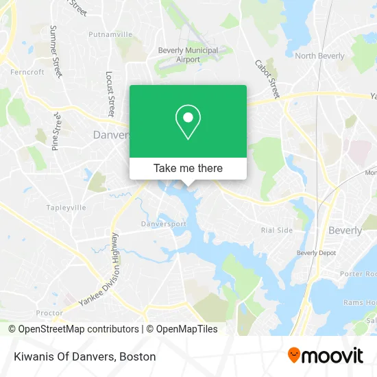
See Kiwanis Of Danvers on the map
Public Transportation to Kiwanis Of Danvers
Wondering how to get to Kiwanis Of Danvers? Moovit helps you find the best way to get to Kiwanis Of Danvers with step-by-step directions from the nearest public transit station.
Moovit provides free maps and live directions to help you navigate through your city. View schedules, routes, timetables, and find out how long does it take to get to Kiwanis Of Danvers in real time.
Looking for the nearest stop or station to Kiwanis Of Danvers? Check out this list of stops closest to your destination: Water St Opp Broad St; Bridge St - Variety Store; Beverly.
Bus: 435, 451, CITY OF BEVERLY SHUTTLE.Train: NEWBURYPORT/ROCKPORT.
Want to see if there’s another route that gets you there at an earlier time? Moovit helps you find alternative routes or times. Get directions from and directions to Kiwanis Of Danvers easily from the Moovit App or Website.
We make riding to Kiwanis Of Danvers easy, which is why over 1.7 million users, including users in Danvers, trust Moovit as the best app for public transit. You don’t need to download an individual bus app or train app, Moovit is your all-in-one transit app that helps you find the best bus time or train time available.
For information on prices of bus and train, costs and ride fares to Kiwanis Of Danvers, please check the Moovit app.
Use the app to navigate to popular places including to the airport, hospital, stadium, grocery store, mall, coffee shop, school, college, and university.
Kiwanis Of Danvers Address: 161 Elliott St street in Danvers
- Boston North Cancer Association, Inc.,
- Danversport Grille & Bistro,
- Danversport Marina,
- Accurate Marine Surveyors,
- Society 28,
- Shyneclub,
- G C Fodera Contracting,
- Fodera Engineering,
- Nafi,
- Infinity Marine Services,
- South Port Marine Boat Sales,
- Cargill Storage Systems,
- Danvers Rug,
- A-Z Chimney Sweeps,
- Kaplan Family Hospice House,
- River Drive Apartments by the Hamilton Company,
- Savoie Nolan Architects,
- Hannah's Bistro,
- 20000 Leagues Jiu Jitsu,
- Bridgewell's the Sovner Center
Places Near Kiwanis Of Danvers
- North End, Boston,
- Castle Island, Boston,
- Prudential Center, Boston,
- Wilbur Theatre, Boston,
- Faneuil Hall, Boston,
- Quincy Market, Boston,
- House Of Blues, Boston,
- Boston Common, Boston,
- Cheers, Boston,
- Td Garden, Boston,
- Seaport District, Boston,
- Isabella Stewart Gardner Museum, Boston,
- Boston Convention & Exhibition Center, Boston,
- Boston Medical Center, Boston,
- Leader Bank Pavilion (Leader Bank Pavillion), Boston,
- Massachusetts General Hospital, Boston,
- Boston Children's Hospital, Boston,
- Mgm Music Hall, Boston,
- Museum Of Science, Boston,
- Wang Theater, Boston
How to get to popular places in Boston with public transit
Get around Danvers by public transit!
Traveling around Danvers has never been so easy. See step by step directions as you travel to any attraction, street or major public transit station. View bus and train schedules, arrival times, service alerts and detailed routes on a map, so you know exactly how to get to anywhere in Danvers.
When traveling to any destination around Danvers use Moovit's Live Directions with Get Off Notifications to know exactly where and how far to walk, how long to wait for your line, and how many stops are left. Moovit will alert you when it's time to get off — no need to constantly re-check whether yours is the next stop.
Wondering how to use public transit in Danvers or how to pay for public transit in Danvers? Moovit public transit app can help you navigate your way with public transit easily, and at minimum cost. It includes public transit fees, ticket prices, and costs. Looking for a map of Danvers public transit lines? Moovit public transit app shows all public transit maps in Danvers with all Bus, Train, Subway and Ferry routes and stops on an interactive map.
Boston has 4 transit type(s), including: Bus, Train, Subway and Ferry, operated by several transit agencies, including MBTA, Southeastern Regional Transit Authority, MetroWest Regional Transit Authority, Rhode Island Public Transit Authority, WRTA, Lowell Regional Transit Authority, Merrimack Valley Transit, Montachusett Regional Transit Authority, Cape Cod Regional Transit Authority, Brockton Area Transit Authority, Martha's Vineyard Transit Authority, the WAVE - Nantucket Regional Transit Authority, GATRA, Cape Ann Transportation Authority and Massport