How to get to Kiwaz Hospitality Services by bus?
Click on the bus route to see step by step directions with maps, line arrival times and updated time schedules.
From Prometric Testing Center, Boston
75 minFrom Six Flags New England, Newton
40 minFrom St. Elizabeth's, Boston
77 minFrom Cambridge, MA, Cambridge
99 minFrom Belmont, MA, Belmont
62 minFrom Agganis Arena, Boston
75 minFrom AC Hotel Boston Cambridge, Cambridge
111 minFrom Assembly Row, Somerville
109 minFrom Arsenal Yards, Watertown Town
60 minFrom Cambridge Hospital, Cambridge
100 min
How to get to Kiwaz Hospitality Services by train?
Click on the train route to see step by step directions with maps, line arrival times and updated time schedules.
Train station near Kiwaz Hospitality Services in Waltham
- Waverley, 16 min walk,VIEW
What are the closest stations to Kiwaz Hospitality Services?
The closest stations to Kiwaz Hospitality Services are:
- Waverley is 1282 yards away, 16 min walk.
Which bus lines stop near Kiwaz Hospitality Services?
These bus lines stop near Kiwaz Hospitality Services: 554, 70, 73.
Which train line stops near Kiwaz Hospitality Services?
FITCHBURG (#409 | Wachusett)
What’s the nearest train station to Kiwaz Hospitality Services in Waltham?
The nearest train station to Kiwaz Hospitality Services in Waltham is Waverley. It’s a 16 min walk away.
What time is the first train to Kiwaz Hospitality Services in Waltham?
The FITCHBURG is the first train that goes to Kiwaz Hospitality Services in Waltham. It stops nearby at 5:39 AM.
What time is the last train to Kiwaz Hospitality Services in Waltham?
The FITCHBURG is the last train that goes to Kiwaz Hospitality Services in Waltham. It stops nearby at 12:12 AM.
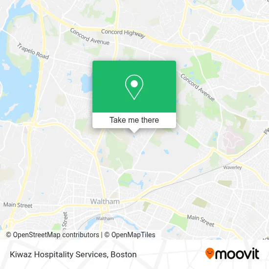
See Kiwaz Hospitality Services, Waltham, on the map
Public Transit to Kiwaz Hospitality Services in Waltham
Wondering how to get to Kiwaz Hospitality Services in Waltham? Moovit helps you find the best way to get to Kiwaz Hospitality Services with step-by-step directions from the nearest public transit station.
Moovit provides free maps and live directions to help you navigate through your city. View schedules, routes, timetables, and find out how long does it take to get to Kiwaz Hospitality Services in real time.
Looking for the nearest stop or station to Kiwaz Hospitality Services? Check out this list of stops closest to your destination: Waverley.
Bus: 554, 70, 73.Train: FITCHBURG.
Want to see if there’s another route that gets you there at an earlier time? Moovit helps you find alternative routes or times. Get directions from and directions to Kiwaz Hospitality Services easily from the Moovit App or Website.
We make riding to Kiwaz Hospitality Services easy, which is why over 1.7 million users, including users in Waltham, trust Moovit as the best app for public transit. You don’t need to download an individual bus app or train app, Moovit is your all-in-one transit app that helps you find the best bus time or train time available.
For information on prices of bus, train and subway, costs and ride fares to Kiwaz Hospitality Services, please check the Moovit app.
Use the app to navigate to popular places including to the airport, hospital, stadium, grocery store, mall, coffee shop, school, college, and university.
Kiwaz Hospitality Services Address: 24 Crescent St Ste. 106 street in Waltham
- Kenneth Harding Field,
- Waltham High School,
- Bentley University,
- Room 432,
- Seasons Bentle,
- Bu Falcon Mart,
- Spiritual Life Center at BENTLEY University,
- College Dropouts,
- BENTLEY University Residential Center,
- Emagination Tech Camps,
- Lacava Lower Cafe,
- Nathan R Miller Hall,
- ID Tech Camps,
- Alpha Kappa Psi - Psi Lambda at BENTLEY University,
- Rha Office,
- Edward W Foster Lawyer,
- Bentley University President's House,
- John F. Kennedy Middle School,
- Bishops Forest Condos,
- Gann Academy
Places Near Kiwaz Hospitality Services (Waltham)
- Faneuil Hall, Boston,
- Boston Common, Boston,
- Mgm Music Hall, Boston,
- Isabella Stewart Gardner Museum, Boston,
- Museum Of Science, Boston,
- Leader Bank Pavilion (Leader Bank Pavillion), Boston,
- Boston Children's Hospital, Boston,
- North End, Boston,
- Td Garden, Boston,
- Wang Theater, Boston,
- Wilbur Theatre, Boston,
- Seaport District, Boston,
- Boston Medical Center, Boston,
- Prudential Center, Boston,
- House Of Blues, Boston,
- Boston Convention & Exhibition Center, Boston,
- Castle Island, Boston,
- Cheers, Boston,
- Massachusetts General Hospital, Boston,
- Quincy Market, Boston
How to get to popular places in Boston with public transit
Get around Waltham by public transit!
Traveling around Waltham has never been so easy. See step by step directions as you travel to any attraction, street or major public transit station. View bus and train schedules, arrival times, service alerts and detailed routes on a map, so you know exactly how to get to anywhere in Waltham.
When traveling to any destination around Waltham use Moovit's Live Directions with Get Off Notifications to know exactly where and how far to walk, how long to wait for your line, and how many stops are left. Moovit will alert you when it's time to get off — no need to constantly re-check whether yours is the next stop.
Wondering how to use public transit in Waltham or how to pay for public transit in Waltham? Moovit public transit app can help you navigate your way with public transit easily, and at minimum cost. It includes public transit fees, ticket prices, and costs. Looking for a map of Waltham public transit lines? Moovit public transit app shows all public transit maps in Waltham with all Bus, Train, Subway and Ferry routes and stops on an interactive map.
Boston has 4 transit type(s), including: Bus, Train, Subway and Ferry, operated by several transit agencies, including MBTA, Southeastern Regional Transit Authority, MetroWest Regional Transit Authority, Rhode Island Public Transit Authority, WRTA, Lowell Regional Transit Authority, Merrimack Valley Transit, Montachusett Regional Transit Authority, Cape Cod Regional Transit Authority, Brockton Area Transit Authority, Martha's Vineyard Transit Authority, the WAVE - Nantucket Regional Transit Authority, GATRA, Cape Ann Transportation Authority and Massport