Directions to Kkira (Cambridge) with public transportation
The following transit lines have routes that pass near Kkira
 Bus: 71, 74, 75, 78.
- Train: FITCHBURG, FRAMINGHAM/WORCESTER.
- Subway: RED LINE, GREEN LINE B, GREEN LINE C, GREEN LINE E.
How to get to Kkira by bus?
Click on the bus route to see step by step directions with maps, line arrival times and updated time schedules.
From Lasell College, Newton
75 minFrom 31 St. James Street, Boston
44 minFrom Homewood Suites-Boston Seaport District, Boston
89 minFrom AMC Theatres, Boston
60 minFrom Dorchester, Boston
74 minFrom Mapparium, Boston
35 minFrom Revere, MA, Revere
84 minFrom Hampton Inn Boston Logan Airport, Revere
95 minFrom Roslindale, Boston
81 minFrom Suffolk County Courthouse, Boston
60 min
How to get to Kkira by train?
Click on the train route to see step by step directions with maps, line arrival times and updated time schedules.
How to get to Kkira by subway?
Click on the subway route to see step by step directions with maps, line arrival times and updated time schedules.
From Lasell College, Newton
100 minFrom 31 St. James Street, Boston
45 minFrom Homewood Suites-Boston Seaport District, Boston
60 minFrom AMC Theatres, Boston
53 minFrom Dorchester, Boston
62 minFrom Mapparium, Boston
53 minFrom Hampton Inn Boston Logan Airport, Revere
79 minFrom Roslindale, Boston
77 minFrom Suffolk County Courthouse, Boston
41 min
Bus stop near Kkira in Cambridge
- Concord Ave @ Buckingham St, 1 min walk,VIEW
Subway stations near Kkira in Cambridge
Train station near Kkira in Cambridge
- Porter, 25 min walk,VIEW
What are the closest stations to Kkira?
The closest stations to Kkira are:
- Concord Ave @ Buckingham St is 14 yards away, 1 min walk.
- Harvard Square is 105 yards away, 2 min walk.
- Magoun Station is 1709 yards away, 21 min walk.
- Porter is 2103 yards away, 25 min walk.
Which bus lines stop near Kkira?
These bus lines stop near Kkira: 71, 74, 75, 78.
Which train lines stop near Kkira?
These train lines stop near Kkira: FITCHBURG, FRAMINGHAM/WORCESTER.
Which subway line stops near Kkira?
RED LINE (Alewife)
What’s the nearest subway station to Kkira in Cambridge?
The nearest subway station to Kkira in Cambridge is Harvard Square. It’s a 2 min walk away.
What’s the nearest train station to Kkira in Cambridge?
The nearest train station to Kkira in Cambridge is Porter. It’s a 25 min walk away.
What’s the nearest bus station to Kkira in Cambridge?
The nearest bus station to Kkira in Cambridge is Concord Ave @ Buckingham St. It’s a 1 min walk away.
What time is the first subway to Kkira in Cambridge?
The GREEN LINE E is the first subway that goes to Kkira in Cambridge. It stops nearby at 4:53 AM.
What time is the last subway to Kkira in Cambridge?
The GREEN LINE E is the last subway that goes to Kkira in Cambridge. It stops nearby at 2:38 AM.
What time is the first train to Kkira in Cambridge?
The FITCHBURG is the first train that goes to Kkira in Cambridge. It stops nearby at 5:47 AM.
What time is the last train to Kkira in Cambridge?
The FITCHBURG is the last train that goes to Kkira in Cambridge. It stops nearby at 12:17 AM.
What time is the first bus to Kkira in Cambridge?
The 74 is the first bus that goes to Kkira in Cambridge. It stops nearby at 5:15 AM.
What time is the last bus to Kkira in Cambridge?
The 74 is the last bus that goes to Kkira in Cambridge. It stops nearby at 1:19 AM.
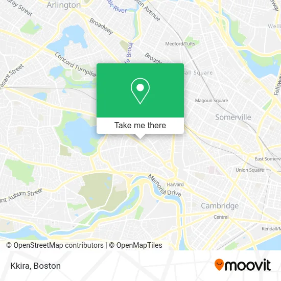
See Kkira, Cambridge, on the map
Public Transit to Kkira in Cambridge
Wondering how to get to Kkira in Cambridge? Moovit helps you find the best way to get to Kkira with step-by-step directions from the nearest public transit station.
Moovit provides free maps and live directions to help you navigate through your city. View schedules, routes, timetables, and find out how long does it take to get to Kkira in real time.
Looking for the nearest stop or station to Kkira? Check out this list of stops closest to your destination: Concord Ave @ Buckingham St; Harvard Square; Magoun Station; Porter.
Bus: 71, 74, 75, 78.Train: FITCHBURG, FRAMINGHAM/WORCESTER.Subway: RED LINE, GREEN LINE B, GREEN LINE C, GREEN LINE E.
Want to see if there’s another route that gets you there at an earlier time? Moovit helps you find alternative routes or times. Get directions from and directions to Kkira easily from the Moovit App or Website.
We make riding to Kkira easy, which is why over 1.7 million users, including users in Cambridge, trust Moovit as the best app for public transit. You don’t need to download an individual bus app or train app, Moovit is your all-in-one transit app that helps you find the best bus time or train time available.
For information on prices of bus, subway and train, costs and ride fares to Kkira, please check the Moovit app.
Use the app to navigate to popular places including to the airport, hospital, stadium, grocery store, mall, coffee shop, school, college, and university.
Kkira Address: 141 Huron Ave street in Cambridge
- Guglielmo USA,
- A&E Service Station,
- Newman Judith,
- Elizabeth's Daycare and Preschool Center,
- Shirinian M Orntal Rug Gallery,
- Lisa Farwell Acupuncture,
- Korn Deborah L,
- Robert Michael Childs,
- Cambridge Fire Department,
- Susan Hileman, Licsw, Psychotherapist,
- Saltzstein Barbara Psychothrpst,
- Glenn Lee,
- O'Reilly Spite House,
- Bernie's Used Furniture,
- Thomas E Alden,
- Smithsonian Astrophysical Observatory,
- Honey Jones Gallery,
- Lin Emprire,
- Saint Gabriels,
- One Earth Designs
Places Near Kkira (Cambridge)
- Prudential Center, Boston,
- Cheers, Boston,
- Boston Convention & Exhibition Center, Boston,
- Td Garden, Boston,
- Castle Island, Boston,
- Wang Theater, Boston,
- Boston Children's Hospital, Boston,
- Leader Bank Pavilion (Leader Bank Pavillion), Boston,
- Massachusetts General Hospital, Boston,
- Boston Medical Center, Boston,
- Seaport District, Boston,
- Faneuil Hall, Boston,
- House Of Blues, Boston,
- Museum Of Science, Boston,
- Quincy Market, Boston,
- Boston Common, Boston,
- Wilbur Theatre, Boston,
- Mgm Music Hall, Boston,
- Isabella Stewart Gardner Museum, Boston,
- North End, Boston
How to get to popular places in Boston with public transit
Get around Cambridge by public transit!
Traveling around Cambridge has never been so easy. See step by step directions as you travel to any attraction, street or major public transit station. View bus and train schedules, arrival times, service alerts and detailed routes on a map, so you know exactly how to get to anywhere in Cambridge.
When traveling to any destination around Cambridge use Moovit's Live Directions with Get Off Notifications to know exactly where and how far to walk, how long to wait for your line, and how many stops are left. Moovit will alert you when it's time to get off — no need to constantly re-check whether yours is the next stop.
Wondering how to use public transit in Cambridge or how to pay for public transit in Cambridge? Moovit public transit app can help you navigate your way with public transit easily, and at minimum cost. It includes public transit fees, ticket prices, and costs. Looking for a map of Cambridge public transit lines? Moovit public transit app shows all public transit maps in Cambridge with all Bus, Train, Subway and Ferry routes and stops on an interactive map.
Boston has 4 transit type(s), including: Bus, Train, Subway and Ferry, operated by several transit agencies, including MBTA, Southeastern Regional Transit Authority, MetroWest Regional Transit Authority, Rhode Island Public Transit Authority, WRTA, Lowell Regional Transit Authority, Merrimack Valley Transit, Montachusett Regional Transit Authority, Cape Cod Regional Transit Authority, Brockton Area Transit Authority, Martha's Vineyard Transit Authority, the WAVE - Nantucket Regional Transit Authority, GATRA, Cape Ann Transportation Authority and Massport