Directions to Known (Cambridge) with public transportation
The following transit lines have routes that pass near Known
 Bus: 77, 83, 87, 89, 96.
- Train: FITCHBURG, RED LINE.
- Subway: RED LINE, GREEN LINE B, GREEN LINE C, GREEN LINE E.
How to get to Known by bus?
Click on the bus route to see step by step directions with maps, line arrival times and updated time schedules.
From Suffolk County Superior Court, Boston
46 minFrom Cheers Beacon Hill, Boston
53 minFrom Market Basket, Revere
81 minFrom Boston College, Boston
61 minFrom 240 Mount Vernon Street, Boston
73 minFrom City Winery, Boston
53 minFrom Forest Hills Station MBTA, Boston
70 minFrom McLean Hospital, Belmont
50 minFrom Faulkner Hospital, Boston
91 minFrom Brigham and Women's Faulkner Hospital, Boston
91 min
How to get to Known by train?
Click on the train route to see step by step directions with maps, line arrival times and updated time schedules.
How to get to Known by subway?
Click on the subway route to see step by step directions with maps, line arrival times and updated time schedules.
From Suffolk County Superior Court, Boston
30 minFrom Cheers Beacon Hill, Boston
32 minFrom Boston College, Boston
78 minFrom 240 Mount Vernon Street, Boston
41 minFrom City Winery, Boston
36 minFrom Forest Hills Station MBTA, Boston
45 minFrom Faulkner Hospital, Boston
64 minFrom Brigham and Women's Faulkner Hospital, Boston
63 min
Bus stops near Known in Cambridge
Subway station near Known in Cambridge
- Magoun Station, 4 min walk,VIEW
Train station near Known in Cambridge
- Porter, 24 min walk,VIEW
Bus lines to Known in Cambridge
What are the closest stations to Known?
The closest stations to Known are:
- Rindge Ave @ Haskell St is 17 yards away, 1 min walk.
- Massachusetts Ave @ Rindge Ave is 222 yards away, 3 min walk.
- Elm St @ Cutter Ave is 271 yards away, 4 min walk.
- Elm St @ Chester St is 289 yards away, 4 min walk.
- Magoun Station is 331 yards away, 4 min walk.
- Massachusetts Ave @ Upland Rd is 432 yards away, 6 min walk.
- Porter is 2001 yards away, 24 min walk.
Which bus lines stop near Known?
These bus lines stop near Known: 77, 83, 87, 89.
Which train line stops near Known?
FITCHBURG (#410 | North Station)
Which subway line stops near Known?
RED LINE (Alewife)
What’s the nearest subway station to Known in Cambridge?
The nearest subway station to Known in Cambridge is Magoun Station. It’s a 4 min walk away.
What’s the nearest train station to Known in Cambridge?
The nearest train station to Known in Cambridge is Porter. It’s a 24 min walk away.
What’s the nearest bus station to Known in Cambridge?
The nearest bus station to Known in Cambridge is Rindge Ave @ Haskell St. It’s a 1 min walk away.
What time is the first subway to Known in Cambridge?
The GREEN LINE E is the first subway that goes to Known in Cambridge. It stops nearby at 4:53 AM.
What time is the last subway to Known in Cambridge?
The GREEN LINE E is the last subway that goes to Known in Cambridge. It stops nearby at 2:39 AM.
What time is the first train to Known in Cambridge?
The FITCHBURG is the first train that goes to Known in Cambridge. It stops nearby at 5:47 AM.
What time is the last train to Known in Cambridge?
The FITCHBURG is the last train that goes to Known in Cambridge. It stops nearby at 12:17 AM.
What time is the first bus to Known in Cambridge?
The 77 is the first bus that goes to Known in Cambridge. It stops nearby at 5:02 AM.
What time is the last bus to Known in Cambridge?
The 87 is the last bus that goes to Known in Cambridge. It stops nearby at 1:32 AM.
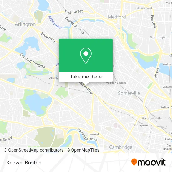
See Known, Cambridge, on the map
Public Transit to Known in Cambridge
Wondering how to get to Known in Cambridge? Moovit helps you find the best way to get to Known with step-by-step directions from the nearest public transit station.
Moovit provides free maps and live directions to help you navigate through your city. View schedules, routes, timetables, and find out how long does it take to get to Known in real time.
Looking for the nearest stop or station to Known? Check out this list of stops closest to your destination: Rindge Ave @ Haskell St; Massachusetts Ave @ Rindge Ave; Elm St @ Cutter Ave; Elm St @ Chester St; Magoun Station; Massachusetts Ave @ Upland Rd; Porter.
Bus: 77, 83, 87, 89, 96, 88, 90, 94.Train: FITCHBURG, RED LINE.Subway: RED LINE, GREEN LINE B, GREEN LINE C, GREEN LINE E.
Want to see if there’s another route that gets you there at an earlier time? Moovit helps you find alternative routes or times. Get directions from and directions to Known easily from the Moovit App or Website.
We make riding to Known easy, which is why over 1.7 million users, including users in Cambridge, trust Moovit as the best app for public transit. You don’t need to download an individual bus app or train app, Moovit is your all-in-one transit app that helps you find the best bus time or train time available.
For information on prices of subway, bus and train, costs and ride fares to Known, please check the Moovit app.
Use the app to navigate to popular places including to the airport, hospital, stadium, grocery store, mall, coffee shop, school, college, and university.
Known Address: 2067 Massachusetts Ave street in Cambridge
- Microbiome Health Research,
- ibis Reproductive Health,
- Donde Locksmith & Key,
- Thayer Delaney & Connor Ins Agency,
- Gustazo Cuban Kitchen & Bar,
- Redemption Tattoo,
- Shingle & Roofing Systems,
- Hess Express,
- 5 Waldon Condominium Trust,
- Prime Locksmith of Cambridge,
- Priscilla Candy Shop,
- Wantea,
- Cambridge School Of Culinary Arts,
- Plansmart Realty,
- Minute Man Bike Trail,
- Kids Co-OP Cambridge,
- Acs Drop-in Center,
- St James Helping Hand Food Pantry,
- Cuisine en Locale,
- Philemon Russell House (Ca. 1845)
Places Near Known (Cambridge)
- Seaport District, Boston,
- Boston Medical Center, Boston,
- Boston Children's Hospital, Boston,
- Quincy Market, Boston,
- Mgm Music Hall, Boston,
- Cheers, Boston,
- House Of Blues, Boston,
- Leader Bank Pavilion (Leader Bank Pavillion), Boston,
- Massachusetts General Hospital, Boston,
- Castle Island, Boston,
- Museum Of Science, Boston,
- Boston Common, Boston,
- Faneuil Hall, Boston,
- North End, Boston,
- Isabella Stewart Gardner Museum, Boston,
- Boston Convention & Exhibition Center, Boston,
- Wang Theater, Boston,
- Prudential Center, Boston,
- Td Garden, Boston,
- Wilbur Theatre, Boston
How to get to popular places in Boston with public transit
Get around Cambridge by public transit!
Traveling around Cambridge has never been so easy. See step by step directions as you travel to any attraction, street or major public transit station. View bus and train schedules, arrival times, service alerts and detailed routes on a map, so you know exactly how to get to anywhere in Cambridge.
When traveling to any destination around Cambridge use Moovit's Live Directions with Get Off Notifications to know exactly where and how far to walk, how long to wait for your line, and how many stops are left. Moovit will alert you when it's time to get off — no need to constantly re-check whether yours is the next stop.
Wondering how to use public transit in Cambridge or how to pay for public transit in Cambridge? Moovit public transit app can help you navigate your way with public transit easily, and at minimum cost. It includes public transit fees, ticket prices, and costs. Looking for a map of Cambridge public transit lines? Moovit public transit app shows all public transit maps in Cambridge with all Bus, Train, Subway and Ferry routes and stops on an interactive map.
Boston has 4 transit type(s), including: Bus, Train, Subway and Ferry, operated by several transit agencies, including MBTA, Southeastern Regional Transit Authority, MetroWest Regional Transit Authority, Rhode Island Public Transit Authority, WRTA, Lowell Regional Transit Authority, Merrimack Valley Transit, Montachusett Regional Transit Authority, Cape Cod Regional Transit Authority, Brockton Area Transit Authority, Martha's Vineyard Transit Authority, the WAVE - Nantucket Regional Transit Authority, GATRA, Cape Ann Transportation Authority and Massport