Directions to Kokopelli Tanning (Chelsea) with public transportation
The following transit lines have routes that pass near Kokopelli Tanning
 Bus: 111, 112.
- Train: NEWBURYPORT/ROCKPORT.
- Subway: BLUE LINE, ORANGE LINE.
How to get to Kokopelli Tanning by bus?
Click on the bus route to see step by step directions with maps, line arrival times and updated time schedules.
From Boston Landing Station, Boston
81 minFrom Mission Hill, Boston
74 minFrom Dubliner, Boston
28 minFrom Fenway Park, Boston
88 minFrom Kendall Square, Cambridge
49 minFrom Highland Ave Somerville MA, Somerville
56 minFrom Harvard Square T Station - Red Line, Cambridge
66 minFrom Uphams Corner, Boston
88 minFrom Courtyard by Marriott Brookline, Brookline
88 minFrom Arlington, MA, Arlington
89 min
How to get to Kokopelli Tanning by train?
Click on the train route to see step by step directions with maps, line arrival times and updated time schedules.
How to get to Kokopelli Tanning by subway?
Click on the subway route to see step by step directions with maps, line arrival times and updated time schedules.
From Boston Landing Station, Boston
114 minFrom Mission Hill, Boston
89 minFrom Dubliner, Boston
60 minFrom Fenway Park, Boston
84 minFrom Kendall Square, Cambridge
78 minFrom Highland Ave Somerville MA, Somerville
88 minFrom Harvard Square T Station - Red Line, Cambridge
77 minFrom Uphams Corner, Boston
89 minFrom Courtyard by Marriott Brookline, Brookline
89 min
Bus stop near Kokopelli Tanning in Chelsea
- 325 Washington Ave, 3 min walk,VIEW
Subway station near Kokopelli Tanning in Chelsea
- Airport, 12 min walk,VIEW
Train station near Kokopelli Tanning in Chelsea
- Chelsea, 23 min walk,VIEW
Bus lines to Kokopelli Tanning in Chelsea
What are the closest stations to Kokopelli Tanning?
The closest stations to Kokopelli Tanning are:
- 325 Washington Ave is 225 yards away, 3 min walk.
- Airport is 962 yards away, 12 min walk.
- Chelsea is 1880 yards away, 23 min walk.
Which bus lines stop near Kokopelli Tanning?
These bus lines stop near Kokopelli Tanning: 111, 112.
Which train line stops near Kokopelli Tanning?
NEWBURYPORT/ROCKPORT (#125 | Newburyport)
Which subway lines stop near Kokopelli Tanning?
These subway lines stop near Kokopelli Tanning: BLUE LINE, ORANGE LINE.
What’s the nearest subway station to Kokopelli Tanning in Chelsea?
The nearest subway station to Kokopelli Tanning in Chelsea is Airport. It’s a 12 min walk away.
What’s the nearest train station to Kokopelli Tanning in Chelsea?
The nearest train station to Kokopelli Tanning in Chelsea is Chelsea. It’s a 23 min walk away.
What’s the nearest bus station to Kokopelli Tanning in Chelsea?
The nearest bus station to Kokopelli Tanning in Chelsea is 325 Washington Ave. It’s a 3 min walk away.
What time is the first subway to Kokopelli Tanning in Chelsea?
The BLUE LINE is the first subway that goes to Kokopelli Tanning in Chelsea. It stops nearby at 5:08 AM.
What time is the last subway to Kokopelli Tanning in Chelsea?
The BLUE LINE is the last subway that goes to Kokopelli Tanning in Chelsea. It stops nearby at 2:03 AM.
What time is the first train to Kokopelli Tanning in Chelsea?
The NEWBURYPORT/ROCKPORT is the first train that goes to Kokopelli Tanning in Chelsea. It stops nearby at 5:40 AM.
What time is the last train to Kokopelli Tanning in Chelsea?
The NEWBURYPORT/ROCKPORT is the last train that goes to Kokopelli Tanning in Chelsea. It stops nearby at 12:06 AM.
What time is the first bus to Kokopelli Tanning in Chelsea?
The 111 is the first bus that goes to Kokopelli Tanning in Chelsea. It stops nearby at 4:32 AM.
What time is the last bus to Kokopelli Tanning in Chelsea?
The 111 is the last bus that goes to Kokopelli Tanning in Chelsea. It stops nearby at 2:34 AM.
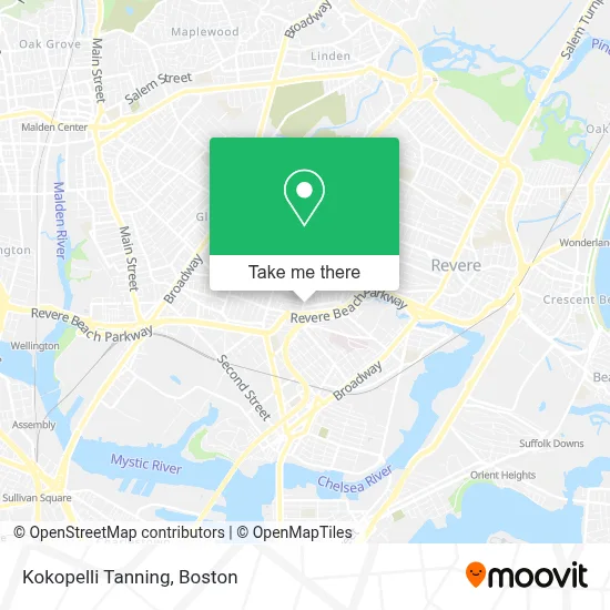
See Kokopelli Tanning, Chelsea, on the map
Public Transit to Kokopelli Tanning in Chelsea
Wondering how to get to Kokopelli Tanning in Chelsea? Moovit helps you find the best way to get to Kokopelli Tanning with step-by-step directions from the nearest public transit station.
Moovit provides free maps and live directions to help you navigate through your city. View schedules, routes, timetables, and find out how long does it take to get to Kokopelli Tanning in real time.
Looking for the nearest stop or station to Kokopelli Tanning? Check out this list of stops closest to your destination: 325 Washington Ave; Airport; Chelsea.
Bus: 111, 112.Train: NEWBURYPORT/ROCKPORT.Subway: BLUE LINE, ORANGE LINE.
Want to see if there’s another route that gets you there at an earlier time? Moovit helps you find alternative routes or times. Get directions from and directions to Kokopelli Tanning easily from the Moovit App or Website.
We make riding to Kokopelli Tanning easy, which is why over 1.7 million users, including users in Chelsea, trust Moovit as the best app for public transit. You don’t need to download an individual bus app or train app, Moovit is your all-in-one transit app that helps you find the best bus time or train time available.
For information on prices of bus, subway and train, costs and ride fares to Kokopelli Tanning, please check the Moovit app.
Use the app to navigate to popular places including to the airport, hospital, stadium, grocery store, mall, coffee shop, school, college, and university.
Kokopelli Tanning Address: 363 Washington Ave street in Chelsea
- African Authentics,
- Revere Beach Parkway & Washington Avenue,
- Southwick Zoo,
- Prattville,
- Canobie Lake Park,
- Orange St & Revere Beach Pkwy,
- Vietnam Veterans Memorial Swimming Pool,
- CHA Everett Hospital-ER,
- Cha Everett Hospital Emergency Department,
- Whidden Memorial Hospital,
- Revere Beach Pkwy / Everett Ave,
- Everett Quick to Go,
- Panaderia Vicentina,
- Massachusetts Soldiers Home,
- Homewood Suites by Hilton Boston Logan Airport Chelsea,
- Chelsea, MA,
- Acapulco Restaurant (Acapulco Mexican Rest Y Cantina),
- Fairfield Inn & Suites-Boston Logan,
- Fairfield Inn & Suites by Marriott Boston Logan Airport / Chelsea,
- Residence Inn by Marriott Boston Logan Airport Chelsea
Places Near Kokopelli Tanning (Chelsea)
- North End, Boston,
- Faneuil Hall, Boston,
- Leader Bank Pavilion (Leader Bank Pavillion), Boston,
- Isabella Stewart Gardner Museum, Boston,
- Quincy Market, Boston,
- Cheers, Boston,
- Boston Convention & Exhibition Center, Boston,
- House Of Blues, Boston,
- Museum Of Science, Boston,
- Massachusetts General Hospital, Boston,
- Wilbur Theatre, Boston,
- Castle Island, Boston,
- Wang Theater, Boston,
- Boston Medical Center, Boston,
- Mgm Music Hall, Boston,
- Boston Common, Boston,
- Boston Children's Hospital, Boston,
- Td Garden, Boston,
- Prudential Center, Boston,
- Seaport District, Boston
How to get to popular places in Boston with public transit
Get around Chelsea by public transit!
Traveling around Chelsea has never been so easy. See step by step directions as you travel to any attraction, street or major public transit station. View bus and train schedules, arrival times, service alerts and detailed routes on a map, so you know exactly how to get to anywhere in Chelsea.
When traveling to any destination around Chelsea use Moovit's Live Directions with Get Off Notifications to know exactly where and how far to walk, how long to wait for your line, and how many stops are left. Moovit will alert you when it's time to get off — no need to constantly re-check whether yours is the next stop.
Wondering how to use public transit in Chelsea or how to pay for public transit in Chelsea? Moovit public transit app can help you navigate your way with public transit easily, and at minimum cost. It includes public transit fees, ticket prices, and costs. Looking for a map of Chelsea public transit lines? Moovit public transit app shows all public transit maps in Chelsea with all Bus, Train, Subway and Ferry routes and stops on an interactive map.
Boston has 4 transit type(s), including: Bus, Train, Subway and Ferry, operated by several transit agencies, including MBTA, Southeastern Regional Transit Authority, MetroWest Regional Transit Authority, Rhode Island Public Transit Authority, WRTA, Lowell Regional Transit Authority, Merrimack Valley Transit, Montachusett Regional Transit Authority, Cape Cod Regional Transit Authority, Brockton Area Transit Authority, Martha's Vineyard Transit Authority, the WAVE - Nantucket Regional Transit Authority, GATRA, Cape Ann Transportation Authority and Massport