How to get to Kool Kats Airbrush Tattoos by bus?
Click on the bus route to see step by step directions with maps, line arrival times and updated time schedules.
From B.M.C. Durfee High School, Fall River
66 minFrom Bedford Industrial Park, New Bedford
165 minFrom RMV New Bedford, New Bedford
166 minFrom Barahona Express, Providence
82 minFrom Providence Amtrak Station, Providence
55 minFrom Amazon Fulfillment Bos7, Fall River
67 minFrom Lizzy Borden House, Fall River
30 minFrom Walmart Fall River Supercenter, Fall River
51 min
Bus stop near Kool Kats Airbrush Tattoos in Somerset
- Read St And Lees River Ave, 7 min walk,VIEW
Bus lines to Kool Kats Airbrush Tattoos in Somerset
- 114, Fall River Terminal Via Route 6,VIEW
What are the closest stations to Kool Kats Airbrush Tattoos?
The closest stations to Kool Kats Airbrush Tattoos are:
- Read St And Lees River Ave is 536 yards away, 7 min walk.
Which bus lines stop near Kool Kats Airbrush Tattoos?
These bus lines stop near Kool Kats Airbrush Tattoos: 114, 24L.
What’s the nearest bus station to Kool Kats Airbrush Tattoos in Somerset?
The nearest bus station to Kool Kats Airbrush Tattoos in Somerset is Read St And Lees River Ave. It’s a 7 min walk away.
What time is the first bus to Kool Kats Airbrush Tattoos in Somerset?
The 114 is the first bus that goes to Kool Kats Airbrush Tattoos in Somerset. It stops nearby at 8:47 AM.
What time is the last bus to Kool Kats Airbrush Tattoos in Somerset?
The 114 is the last bus that goes to Kool Kats Airbrush Tattoos in Somerset. It stops nearby at 9:14 PM.
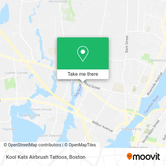
See Kool Kats Airbrush Tattoos, Somerset, on the map
Public Transit to Kool Kats Airbrush Tattoos in Somerset
Wondering how to get to Kool Kats Airbrush Tattoos in Somerset? Moovit helps you find the best way to get to Kool Kats Airbrush Tattoos with step-by-step directions from the nearest public transit station.
Moovit provides free maps and live directions to help you navigate through your city. View schedules, routes, timetables, and find out how long does it take to get to Kool Kats Airbrush Tattoos in real time.
Looking for the nearest stop or station to Kool Kats Airbrush Tattoos? Check out this list of stops closest to your destination: Read St And Lees River Ave.
Bus: 114, 24L.
Want to see if there’s another route that gets you there at an earlier time? Moovit helps you find alternative routes or times. Get directions from and directions to Kool Kats Airbrush Tattoos easily from the Moovit App or Website.
We make riding to Kool Kats Airbrush Tattoos easy, which is why over 1.7 million users, including users in Somerset, trust Moovit as the best app for public transit. You don’t need to download an individual bus app or train app, Moovit is your all-in-one transit app that helps you find the best bus time or train time available.
For information on prices of bus, costs and ride fares to Kool Kats Airbrush Tattoos, please check the Moovit app.
Use the app to navigate to popular places including to the airport, hospital, stadium, grocery store, mall, coffee shop, school, college, and university.
Kool Kats Airbrush Tattoos Address: 112 Evergreen Ave street in Somerset
- Castigliego's Seafood,
- J Petal,
- Bergeron Chiropractic Neurology PC,
- Light House,
- Riverside Auto Sales,
- Choo Chew Craft Kitchen,
- ATM,
- Changing Directions Counseling,
- Hair Affair,
- Goodfella Vapor Lounge,
- Medicare Made Easy,
- Antique Acquisitions,
- Venus de Milo,
- Swansea Lounge,
- Empire Grille,
- Speech and Language Therapy Service for Children,
- Planet Garden,
- Almeida's Earth Bar,
- Sears,
- Portuguese American Baptist
Places Near Kool Kats Airbrush Tattoos (Somerset)
- Quincy Market, Boston,
- Museum Of Science, Boston,
- Cheers, Boston,
- North End, Boston,
- Castle Island, Boston,
- Seaport District, Boston,
- Wilbur Theatre, Boston,
- Td Garden, Boston,
- Mgm Music Hall, Boston,
- Isabella Stewart Gardner Museum, Boston,
- Boston Children's Hospital, Boston,
- Boston Medical Center, Boston,
- Wang Theater, Boston,
- House Of Blues, Boston,
- Prudential Center, Boston,
- Faneuil Hall, Boston,
- Leader Bank Pavilion (Leader Bank Pavillion), Boston,
- Boston Common, Boston,
- Massachusetts General Hospital, Boston,
- Boston Convention & Exhibition Center, Boston
How to get to popular places in Boston with public transit
Get around Somerset by public transit!
Traveling around Somerset has never been so easy. See step by step directions as you travel to any attraction, street or major public transit station. View bus and train schedules, arrival times, service alerts and detailed routes on a map, so you know exactly how to get to anywhere in Somerset.
When traveling to any destination around Somerset use Moovit's Live Directions with Get Off Notifications to know exactly where and how far to walk, how long to wait for your line, and how many stops are left. Moovit will alert you when it's time to get off — no need to constantly re-check whether yours is the next stop.
Wondering how to use public transit in Somerset or how to pay for public transit in Somerset? Moovit public transit app can help you navigate your way with public transit easily, and at minimum cost. It includes public transit fees, ticket prices, and costs. Looking for a map of Somerset public transit lines? Moovit public transit app shows all public transit maps in Somerset with all Bus, Train, Subway and Ferry routes and stops on an interactive map.
Boston has 4 transit type(s), including: Bus, Train, Subway and Ferry, operated by several transit agencies, including MBTA, Southeastern Regional Transit Authority, MetroWest Regional Transit Authority, Rhode Island Public Transit Authority, WRTA, Lowell Regional Transit Authority, Merrimack Valley Transit, Montachusett Regional Transit Authority, Cape Cod Regional Transit Authority, Brockton Area Transit Authority, Martha's Vineyard Transit Authority, the WAVE - Nantucket Regional Transit Authority, GATRA, Cape Ann Transportation Authority and Massport