How to get to Kool Kone by bus?
Click on the bus route to see step by step directions with maps, line arrival times and updated time schedules.
From Charlton Memorial Hospital, Fall River
164 minFrom B.M.C. Durfee High School, Fall River
144 minFrom Bedford Industrial Park, New Bedford
169 minFrom Amazon Fulfillment Bos7, Fall River
176 minFrom RMV New Bedford, New Bedford
167 minFrom Falmouth MA USA, Falmouth
163 minFrom Mass Maritime Academy, Buzzards Bay
97 min
Bus stop near Kool Kone in Weweantic
- Cromeset, 23 min walk,VIEW
Train station near Kool Kone in Weweantic
- Wareham Village, 46 min walk,VIEW
Bus lines to Kool Kone in Weweantic
- L1, Cromeset,VIEW
What are the closest stations to Kool Kone?
The closest stations to Kool Kone are:
- Cromeset is 1929 yards away, 23 min walk.
- Wareham Village is 3900 yards away, 46 min walk.
Which bus lines stop near Kool Kone?
These bus lines stop near Kool Kone: L1, WARE.
What time is the first bus to Kool Kone in Weweantic?
The L1 is the first bus that goes to Kool Kone in Weweantic. It stops nearby at 7:50 AM.
What time is the last bus to Kool Kone in Weweantic?
The L1 is the last bus that goes to Kool Kone in Weweantic. It stops nearby at 5:50 PM.
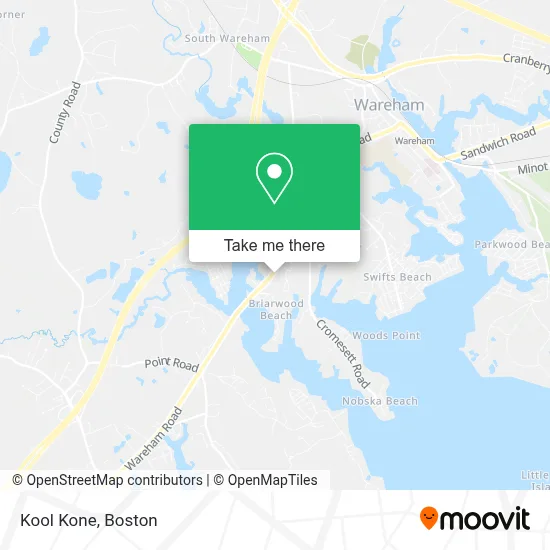
See Kool Kone, Weweantic, on the map
Public Transit to Kool Kone in Weweantic
Wondering how to get to Kool Kone in Weweantic? Moovit helps you find the best way to get to Kool Kone with step-by-step directions from the nearest public transit station.
Moovit provides free maps and live directions to help you navigate through your city. View schedules, routes, timetables, and find out how long does it take to get to Kool Kone in real time.
Looking for the nearest stop or station to Kool Kone? Check out this list of stops closest to your destination: Cromeset; Wareham Village.
Bus: L1, WARE.Train: CAPEFLYER.
Want to see if there’s another route that gets you there at an earlier time? Moovit helps you find alternative routes or times. Get directions from and directions to Kool Kone easily from the Moovit App or Website.
We make riding to Kool Kone easy, which is why over 1.7 million users, including users in Weweantic, trust Moovit as the best app for public transit. You don’t need to download an individual bus app or train app, Moovit is your all-in-one transit app that helps you find the best bus time or train time available.
For information on prices of bus, costs and ride fares to Kool Kone, please check the Moovit app.
Use the app to navigate to popular places including to the airport, hospital, stadium, grocery store, mall, coffee shop, school, college, and university.
Kool Kone Address: 374 Marion Rd street in Weweantic
- Rose Point,
- Diane Gonsalves,
- Medicare Insurance Advisors Wareham,
- Health Insurance Brokers Wareham,
- James Silva,
- Notch Your Average Tree Service,
- R & B Painting,
- Stanley S Russo,
- James E Kearns Dmd Pc,
- Blackmore Cranberry Bogs,
- Stephanie's Hair Salon,
- Main Street Shopping Center,
- Hammond Brook,
- Fairhaven Brook,
- 29 Caron's Way,
- Blackmore Pond West Dam,
- William T Shannon Consulting,
- Wareham Roofing Contractors Roofing,
- Cafe Gelatte,
- Deb Levesque Massage Therapy
Places Near Kool Kone (Weweantic)
- Museum Of Science, Boston,
- Quincy Market, Boston,
- Wilbur Theatre, Boston,
- Wang Theater, Boston,
- Faneuil Hall, Boston,
- North End, Boston,
- House Of Blues, Boston,
- Boston Common, Boston,
- Seaport District, Boston,
- Prudential Center, Boston,
- Cheers, Boston,
- Boston Children's Hospital, Boston,
- Mgm Music Hall, Boston,
- Boston Medical Center, Boston,
- Castle Island, Boston,
- Isabella Stewart Gardner Museum, Boston,
- Boston Convention & Exhibition Center, Boston,
- Massachusetts General Hospital, Boston,
- Td Garden, Boston,
- Leader Bank Pavilion (Leader Bank Pavillion), Boston
How to get to popular places in Boston with public transit
Get around Weweantic by public transit!
Traveling around Weweantic has never been so easy. See step by step directions as you travel to any attraction, street or major public transit station. View bus and train schedules, arrival times, service alerts and detailed routes on a map, so you know exactly how to get to anywhere in Weweantic.
When traveling to any destination around Weweantic use Moovit's Live Directions with Get Off Notifications to know exactly where and how far to walk, how long to wait for your line, and how many stops are left. Moovit will alert you when it's time to get off — no need to constantly re-check whether yours is the next stop.
Wondering how to use public transit in Weweantic or how to pay for public transit in Weweantic? Moovit public transit app can help you navigate your way with public transit easily, and at minimum cost. It includes public transit fees, ticket prices, and costs. Looking for a map of Weweantic public transit lines? Moovit public transit app shows all public transit maps in Weweantic with all Bus, Train, Subway and Ferry routes and stops on an interactive map.
Boston has 4 transit type(s), including: Bus, Train, Subway and Ferry, operated by several transit agencies, including MBTA, Southeastern Regional Transit Authority, MetroWest Regional Transit Authority, Rhode Island Public Transit Authority, WRTA, Lowell Regional Transit Authority, Merrimack Valley Transit, Montachusett Regional Transit Authority, Cape Cod Regional Transit Authority, Brockton Area Transit Authority, Martha's Vineyard Transit Authority, the WAVE - Nantucket Regional Transit Authority, GATRA, Cape Ann Transportation Authority and Massport