Directions to Kosher Bakery (Brookline) with public transportation
The following transit lines have routes that pass near Kosher Bakery
 Bus: 51.
- Train: NEEDHAM.
- Subway: GREEN LINE D, ORANGE LINE.
How to get to Kosher Bakery by bus?
Click on the bus route to see step by step directions with maps, line arrival times and updated time schedules.
From Lolita Cocina & Tequila Bar, Boston
60 minFrom Kimpton Marlowe Hotel, Cambridge
89 minFrom JFK Federal Building, Boston
76 minFrom Boston Children's Museum, Boston
82 minFrom Google, Cambridge
73 minFrom Fenway Park, Boston
51 minFrom City Hall To Go, Boston
81 minFrom 60 State St, Boston
67 minFrom James Hook & Co, Boston
80 minFrom 125 High Street, Boston
65 min
How to get to Kosher Bakery by train?
Click on the train route to see step by step directions with maps, line arrival times and updated time schedules.
How to get to Kosher Bakery by subway?
Click on the subway route to see step by step directions with maps, line arrival times and updated time schedules.
From Lolita Cocina & Tequila Bar, Boston
68 minFrom Kimpton Marlowe Hotel, Cambridge
97 minFrom JFK Federal Building, Boston
84 minFrom Boston Children's Museum, Boston
90 minFrom Google, Cambridge
84 minFrom Fenway Park, Boston
67 minFrom City Hall To Go, Boston
102 minFrom 60 State St, Boston
70 minFrom James Hook & Co, Boston
89 minFrom 125 High Street, Boston
77 min
Bus stop near Kosher Bakery in Brookline
- Independence Dr @ Sherman Rd, 1 min walk,VIEW
Subway station near Kosher Bakery in Brookline
- Chestnut Hill, 17 min walk,VIEW
Train station near Kosher Bakery in Brookline
- Bellevue, 19 min walk,VIEW
Bus lines to Kosher Bakery in Brookline
- 51, Forest Hills,VIEW
What are the closest stations to Kosher Bakery?
The closest stations to Kosher Bakery are:
- Independence Dr @ Sherman Rd is 25 yards away, 1 min walk.
- Chestnut Hill is 1378 yards away, 17 min walk.
- Bellevue is 1598 yards away, 19 min walk.
Which bus line stops near Kosher Bakery?
51 (Forest Hills)
Which train line stops near Kosher Bakery?
NEEDHAM (#625 | Needham Heights)
Which subway lines stop near Kosher Bakery?
These subway lines stop near Kosher Bakery: GREEN LINE D, ORANGE LINE.
What’s the nearest subway station to Kosher Bakery in Brookline?
The nearest subway station to Kosher Bakery in Brookline is Chestnut Hill. It’s a 17 min walk away.
What’s the nearest train station to Kosher Bakery in Brookline?
The nearest train station to Kosher Bakery in Brookline is Bellevue. It’s a 19 min walk away.
What’s the nearest bus station to Kosher Bakery in Brookline?
The nearest bus station to Kosher Bakery in Brookline is Independence Dr @ Sherman Rd. It’s a 1 min walk away.
What time is the first subway to Kosher Bakery in Brookline?
The GREEN LINE D is the first subway that goes to Kosher Bakery in Brookline. It stops nearby at 4:57 AM.
What time is the last subway to Kosher Bakery in Brookline?
The GREEN LINE D is the last subway that goes to Kosher Bakery in Brookline. It stops nearby at 2:34 AM.
What time is the first train to Kosher Bakery in Brookline?
The NEEDHAM is the first train that goes to Kosher Bakery in Brookline. It stops nearby at 7:22 AM.
What time is the last train to Kosher Bakery in Brookline?
The NEEDHAM is the last train that goes to Kosher Bakery in Brookline. It stops nearby at 6:18 PM.
What time is the first bus to Kosher Bakery in Brookline?
The 51 is the first bus that goes to Kosher Bakery in Brookline. It stops nearby at 6:10 AM.
What time is the last bus to Kosher Bakery in Brookline?
The 51 is the last bus that goes to Kosher Bakery in Brookline. It stops nearby at 10:10 PM.
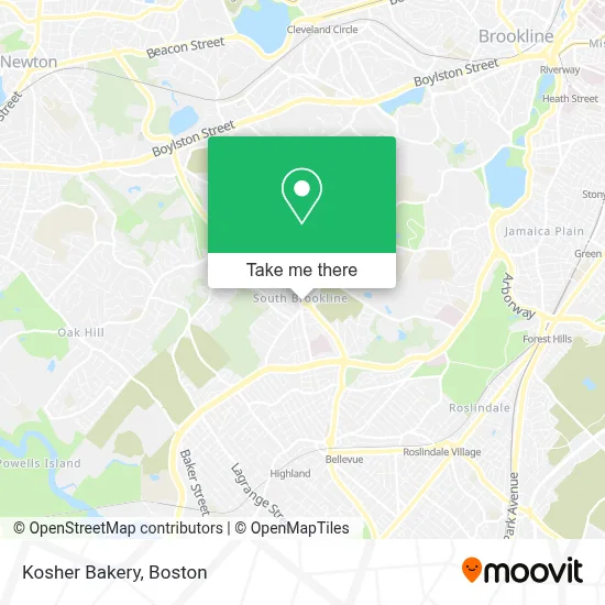
See Kosher Bakery, Brookline, on the map
Public Transit to Kosher Bakery in Brookline
Wondering how to get to Kosher Bakery in Brookline? Moovit helps you find the best way to get to Kosher Bakery with step-by-step directions from the nearest public transit station.
Moovit provides free maps and live directions to help you navigate through your city. View schedules, routes, timetables, and find out how long does it take to get to Kosher Bakery in real time.
Looking for the nearest stop or station to Kosher Bakery? Check out this list of stops closest to your destination: Independence Dr @ Sherman Rd; Chestnut Hill; Bellevue.
Bus: 51.Train: NEEDHAM.Subway: GREEN LINE D, ORANGE LINE.
Want to see if there’s another route that gets you there at an earlier time? Moovit helps you find alternative routes or times. Get directions from and directions to Kosher Bakery easily from the Moovit App or Website.
We make riding to Kosher Bakery easy, which is why over 1.7 million users, including users in Brookline, trust Moovit as the best app for public transit. You don’t need to download an individual bus app or train app, Moovit is your all-in-one transit app that helps you find the best bus time or train time available.
For information on prices of bus, subway and train, costs and ride fares to Kosher Bakery, please check the Moovit app.
Use the app to navigate to popular places including to the airport, hospital, stadium, grocery store, mall, coffee shop, school, college, and university.
Kosher Bakery Address: 1010 W Roxbury Pkwy street in Brookline
- South Brookline,
- Putterham Library,
- Public Library of Brookline,
- Siding Repair Contractor,
- West Roxbury Parkway,
- Edith C. Baker School,
- Bournewood Hospital,
- Rehabilitation From Orthopedic Surgery,
- Hancock Village Apartments,
- Longwood Towers Apartments,
- Hancock Village Apartments,
- Apple Orchard Nursery,
- Hornsby & Thorndyke Assoc,
- Actual Synergy Consulting,
- Acorn Editions,
- MiniLuxe West Roxbury at Hancock Village,
- Mane Tame Hair,
- Mal's Landscape & Design,
- Shred Nations,
- CC Masonry & Restoration
Places Near Kosher Bakery (Brookline)
- North End, Boston,
- House Of Blues, Boston,
- Seaport District, Boston,
- Prudential Center, Boston,
- Castle Island, Boston,
- Td Garden, Boston,
- Massachusetts General Hospital, Boston,
- Cheers, Boston,
- Museum Of Science, Boston,
- Boston Medical Center, Boston,
- Wilbur Theatre, Boston,
- Isabella Stewart Gardner Museum, Boston,
- Leader Bank Pavilion (Leader Bank Pavillion), Boston,
- Boston Common, Boston,
- Boston Children's Hospital, Boston,
- Mgm Music Hall, Boston,
- Faneuil Hall, Boston,
- Wang Theater, Boston,
- Boston Convention & Exhibition Center, Boston,
- Quincy Market, Boston
How to get to popular places in Boston with public transit
Get around Brookline by public transit!
Traveling around Brookline has never been so easy. See step by step directions as you travel to any attraction, street or major public transit station. View bus and train schedules, arrival times, service alerts and detailed routes on a map, so you know exactly how to get to anywhere in Brookline.
When traveling to any destination around Brookline use Moovit's Live Directions with Get Off Notifications to know exactly where and how far to walk, how long to wait for your line, and how many stops are left. Moovit will alert you when it's time to get off — no need to constantly re-check whether yours is the next stop.
Wondering how to use public transit in Brookline or how to pay for public transit in Brookline? Moovit public transit app can help you navigate your way with public transit easily, and at minimum cost. It includes public transit fees, ticket prices, and costs. Looking for a map of Brookline public transit lines? Moovit public transit app shows all public transit maps in Brookline with all Bus, Train, Subway and Ferry routes and stops on an interactive map.
Boston has 4 transit type(s), including: Bus, Train, Subway and Ferry, operated by several transit agencies, including MBTA, Southeastern Regional Transit Authority, MetroWest Regional Transit Authority, Rhode Island Public Transit Authority, WRTA, Lowell Regional Transit Authority, Merrimack Valley Transit, Montachusett Regional Transit Authority, Cape Cod Regional Transit Authority, Brockton Area Transit Authority, Martha's Vineyard Transit Authority, the WAVE - Nantucket Regional Transit Authority, GATRA, Cape Ann Transportation Authority and Massport