Directions to Kp Sells Boston with public transportation
The following transit lines have routes that pass near Kp Sells Boston
 Bus: 38, 39, 35, 41, 42.
- Train: NEEDHAM, FRANKLIN/FOXBORO, PROVIDENCE/STOUGHTON.
- Subway: ORANGE LINE, GREEN LINE E.
How to get to Kp Sells Boston by bus?
Click on the bus route to see step by step directions with maps, line arrival times and updated time schedules.
From Old State House
53 minFrom Citizenm Boston North Station
61 minFrom Assembly Square Mall Shopping Center
84 minFrom Godfrey Hotel Boston
51 minFrom Kimpton Marlowe Hotel
69 minFrom MBTA Alewife Station
91 minFrom MBTA / Alewife #6
91 minFrom Silver Line Stop Terminal B
44 minFrom Reelhouse
78 minFrom Hilton Boston Logan Airport
42 min
How to get to Kp Sells Boston by train?
Click on the train route to see step by step directions with maps, line arrival times and updated time schedules.
How to get to Kp Sells Boston by subway?
Click on the subway route to see step by step directions with maps, line arrival times and updated time schedules.
From Old State House
31 minFrom Silver Line Stop Terminal B
66 minFrom Citizenm Boston North Station
38 minFrom Assembly Square Mall Shopping Center
50 minFrom Godfrey Hotel Boston
32 minFrom Reelhouse
46 minFrom Hilton Boston Logan Airport
46 minFrom Kimpton Marlowe Hotel
47 minFrom MBTA Alewife Station
53 minFrom MBTA / Alewife #6
54 min
Bus stops near Kp Sells Boston
Train station near Kp Sells Boston
- Forest Hills, 28 min walk,VIEW
Bus lines to Kp Sells Boston
What are the closest stations to Kp Sells Boston?
The closest stations to Kp Sells Boston are:
- Centre St @ Seaverns Ave is 159 yards away, 2 min walk.
- South St @ Jamaica St is 180 yards away, 3 min walk.
- Green Street is 700 yards away, 9 min walk.
- Washington St @ Burnett St is 924 yards away, 12 min walk.
- Heath Street is 1154 yards away, 14 min walk.
- Forest Hills is 2283 yards away, 28 min walk.
Which bus lines stop near Kp Sells Boston?
These bus lines stop near Kp Sells Boston: 38, 39.
Which train line stops near Kp Sells Boston?
NEEDHAM (#625 | Needham Heights)
Which subway line stops near Kp Sells Boston?
ORANGE LINE (Forest Hills)
What’s the nearest subway station to Kp Sells Boston?
The nearest subway station to Kp Sells Boston is Green Street. It’s a 9 min walk away.
What’s the nearest train station to Kp Sells Boston?
The nearest train station to Kp Sells Boston is Forest Hills. It’s a 28 min walk away.
What’s the nearest bus station to Kp Sells Boston?
The nearest bus station to Kp Sells Boston is Centre St @ Seaverns Ave. It’s a 2 min walk away.
What time is the first subway to Kp Sells Boston?
The ORANGE LINE is the first subway that goes to Kp Sells Boston. It stops nearby at 5:15 AM.
What time is the last subway to Kp Sells Boston?
The GREEN LINE E is the last subway that goes to Kp Sells Boston. It stops nearby at 2:00 AM.
What time is the first train to Kp Sells Boston?
The NEEDHAM is the first train that goes to Kp Sells Boston. It stops nearby at 7:34 AM.
What time is the last train to Kp Sells Boston?
The PROVIDENCE/STOUGHTON is the last train that goes to Kp Sells Boston. It stops nearby at 12:08 AM.
What time is the first bus to Kp Sells Boston?
The 39 is the first bus that goes to Kp Sells Boston. It stops nearby at 4:39 AM.
What time is the last bus to Kp Sells Boston?
The 39 is the last bus that goes to Kp Sells Boston. It stops nearby at 1:32 AM.
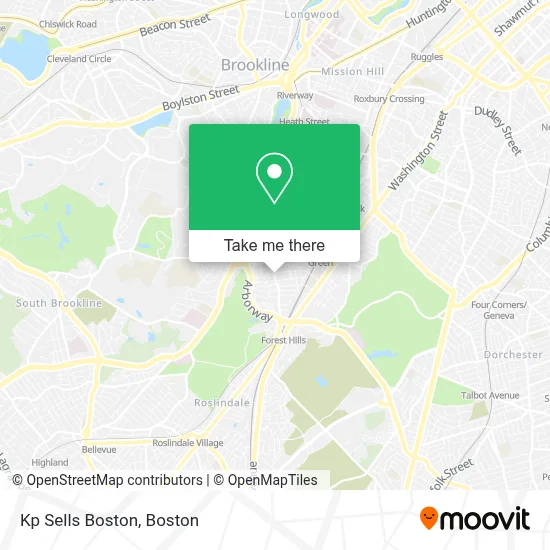
See Kp Sells Boston on the map
Public Transportation to Kp Sells Boston
Wondering how to get to Kp Sells Boston? Moovit helps you find the best way to get to Kp Sells Boston with step-by-step directions from the nearest public transit station.
Moovit provides free maps and live directions to help you navigate through your city. View schedules, routes, timetables, and find out how long does it take to get to Kp Sells Boston in real time.
Looking for the nearest stop or station to Kp Sells Boston? Check out this list of stops closest to your destination: Centre St @ Seaverns Ave; South St @ Jamaica St; Green Street; Washington St @ Burnett St; Heath Street; Forest Hills.
Bus: 38, 39, 35, 41, 42.Train: NEEDHAM, FRANKLIN/FOXBORO, PROVIDENCE/STOUGHTON.Subway: ORANGE LINE, GREEN LINE E.
Want to see if there’s another route that gets you there at an earlier time? Moovit helps you find alternative routes or times. Get directions from and directions to Kp Sells Boston easily from the Moovit App or Website.
We make riding to Kp Sells Boston easy, which is why over 1.7 million users, including users in Boston, trust Moovit as the best app for public transit. You don’t need to download an individual bus app or train app, Moovit is your all-in-one transit app that helps you find the best bus time or train time available.
For information on prices of bus, subway and train, costs and ride fares to Kp Sells Boston, please check the Moovit app.
Use the app to navigate to popular places including to the airport, hospital, stadium, grocery store, mall, coffee shop, school, college, and university.
Kp Sells Boston Address: 68 South St street in Boston
- Glenn's Gardening & Woodworking,
- Aviary,
- Curtis Hall Community Center ,
- Curtis Hall Pool,
- Curtis Community Hall,
- Zipcar,
- The Monument,
- Asap Lock & Key,
- Hyde Park Telecommunications,
- Santia's Bakery,
- J.P. Center,
- Ryan Painting,
- Brianna's Closet,
- Arborway,
- Arnold Arboretum-Arborway Gate,
- Zircteeth - Boston,
- Boston College Law School,
- Costello's Tavern (Costello's Bistro),
- Longyear Museum,
- The Arnold Arboretum of Harvard University
Places Near Kp Sells Boston
- Td Garden, Boston,
- Wang Theater, Boston,
- Museum Of Science, Boston,
- North End, Boston,
- Isabella Stewart Gardner Museum, Boston,
- Faneuil Hall, Boston,
- Boston Medical Center, Boston,
- Wilbur Theatre, Boston,
- Prudential Center, Boston,
- Cheers, Boston,
- Boston Common, Boston,
- Mgm Music Hall, Boston,
- House Of Blues, Boston,
- Massachusetts General Hospital, Boston,
- Quincy Market, Boston,
- Boston Children's Hospital, Boston,
- Boston Convention & Exhibition Center, Boston,
- Seaport District, Boston,
- Leader Bank Pavilion (Leader Bank Pavillion), Boston,
- Castle Island, Boston
How to get to popular places in Boston with public transit
Get around Boston by public transit!
Traveling around Boston has never been so easy. See step by step directions as you travel to any attraction, street or major public transit station. View bus and train schedules, arrival times, service alerts and detailed routes on a map, so you know exactly how to get to anywhere in Boston.
When traveling to any destination around Boston use Moovit's Live Directions with Get Off Notifications to know exactly where and how far to walk, how long to wait for your line, and how many stops are left. Moovit will alert you when it's time to get off — no need to constantly re-check whether yours is the next stop.
Wondering how to use public transit in Boston or how to pay for public transit in Boston? Moovit public transit app can help you navigate your way with public transit easily, and at minimum cost. It includes public transit fees, ticket prices, and costs. Looking for a map of Boston public transit lines? Moovit public transit app shows all public transit maps in Boston with all Bus, Train, Subway and Ferry routes and stops on an interactive map.
Boston has 4 transit type(s), including: Bus, Train, Subway and Ferry, operated by several transit agencies, including MBTA, Southeastern Regional Transit Authority, MetroWest Regional Transit Authority, Rhode Island Public Transit Authority, WRTA, Lowell Regional Transit Authority, Merrimack Valley Transit, Montachusett Regional Transit Authority, Cape Cod Regional Transit Authority, Brockton Area Transit Authority, Martha's Vineyard Transit Authority, the WAVE - Nantucket Regional Transit Authority, GATRA, Cape Ann Transportation Authority and Massport