How to get to Krw Pools by bus?
Click on the bus route to see step by step directions with maps, line arrival times and updated time schedules.
From Woburn, MA, Woburn
52 minFrom Target, Lowell
40 minFrom Middlesex Superior Court, Woburn
77 minFrom Burlington, Ma, Burlington
42 minFrom Burlington, MA, Burlington
33 minFrom MIT Lincoln Laboratory, Lexington
128 minFrom Lexington, MA, Lexington
126 minFrom 200 Trade Center, Woburn
77 minFrom Wilmington, MA, Wilmington
105 min
Bus stops near Krw Pools in Boston
What are the closest stations to Krw Pools?
The closest stations to Krw Pools are:
- Middlesex Tpk & Pearl Rd is 336 yards away, 5 min walk.
- Boston Rd & Webb Brook Rd is 1157 yards away, 14 min walk.
Which bus lines stop near Krw Pools?
These bus lines stop near Krw Pools: 13, 14.
What’s the nearest bus station to Krw Pools in Boston?
The nearest bus station to Krw Pools in Boston is Middlesex Tpk & Pearl Rd. It’s a 5 min walk away.
What time is the first bus to Krw Pools in Boston?
The 14 is the first bus that goes to Krw Pools in Boston. It stops nearby at 6:30 AM.
What time is the last bus to Krw Pools in Boston?
The 14 is the last bus that goes to Krw Pools in Boston. It stops nearby at 7:26 PM.
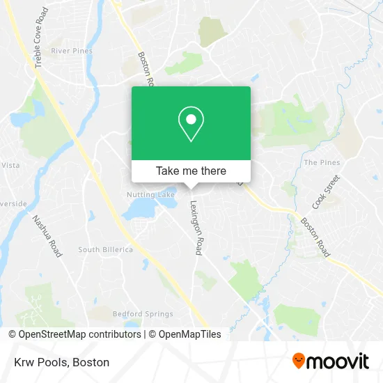
See Krw Pools, Boston, on the map
Public Transit to Krw Pools in Boston
Wondering how to get to Krw Pools in Boston? Moovit helps you find the best way to get to Krw Pools with step-by-step directions from the nearest public transit station.
Moovit provides free maps and live directions to help you navigate through your city. View schedules, routes, timetables, and find out how long does it take to get to Krw Pools in real time.
Looking for the nearest stop or station to Krw Pools? Check out this list of stops closest to your destination: Middlesex Tpk & Pearl Rd; Boston Rd & Webb Brook Rd.
Bus: 13, 14.
Want to see if there’s another route that gets you there at an earlier time? Moovit helps you find alternative routes or times. Get directions from and directions to Krw Pools easily from the Moovit App or Website.
We make riding to Krw Pools easy, which is why over 1.7 million users, including users in Boston, trust Moovit as the best app for public transit. You don’t need to download an individual bus app or train app, Moovit is your all-in-one transit app that helps you find the best bus time or train time available.
For information on prices of bus and train, costs and ride fares to Krw Pools, please check the Moovit app.
Use the app to navigate to popular places including to the airport, hospital, stadium, grocery store, mall, coffee shop, school, college, and university.
Krw Pools Address: 85 Lexington Rd street in Boston
- Rusty Roller,
- Sworby,
- Bowman Rd & School House Ln,
- Vining Elementary School,
- Coinhub,
- Heavenly Carpet Cleaning,
- Certified Movers,
- O'Keefe Field,
- Homovix,
- Dunkin',
- Masterpiece Media,
- Marlysse's Cleaning Services,
- Billerica Veterinary Hospital,
- United States Government,
- USPS Collection Box - Blue Box,
- Billerica Nutrition,
- Sandra Giroux, Billerica Town Clerk,
- Milco Construction,
- Jax Auto Sales Inc,
- Coinflip Bitcoin Atm - Augusta Liquors (Billerica)
Places Near Krw Pools (Boston)
- Boston Convention & Exhibition Center, Boston,
- Leader Bank Pavilion (Leader Bank Pavillion), Boston,
- Prudential Center, Boston,
- House Of Blues, Boston,
- Mgm Music Hall, Boston,
- Boston Children's Hospital, Boston,
- Boston Medical Center, Boston,
- Wang Theater, Boston,
- Faneuil Hall, Boston,
- Massachusetts General Hospital, Boston,
- Td Garden, Boston,
- Boston Common, Boston,
- Cheers, Boston,
- Museum Of Science, Boston,
- Quincy Market, Boston,
- North End, Boston,
- Isabella Stewart Gardner Museum, Boston,
- Wilbur Theatre, Boston,
- Castle Island, Boston,
- Seaport District, Boston
How to get to popular places in Boston with public transit
Get around Boston by public transit!
Traveling around Boston has never been so easy. See step by step directions as you travel to any attraction, street or major public transit station. View bus and train schedules, arrival times, service alerts and detailed routes on a map, so you know exactly how to get to anywhere in Boston.
When traveling to any destination around Boston use Moovit's Live Directions with Get Off Notifications to know exactly where and how far to walk, how long to wait for your line, and how many stops are left. Moovit will alert you when it's time to get off — no need to constantly re-check whether yours is the next stop.
Wondering how to use public transit in Boston or how to pay for public transit in Boston? Moovit public transit app can help you navigate your way with public transit easily, and at minimum cost. It includes public transit fees, ticket prices, and costs. Looking for a map of Boston public transit lines? Moovit public transit app shows all public transit maps in Boston with all Bus, Train, Subway and Ferry routes and stops on an interactive map.
Boston has 4 transit type(s), including: Bus, Train, Subway and Ferry, operated by several transit agencies, including MBTA, Southeastern Regional Transit Authority, MetroWest Regional Transit Authority, Rhode Island Public Transit Authority, WRTA, Lowell Regional Transit Authority, Merrimack Valley Transit, Montachusett Regional Transit Authority, Cape Cod Regional Transit Authority, Brockton Area Transit Authority, Martha's Vineyard Transit Authority, the WAVE - Nantucket Regional Transit Authority, GATRA, Cape Ann Transportation Authority and Massport