Directions to Kyle Shortell (Boston) with public transportation
The following transit lines have routes that pass near Kyle Shortell
 Bus: 39, 501, 504, 9, SL4.
- Train: FITCHBURG, FRAMINGHAM/WORCESTER, NEEDHAM, NEWBURYPORT/ROCKPORT, FOXBORO EVENT SERVICE.
- Subway: GREEN LINE B, GREEN LINE C, GREEN LINE D, ORANGE LINE, GREEN LINE E.
How to get to Kyle Shortell by bus?
Click on the bus route to see step by step directions with maps, line arrival times and updated time schedules.
From Milton Academy, Milton
102 minFrom Newton, MA, Newton
50 minFrom West Roxbury, Boston
63 minFrom Conte Forum, Boston
57 minFrom Ramada by Wyndham Boston, Boston
65 minFrom Brighton District Court, Boston
40 minFrom Arlington, MA, Arlington
95 minFrom VFW Parkway, Boston
59 minFrom Hampton Inn Boston Logan Airport Chelsea, Chelsea
61 minFrom Sommerville Theatre, Somerville
71 min
How to get to Kyle Shortell by train?
Click on the train route to see step by step directions with maps, line arrival times and updated time schedules.
How to get to Kyle Shortell by subway?
Click on the subway route to see step by step directions with maps, line arrival times and updated time schedules.
Subway station near Kyle Shortell in Boston
- Arlington, 2 min walk,VIEW
Bus stops near Kyle Shortell in Boston
- Boylston St @ Berkeley St, 2 min walk,VIEW
- Arlington, 2 min walk,VIEW
- Saint James Ave @ Arlington St, 4 min walk,VIEW
- Boylston St @ Clarendon St, 5 min walk,VIEW
- Boston, MA - Copley Square (Corner Of Clarendon St. & St. James Ave. In Front Of Trinity Church), 6 min walk,VIEW
- Tremont St @ Marginal St, 7 min walk,VIEW
- Copley - Saint James Ave @ Trinity Pl, 7 min walk,VIEW
- Stuart St @ Dartmouth St, 11 min walk,VIEW
Train station near Kyle Shortell in Boston
- Back Bay - South End, 8 min walk,VIEW
Bus lines to Kyle Shortell in Boston
- 9, Kenmore Via Boston Latin,VIEW
- 10, Arlington Via South Bay Center,VIEW
- 39, Haymarket Via Forest Hills,VIEW
- 55, West Fenway,VIEW
- 57, Haymarket Via Kenmore,VIEW
- GREEN LINE E SHUTTLE, Heath Street - Park Street,VIEW
- GREEN LINE SHUTTLE, Boston University East - Park Street,VIEW
- 501, Brighton Via Copley (Express),VIEW
- 504, Watertown Via Copley And Newton Corner (Express),VIEW
- GREEN LINE D SHUTTLE, Riverside (Shuttle),VIEW
- ORANGE LINE SHUTTLE, Back Bay Via Copley (Shuttle),VIEW
- ACTON/CONCORD COMMUTER, Acton,VIEW
- 43, Ruggles,VIEW
- GREEN LINE B SHUTTLE, Copley (Shuttle),VIEW
- BB, Back Bay,VIEW
What are the closest stations to Kyle Shortell?
The closest stations to Kyle Shortell are:
- Arlington is 71 yards away, 2 min walk.
- Boylston St @ Berkeley St is 113 yards away, 2 min walk.
- Saint James Ave @ Arlington St is 238 yards away, 4 min walk.
- Boylston St @ Clarendon St is 336 yards away, 5 min walk.
- Boston, MA - Copley Square (Corner Of Clarendon St. & St. James Ave. In Front Of Trinity Church) is 441 yards away, 6 min walk.
- Tremont St @ Marginal St is 501 yards away, 7 min walk.
- Copley - Saint James Ave @ Trinity Pl is 506 yards away, 7 min walk.
- Back Bay - South End is 646 yards away, 8 min walk.
- Stuart St @ Dartmouth St is 888 yards away, 11 min walk.
Which bus lines stop near Kyle Shortell?
These bus lines stop near Kyle Shortell: 39, 501, 504, 9, SL4.
Which train lines stop near Kyle Shortell?
These train lines stop near Kyle Shortell: FITCHBURG, FRAMINGHAM/WORCESTER, NEEDHAM, NEWBURYPORT/ROCKPORT.
Which subway lines stop near Kyle Shortell?
These subway lines stop near Kyle Shortell: GREEN LINE B, GREEN LINE C, GREEN LINE D, ORANGE LINE.
What’s the nearest subway station to Kyle Shortell in Boston?
The nearest subway station to Kyle Shortell in Boston is Arlington. It’s a 2 min walk away.
What’s the nearest train station to Kyle Shortell in Boston?
The nearest train station to Kyle Shortell in Boston is Back Bay - South End. It’s a 8 min walk away.
What’s the nearest bus station to Kyle Shortell in Boston?
The nearest bus stations to Kyle Shortell in Boston are Boylston St @ Berkeley St and Arlington. The closest one is a 2 min walk away.
What time is the first subway to Kyle Shortell in Boston?
The GREEN LINE D is the first subway that goes to Kyle Shortell in Boston. It stops nearby at 5:05 AM.
What time is the last subway to Kyle Shortell in Boston?
The GREEN LINE E is the last subway that goes to Kyle Shortell in Boston. It stops nearby at 2:16 AM.
What time is the first train to Kyle Shortell in Boston?
The PROVIDENCE/STOUGHTON is the first train that goes to Kyle Shortell in Boston. It stops nearby at 4:25 AM.
What time is the last train to Kyle Shortell in Boston?
The LAKE SHORE LIMITED is the last train that goes to Kyle Shortell in Boston. It stops nearby at 8:26 PM.
What time is the first bus to Kyle Shortell in Boston?
The 57 is the first bus that goes to Kyle Shortell in Boston. It stops nearby at 4:54 AM.
What time is the last bus to Kyle Shortell in Boston?
The 10 is the last bus that goes to Kyle Shortell in Boston. It stops nearby at 1:19 AM.
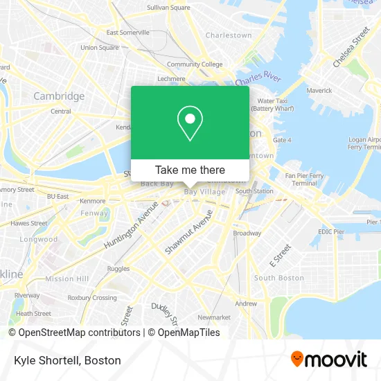
See Kyle Shortell, Boston, on the map
Public Transit to Kyle Shortell in Boston
Wondering how to get to Kyle Shortell in Boston? Moovit helps you find the best way to get to Kyle Shortell with step-by-step directions from the nearest public transit station.
Moovit provides free maps and live directions to help you navigate through your city. View schedules, routes, timetables, and find out how long does it take to get to Kyle Shortell in real time.
Looking for the nearest stop or station to Kyle Shortell? Check out this list of stops closest to your destination: Arlington; Boylston St @ Berkeley St; Saint James Ave @ Arlington St; Boylston St @ Clarendon St; Boston, MA - Copley Square (Corner Of Clarendon St. & St. James Ave. In Front Of Trinity Church); Tremont St @ Marginal St; Copley - Saint James Ave @ Trinity Pl; Back Bay - South End; Stuart St @ Dartmouth St.
Bus: 39, 501, 504, 9, SL4, 10, 55, 57, GREEN LINE E SHUTTLE, GREEN LINE SHUTTLE, GREEN LINE D SHUTTLE, ORANGE LINE SHUTTLE.Train: FITCHBURG, FRAMINGHAM/WORCESTER, NEEDHAM, NEWBURYPORT/ROCKPORT, FOXBORO EVENT SERVICE, FRANKLIN/FOXBORO, ORANGE LINE.Subway: GREEN LINE B, GREEN LINE C, GREEN LINE D, ORANGE LINE, GREEN LINE E.
Want to see if there’s another route that gets you there at an earlier time? Moovit helps you find alternative routes or times. Get directions from and directions to Kyle Shortell easily from the Moovit App or Website.
We make riding to Kyle Shortell easy, which is why over 1.7 million users, including users in Boston, trust Moovit as the best app for public transit. You don’t need to download an individual bus app or train app, Moovit is your all-in-one transit app that helps you find the best bus time or train time available.
For information on prices of bus, subway and train, costs and ride fares to Kyle Shortell, please check the Moovit app.
Use the app to navigate to popular places including to the airport, hospital, stadium, grocery store, mall, coffee shop, school, college, and university.
Kyle Shortell Address: 155 Columbus Ave 7th Fl street in Boston
- Liberty Mutual,
- Liberty Mutual Insurance,
- Comparion Insurance Agency,
- Grill 23 & Bar,
- MBTA | Worcester-Boston Commuter Rail,
- Slate Casting,
- Basile,
- Precinct Kitchen + Bar,
- Citrus & Salt,
- Backbay Hotel (The Back Bay Hotel),
- Hotel Aka Back Bay ,
- Park Plaza Castle,
- Liberty Mutual Insurance Company,
- Medeiros Homeless Shelter (Cardinal Medeiros Center for the Homeless),
- Castle at Park Plaza (Salvation Army Christmas Castle),
- Downton Abbey: the Exhibition,
- Metropolitan Health Club,
- Tower,
- Dorothy Quincy Suite,
- 75 Arlington St / 10 St. James Atrium
Places Near Kyle Shortell (Boston)
- Prudential Center, Boston,
- Wilbur Theatre, Boston,
- Mgm Music Hall, Boston,
- North End, Boston,
- Td Garden, Boston,
- Boston Children's Hospital, Boston,
- Seaport District, Boston,
- Cheers, Boston,
- Castle Island, Boston,
- Boston Convention & Exhibition Center, Boston,
- Massachusetts General Hospital, Boston,
- House Of Blues, Boston,
- Isabella Stewart Gardner Museum, Boston,
- Boston Common, Boston,
- Wang Theater, Boston,
- Boston Medical Center, Boston,
- Leader Bank Pavilion (Leader Bank Pavillion), Boston,
- Faneuil Hall, Boston,
- Museum Of Science, Boston,
- Quincy Market, Boston
How to get to popular places in Boston with public transit
Get around Boston by public transit!
Traveling around Boston has never been so easy. See step by step directions as you travel to any attraction, street or major public transit station. View bus and train schedules, arrival times, service alerts and detailed routes on a map, so you know exactly how to get to anywhere in Boston.
When traveling to any destination around Boston use Moovit's Live Directions with Get Off Notifications to know exactly where and how far to walk, how long to wait for your line, and how many stops are left. Moovit will alert you when it's time to get off — no need to constantly re-check whether yours is the next stop.
Wondering how to use public transit in Boston or how to pay for public transit in Boston? Moovit public transit app can help you navigate your way with public transit easily, and at minimum cost. It includes public transit fees, ticket prices, and costs. Looking for a map of Boston public transit lines? Moovit public transit app shows all public transit maps in Boston with all Bus, Train, Subway and Ferry routes and stops on an interactive map.
Boston has 4 transit type(s), including: Bus, Train, Subway and Ferry, operated by several transit agencies, including MBTA, Southeastern Regional Transit Authority, MetroWest Regional Transit Authority, Rhode Island Public Transit Authority, WRTA, Lowell Regional Transit Authority, Merrimack Valley Transit, Montachusett Regional Transit Authority, Cape Cod Regional Transit Authority, Brockton Area Transit Authority, Martha's Vineyard Transit Authority, the WAVE - Nantucket Regional Transit Authority, GATRA, Cape Ann Transportation Authority and Massport