How to get to L+ by bus?
Click on the bus route to see step by step directions with maps, line arrival times and updated time schedules.
From IFS Golden Center T1 Office Building, Tianxin District
34 minFrom Yuelu Mountain Juzizhou Tourist Area - Observation Deck, Yuelu District
53 minFrom Heneng Fendan New Community - Southwest Gate, Changsha County
36 minFrom Shumuling, Yuhua District
42 minFrom Hunan International Exhibition Center, Furong District
35 minFrom Hunan Province Changsha Yuelu District Juzizhou Street, Yuelu District
50 minFrom Changsha Yucheng Chaoyang Hotel, Furong District
34 minFrom Changsha Meixi Lake Jinmao Luxury Collection Hotel, Yuelu District
52 minFrom Jingtai Plaza Security Market, Furong District
31 minFrom Hunan University of Traditional Chinese Medicine (Dongtang Campus), Yuhua District
45 min
How to get to L+ by metro?
Click on the metro route to see step by step directions with maps, line arrival times and updated time schedules.
From IFS Golden Center T1 Office Building, Tianxin District
26 minFrom Yuelu Mountain Juzizhou Tourist Area - Observation Deck, Yuelu District
43 minFrom Shumuling, Yuhua District
59 minFrom Hunan International Exhibition Center, Furong District
47 minFrom Hunan Province Changsha Yuelu District Juzizhou Street, Yuelu District
36 minFrom Changsha Yucheng Chaoyang Hotel, Furong District
42 minFrom Changsha Meixi Lake Jinmao Luxury Collection Hotel, Yuelu District
51 minFrom Jingtai Plaza Security Market, Furong District
36 minFrom Hunan University of Traditional Chinese Medicine (Dongtang Campus), Yuhua District
49 min
Bus stops near L+ in Kaifu District
Bus lines to L+ in Kaifu District
- Route 112, Xiangjiang Century City,VIEW
- Temp Route 149, West Auto Station,VIEW
- Route 801, Carnival Bus Depot,VIEW
- Route 208, Changsha South Railway,VIEW
- Route 807, Bayi Bridge,VIEW
- Temp Route 159, Huxiang Art Market,VIEW
- Route 128, Zhongshan Pavilion,VIEW
- Route 116, Xiufeng Park,VIEW
- Temporary Route 131, West Fuyuan Road Bridge,VIEW
- Xingsha Route 2, Jiangling Tianxia Complex,VIEW
- Route 812, Wantian International,VIEW
- Route 931, East 2nd Ring Shuangyong Intersection,VIEW
- Route W105, Linke Foreign Studies College,VIEW
- Route W111, Window of the World,VIEW
What are the closest stations to L+?
The closest stations to L+ are:
- Fucheng Intersection is 209 meters away, 3 min walk.
- Machang is 260 meters away, 4 min walk.
- Fishery Branch is 482 meters away, 7 min walk.
- Huazhang Road & Jinma Road Intersection is 632 meters away, 9 min walk.
- Beichen Delta is 711 meters away, 10 min walk.
- Kaifu District Government is 794 meters away, 11 min walk.
- Sifangping is 1379 meters away, 18 min walk.
Which bus lines stop near L+?
These bus lines stop near L+: Route 112, Route 128, Route 208, Route 801, Route 807, Temp Route 149, Temp Route 159.
Which metro line stops near L+?
Line 1 (Kaifu District Government)
What’s the nearest metro station to L+ in Kaifu District?
The nearest metro station to L+ in Kaifu District is Beichen Delta. It’s a 10 min walk away.
What’s the nearest bus station to L+ in Kaifu District?
The nearest bus station to L+ in Kaifu District is Fucheng Intersection. It’s a 3 min walk away.
What time is the first metro to L+ in Kaifu District?
The Line 1 is the first metro that goes to L+ in Kaifu District. It stops nearby at 6:30 AM.
What time is the last metro to L+ in Kaifu District?
The Line 1 is the last metro that goes to L+ in Kaifu District. It stops nearby at 11:42 PM.
What time is the first bus to L+ in Kaifu District?
The Xingsha Route 2 is the first bus that goes to L+ in Kaifu District. It stops nearby at 5:52 AM.
What time is the last bus to L+ in Kaifu District?
The Route 112 is the last bus that goes to L+ in Kaifu District. It stops nearby at 10:40 PM.
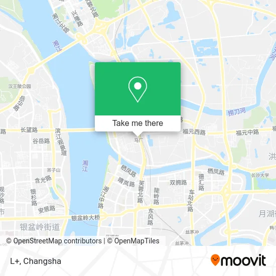
See L+, Kaifu District, on the map
Public Transit to L+ in Kaifu District
Wondering how to get to L+ in Kaifu District? Moovit helps you find the best way to get to L+ with step-by-step directions from the nearest public transit station.
Moovit provides free maps and live directions to help you navigate through your city. View schedules, routes, timetables, and find out how long does it take to get to L+ in real time.
Looking for the nearest stop or station to L+? Check out this list of stops closest to your destination: Fucheng Intersection; Machang; Fishery Branch; Huazhang Road & Jinma Road Intersection; Beichen Delta; Kaifu District Government; Sifangping.
Bus: Route 112, Route 128, Route 208, Route 801, Route 807, Temp Route 149, Temp Route 159, Route 112, Temp Route 149, Route 801, Route 208, Route 807, Temp Route 159, Route 128.Metro: Line 1, Line 1, Line 3.
Want to see if there’s another route that gets you there at an earlier time? Moovit helps you find alternative routes or times. Get directions from and directions to L+ easily from the Moovit App or Website.
We make riding to L+ easy, which is why over 1.5 million users, including users in Kaifu District, trust Moovit as the best app for public transit. You don’t need to download an individual bus app or train app, Moovit is your all-in-one transit app that helps you find the best bus time or train time available.
For information on prices of bus and metro, costs and ride fares to L+, please check the Moovit app.
Use the app to navigate to popular places including to the airport, hospital, stadium, grocery store, mall, coffee shop, school, college, and university.
L+ Address: 湖南省长沙市开福区芙蓉北路辅路 street in Kaifu District
- Seven Wolf,
- Railway Ticket Sales Office,
- Furong North Road / Fuyuan West Road (Intersection),
- Community Bus Line 9 (Machang Metro Station - Happy Koala 789),
- Hengyu Foreign Trade Brand Discount (Lanbeibay Store),
- Longwenstein (Beiguo Fenguang Community Store),
- Furong North Road Street Xincheng Community Residents Committee,
- Bebe Kang Pet Hospital (Xiangjiang Century City Branch),
- Binlin Oral Clinic,
- Binjiang Elegant Apartment - Building 9,
- Industrial and Commercial Bank of China (Changsha Lannan Bay Branch),
- China Construction Bank 24-Hour Self-Service Bank (Lan North Bay Branch),
- Lannan Bay Conference Hall,
- China Taiping Insurance,
- Shuntian North Country Scenery,
- Hengxin Lan North Bay,
- Machang Metro Station - Exit 1,
- China Construction Bank ATM (Shengshi Road),
- Snack Fruit Market,
- Changsha Real Estate
Places Near L+ (Kaifu District)
- Hunan Province Tumor Hospital, Yuelu District,
- Zhongnan University Xiangya Hospital, Kaifu District,
- Central South University Xiangya Second Hospital, Furong District,
- Du Fu River Pavilion, Tianxin District,
- Xingsha Police Station Songya Community Police Room, Changsha County,
- Changsha Bank ATM (Sifang Branch), Kaifu District,
- Hunan University of Traditional Chinese Medicine First Affiliated Hospital, Yuhua District,
- First Affiliated Hospital of Hunan University of Traditional Chinese Medicine - Outpatient Department, Yuhua District,
- Changsha South Station, Yuhua District,
- Hunan Provincial Maternal and Child Health Hospital - Outpatient Department, Kaifu District,
- Changsha South Station Square, Yuelu District,
- Wanjiali International Mall, Furong District,
- First Club, Kaifu District,
- National University of Defense Technology (North Gate), Kaifu District,
- Desiqin City Square, Yuhua District,
- Apple Authorized Dealer (Sam Changsha Store), Yuhua District,
- Changsha Yangming Mountain Funeral Home, Yuhua District,
- Changsha Bank (Sifang Branch), Kaifu District,
- Yuelu Mountain Juzizhou Tourist Area, Yuelu District,
- Hunan Provincial Museum - Multipurpose Hall, Kaifu District
How to get to popular places in Changsha with public transit
Get around Kaifu District by public transit!
Traveling around Kaifu District has never been so easy. See step by step directions as you travel to any attraction, street or major public transit station. View bus and train schedules, arrival times, service alerts and detailed routes on a map, so you know exactly how to get to anywhere in Kaifu District.
When traveling to any destination around Kaifu District use Moovit's Live Directions with Get Off Notifications to know exactly where and how far to walk, how long to wait for your line, and how many stops are left. Moovit will alert you when it's time to get off — no need to constantly re-check whether yours is the next stop.
Wondering how to use public transit in Kaifu District or how to pay for public transit in Kaifu District? Moovit public transit app can help you navigate your way with public transit easily, and at minimum cost. It includes public transit fees, ticket prices, and costs. Looking for a map of Kaifu District public transit lines? Moovit public transit app shows all public transit maps in Kaifu District with all Bus and Metro routes and stops on an interactive map.
Changsha has 2 transit type(s), including: Bus and Metro, operated by several transit agencies, including Changsha Metro and Changsha Bus Group