Directions to L2p - Les 2 Philanthropes (Dedham) with public transportation
The following transit lines have routes that pass near L2p - Les 2 Philanthropes
 Bus: 34E, 35, 34.
- Train: FRANKLIN/FOXBORO, PROVIDENCE/STOUGHTON, FOXBORO EVENT SERVICE.
How to get to L2p - Les 2 Philanthropes by bus?
Click on the bus route to see step by step directions with maps, line arrival times and updated time schedules.
From New England Baptist Hospital, Boston
66 minFrom Brigham and Women's Faulkner Hospital, Boston
48 minFrom 1 Brookline Place, Brookline
60 minFrom Hilton Garden Inn, Brookline
59 minFrom Heartbreak Hill, Newton
60 minFrom Brookline High School (Brookline Town High School), Brookline
77 minFrom Hilton Garden Inn Boston Brookline, Brookline
59 minFrom VA Medical Center, Boston (Jamaica Plain), Boston
55 minFrom Faulkner Hospital, Boston
48 min
How to get to L2p - Les 2 Philanthropes by train?
Click on the train route to see step by step directions with maps, line arrival times and updated time schedules.
Bus stops near L2p - Les 2 Philanthropes in Dedham
Train stations near L2p - Les 2 Philanthropes in Dedham
Bus lines to L2p - Les 2 Philanthropes in Dedham
What are the closest stations to L2p - Les 2 Philanthropes?
The closest stations to L2p - Les 2 Philanthropes are:
- Washington St @ High St is 21 yards away, 1 min walk.
- 272 Washington St is 390 yards away, 5 min walk.
- 38 Washington St Opp Sumner St is 444 yards away, 6 min walk.
- Dedham Mall @ South Side is 809 yards away, 10 min walk.
- Endicott is 960 yards away, 12 min walk.
- Dedham Corporate Center is 2227 yards away, 26 min walk.
- Readville is 2468 yards away, 30 min walk.
Which bus lines stop near L2p - Les 2 Philanthropes?
These bus lines stop near L2p - Les 2 Philanthropes: 34E, 35.
Which train lines stop near L2p - Les 2 Philanthropes?
These train lines stop near L2p - Les 2 Philanthropes: FRANKLIN/FOXBORO, PROVIDENCE/STOUGHTON.
What’s the nearest train station to L2p - Les 2 Philanthropes in Dedham?
The nearest train station to L2p - Les 2 Philanthropes in Dedham is Endicott. It’s a 12 min walk away.
What’s the nearest bus station to L2p - Les 2 Philanthropes in Dedham?
The nearest bus station to L2p - Les 2 Philanthropes in Dedham is Washington St @ High St. It’s a 1 min walk away.
What time is the first train to L2p - Les 2 Philanthropes in Dedham?
The PROVIDENCE/STOUGHTON is the first train that goes to L2p - Les 2 Philanthropes in Dedham. It stops nearby at 5:05 AM.
What time is the last train to L2p - Les 2 Philanthropes in Dedham?
The PROVIDENCE/STOUGHTON is the last train that goes to L2p - Les 2 Philanthropes in Dedham. It stops nearby at 12:20 AM.
What time is the first bus to L2p - Les 2 Philanthropes in Dedham?
The 34 is the first bus that goes to L2p - Les 2 Philanthropes in Dedham. It stops nearby at 4:43 AM.
What time is the last bus to L2p - Les 2 Philanthropes in Dedham?
The 34 is the last bus that goes to L2p - Les 2 Philanthropes in Dedham. It stops nearby at 1:32 AM.
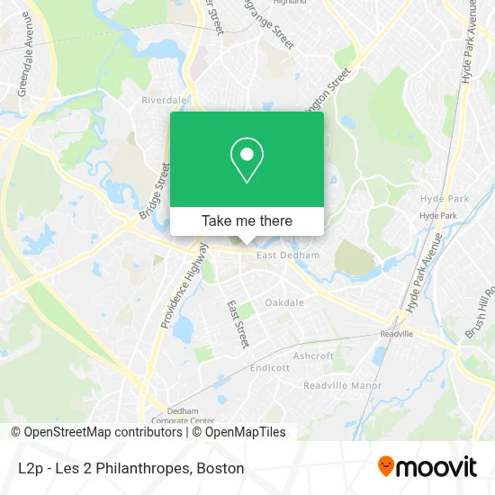
See L2p - Les 2 Philanthropes, Dedham, on the map
Public Transit to L2p - Les 2 Philanthropes in Dedham
Wondering how to get to L2p - Les 2 Philanthropes in Dedham? Moovit helps you find the best way to get to L2p - Les 2 Philanthropes with step-by-step directions from the nearest public transit station.
Moovit provides free maps and live directions to help you navigate through your city. View schedules, routes, timetables, and find out how long does it take to get to L2p - Les 2 Philanthropes in real time.
Looking for the nearest stop or station to L2p - Les 2 Philanthropes? Check out this list of stops closest to your destination: Washington St @ High St; 272 Washington St; 38 Washington St Opp Sumner St; Dedham Mall @ South Side; Endicott; Dedham Corporate Center; Readville.
Bus: 34E, 35, 34.Train: FRANKLIN/FOXBORO, PROVIDENCE/STOUGHTON, FOXBORO EVENT SERVICE.
Want to see if there’s another route that gets you there at an earlier time? Moovit helps you find alternative routes or times. Get directions from and directions to L2p - Les 2 Philanthropes easily from the Moovit App or Website.
We make riding to L2p - Les 2 Philanthropes easy, which is why over 1.7 million users, including users in Dedham, trust Moovit as the best app for public transit. You don’t need to download an individual bus app or train app, Moovit is your all-in-one transit app that helps you find the best bus time or train time available.
For information on prices of bus, train and subway, costs and ride fares to L2p - Les 2 Philanthropes, please check the Moovit app.
Use the app to navigate to popular places including to the airport, hospital, stadium, grocery store, mall, coffee shop, school, college, and university.
L2p - Les 2 Philanthropes Address: ���� Agenda Les 2 Philanthropes 2026-2027 - Précommande AMAZON et FNAC ���� street in Dedham
- 12 Mt Vernon St,
- Juju's Pool- Dedham,
- Dedham High School Track,
- Italian American Citizens Club - San Giovanni Battista,
- Crown Contracting,
- Sampson Landscaping Service,
- B.A. Perazim,
- Euro Glam,
- A To Z Custom Home S,
- P & S Complete Cleaning Service,
- Dedham Middle School ,
- Dedham Town Locksmith Solutions,
- Amazon Locker-Virginia,
- New England Insurance Group,
- All Stars Barber Shop,
- 24 Hour Emergency Locksmith A,
- Day 2 Day Auto,
- Emami Robert, DMD,
- Bundts and Tea,
- Pevomat
Places Near L2p - Les 2 Philanthropes (Dedham)
- House Of Blues, Boston,
- Boston Children's Hospital, Boston,
- Leader Bank Pavilion (Leader Bank Pavillion), Boston,
- Prudential Center, Boston,
- North End, Boston,
- Boston Common, Boston,
- Quincy Market, Boston,
- Faneuil Hall, Boston,
- Isabella Stewart Gardner Museum, Boston,
- Wang Theater, Boston,
- Mgm Music Hall, Boston,
- Wilbur Theatre, Boston,
- Cheers, Boston,
- Castle Island, Boston,
- Museum Of Science, Boston,
- Boston Medical Center, Boston,
- Seaport District, Boston,
- Boston Convention & Exhibition Center, Boston,
- Massachusetts General Hospital, Boston,
- Td Garden, Boston
How to get to popular places in Boston with public transit
Get around Dedham by public transit!
Traveling around Dedham has never been so easy. See step by step directions as you travel to any attraction, street or major public transit station. View bus and train schedules, arrival times, service alerts and detailed routes on a map, so you know exactly how to get to anywhere in Dedham.
When traveling to any destination around Dedham use Moovit's Live Directions with Get Off Notifications to know exactly where and how far to walk, how long to wait for your line, and how many stops are left. Moovit will alert you when it's time to get off — no need to constantly re-check whether yours is the next stop.
Wondering how to use public transit in Dedham or how to pay for public transit in Dedham? Moovit public transit app can help you navigate your way with public transit easily, and at minimum cost. It includes public transit fees, ticket prices, and costs. Looking for a map of Dedham public transit lines? Moovit public transit app shows all public transit maps in Dedham with all Bus, Train, Subway and Ferry routes and stops on an interactive map.
Boston has 4 transit type(s), including: Bus, Train, Subway and Ferry, operated by several transit agencies, including MBTA, Southeastern Regional Transit Authority, MetroWest Regional Transit Authority, Rhode Island Public Transit Authority, WRTA, Lowell Regional Transit Authority, Merrimack Valley Transit, Montachusett Regional Transit Authority, Cape Cod Regional Transit Authority, Brockton Area Transit Authority, Martha's Vineyard Transit Authority, the WAVE - Nantucket Regional Transit Authority, GATRA, Cape Ann Transportation Authority and Massport