Directions to L & A Clean Machine (St. Paul) with public transportation
The following transit lines have routes that pass near L & A Clean Machine
 Bus: 3, 63, 67, 68, 74.
- Train: BOREALIS, EMPIRE BUILDER.
- Light Rail: METRO GREEN LINE.
How to get to L & A Clean Machine by bus?
Click on the bus route to see step by step directions with maps, line arrival times and updated time schedules.
From Restaurant Depot, St. Paul
34 minFrom 3M Center, Maplewood
33 minFrom 46 street parking lot, Minneapolis
37 minFrom TDF Transportation, South St. Paul
37 minFrom Holiday Stationstores, Minneapolis
36 minFrom 2700 Snelling Ave Parking, Roseville
54 minFrom Prospect Park, Minneapolis
45 minFrom MN Lottery at the MN State Fair, Falcon Heights
33 minFrom University of Minnesota Transitway, Minneapolis
45 min
Bus stops near L & A Clean Machine in St. Paul
Light Rail stations near L & A Clean Machine in St. Paul
- Central Station, 34 min walk,VIEW
Train station near L & A Clean Machine in St. Paul
- St. Paul-Minneapolis, 40 min walk,VIEW
Bus lines to L & A Clean Machine in St. Paul
- 3, Dwtn Mpls / North Loop / Via Maryland,VIEW
- 62, Smith Av / Signal Hills / Thompson,VIEW
- 67, Minnehaha / Franklin Station,VIEW
- 75, Dtwn St Paul / Wabasha / Via Stryker,VIEW
- 480, Apple Valley/Burnsville-St Paul,VIEW
- 489, St Paul-Eagan Rev Comm,VIEW
- 275, Express / Co Rd E P&R / Co Rd 14 P&R,VIEW
- 294, Express / St Crx P&R / Stillwater,VIEW
- 363, Express / St Paul / Minneapolis,VIEW
- 860, Express / Northtown / Dtwn St Paul,VIEW
- METRO B LINE, Selby-Lake / Downtown St Paul,VIEW
- METRO GOLD LINE, Gold Woodbury,VIEW
- 54, Ltd Stop / Mplwd Mall / Via Airport,VIEW
- 61, Henn-Larp / Dwtn Mpls / Via Arcade,VIEW
- 63, Grand-E 3st / Westgate Sta,VIEW
- 64, Payne Av / Hillcrest / Wh Bear Av,VIEW
- 72, Selby-Burns / University & Hamline,VIEW
- 74, E 7th St / Sunray,VIEW
- 94, Express / I-94 / Downtown St Paul,VIEW
- 484, Rosemount Transit Station,VIEW
What are the closest stations to L & A Clean Machine?
The closest stations to L & A Clean Machine are:
- Cedar St & 5th St is 194 yards away, 3 min walk.
- 6 St at Wabasha St is 214 yards away, 3 min walk.
- 6th St & Wabasha St is 218 yards away, 3 min walk.
- Rice Park Station is 279 yards away, 4 min walk.
- 5 St at Wabasha St/Cedar St S Corner is 387 yards away, 5 min walk.
- Minnesota St & 4th St is 409 yards away, 5 min walk.
- Central Station is 2850 yards away, 34 min walk.
- St. Paul-Minneapolis is 3360 yards away, 40 min walk.
Which bus lines stop near L & A Clean Machine?
These bus lines stop near L & A Clean Machine: 3, 63, 67, 68, 74, 94, METRO B LINE, METRO GOLD LINE.
Which light rail line stops near L & A Clean Machine?
METRO GREEN LINE (St. Paul-Union Depot)
What’s the nearest bus station to L & A Clean Machine in St. Paul?
The nearest bus stations to L & A Clean Machine in St. Paul are Cedar St & 5th St, 6 St at Wabasha St and 6th St & Wabasha St. The closest one is a 3 min walk away.
What time is the first light rail to L & A Clean Machine in St. Paul?
The METRO GREEN LINE is the first light rail that goes to L & A Clean Machine in St. Paul. It stops nearby at 4:26 AM.
What time is the last light rail to L & A Clean Machine in St. Paul?
The METRO GREEN LINE is the last light rail that goes to L & A Clean Machine in St. Paul. It stops nearby at 12:10 AM.
What time is the first train to L & A Clean Machine in St. Paul?
The BOREALIS is the first train that goes to L & A Clean Machine in St. Paul. It stops nearby at 11:39 AM.
What time is the last train to L & A Clean Machine in St. Paul?
The EMPIRE BUILDER is the last train that goes to L & A Clean Machine in St. Paul. It stops nearby at 8:50 AM.
What time is the first bus to L & A Clean Machine in St. Paul?
The 54 is the first bus that goes to L & A Clean Machine in St. Paul. It stops nearby at 3:06 AM.
What time is the last bus to L & A Clean Machine in St. Paul?
The 3 is the last bus that goes to L & A Clean Machine in St. Paul. It stops nearby at 2:15 AM.
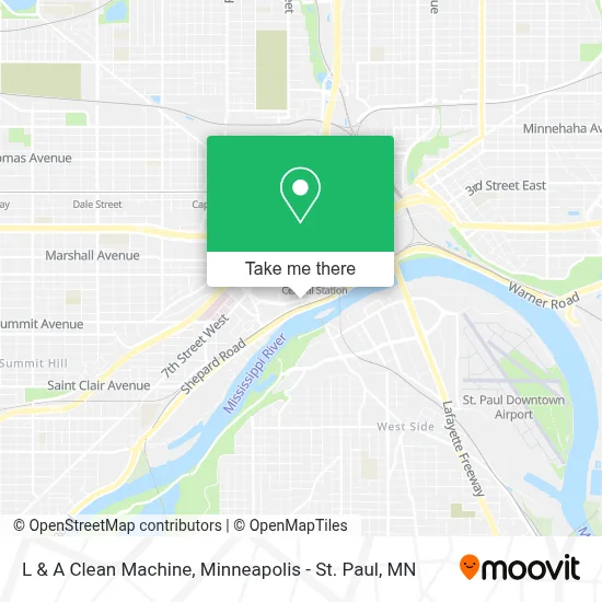
See L & A Clean Machine, St. Paul, on the map
Public Transit to L & A Clean Machine in St. Paul
Wondering how to get to L & A Clean Machine in St. Paul? Moovit helps you find the best way to get to L & A Clean Machine with step-by-step directions from the nearest public transit station.
Moovit provides free maps and live directions to help you navigate through your city. View schedules, routes, timetables, and find out how long does it take to get to L & A Clean Machine in real time.
Looking for the nearest stop or station to L & A Clean Machine? Check out this list of stops closest to your destination: Cedar St & 5th St; 6 St at Wabasha St; 6th St & Wabasha St; Rice Park Station; 5 St at Wabasha St/Cedar St S Corner; Minnesota St & 4th St; Central Station; St. Paul-Minneapolis.
Bus: 3, 63, 67, 68, 74, 94, METRO B LINE, METRO GOLD LINE, 62, 75, 480, 489, 275, 294, 363, 860, 54, 61, 484.Train: BOREALIS, EMPIRE BUILDER.Light Rail: METRO GREEN LINE.
Want to see if there’s another route that gets you there at an earlier time? Moovit helps you find alternative routes or times. Get directions from and directions to L & A Clean Machine easily from the Moovit App or Website.
We make riding to L & A Clean Machine easy, which is why over 1.7 million users, including users in St. Paul, trust Moovit as the best app for public transit. You don’t need to download an individual bus app or train app, Moovit is your all-in-one transit app that helps you find the best bus time or train time available.
For information on prices of bus and light rail, costs and ride fares to L & A Clean Machine, please check the Moovit app.
Use the app to navigate to popular places including to the airport, hospital, stadium, grocery store, mall, coffee shop, school, college, and university.
L & A Clean Machine Address: 767 Ohio St street in St. Paul
- Saint Paul Women's City Club,
- Department of Safety and Inspections Dsi,
- 2nd Judicial District Courts - St Paul MN,
- City Attorney,
- East Metro Community Health Network,
- Department Records & Revenue,
- County of Ramsey,
- Saint Paul City Hall And Courthouse,
- Allen Short - Morgan Stanley,
- Bruce J Nerland - Morgan Stanley,
- Rocky Wold - Morgan Stanley,
- Ditech Financial,
- Office Tech & Info Systems MGT,
- InterContinental St Paul Riverfront,
- Ecolab,
- Duggins Law Firm,
- St Paul Opticians,
- Lowry Lofts,
- Ballenthin Funk & Johnson,
- Saint Paul- City Police Department
Places Near L & A Clean Machine (St. Paul)
- Minnesota State Capitol, St. Paul,
- Grand Casino Hinckley,MN, Minneapolis,
- Target Center, Minneapolis,
- Abbott Northwestern Piper Building, Minneapolis,
- Mystic lake casino bus, Minneapolis,
- Mpls. Convention Center, Minneapolis,
- Treasure Island Resort & Casino, St. Paul,
- Huntington Bank Stadium, Minneapolis,
- Minneapolis Sculpture Garden, Minneapolis,
- Target Field, Minneapolis,
- Minnehaha Falls, Minneapolis,
- Northrop Auditorium, Minneapolis,
- Orpheum Theatre (Minneapolis, Minnesota), Minneapolis,
- Harriet Island Regional Park, St. Paul,
- St. Paul College, St. Paul,
- Bishop Henry Whipple Federal Building,
- Minneapolis Institute of Art, Minneapolis,
- 3m Arena at Mariucci, Minneapolis,
- Surly Brewing Co., Minneapolis,
- Xcel Energy Center, St. Paul
How to get to popular places in Minneapolis - St. Paul, MN with public transit
Get around St. Paul by public transit!
Traveling around St. Paul has never been so easy. See step by step directions as you travel to any attraction, street or major public transit station. View bus and train schedules, arrival times, service alerts and detailed routes on a map, so you know exactly how to get to anywhere in St. Paul.
When traveling to any destination around St. Paul use Moovit's Live Directions with Get Off Notifications to know exactly where and how far to walk, how long to wait for your line, and how many stops are left. Moovit will alert you when it's time to get off — no need to constantly re-check whether yours is the next stop.
Wondering how to use public transit in St. Paul or how to pay for public transit in St. Paul? Moovit public transit app can help you navigate your way with public transit easily, and at minimum cost. It includes public transit fees, ticket prices, and costs. Looking for a map of St. Paul public transit lines? Moovit public transit app shows all public transit maps in St. Paul with all Bus, Train and Light Rail routes and stops on an interactive map.
Minneapolis - St. Paul, MN has 3 transit type(s), including: Bus, Train and Light Rail, operated by several transit agencies, including Metro Transit , Metro Transit, MVTA, Plymouth Metrolink, SouthWest Transit, Maple Grove, University of Minnesota, Airport (MAC), Amtrak, Mankato Transit System, SMART, FlixBus-us and Greyhound-us