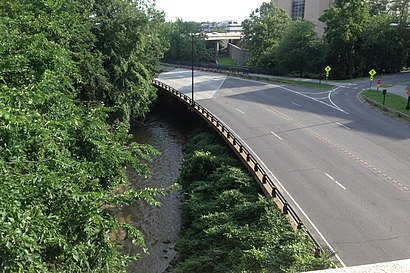
See L Street Bridge, Washington, on the map
Directions to L Street Bridge (Washington) with public transportation
The following transit lines have routes that pass near L Street Bridge
Bus:
Train:
Metro:
How to get to L Street Bridge by Bus?
Click on the Bus route to see step by step directions with maps, line arrival times and updated time schedules.
How to get to L Street Bridge by Train?
Click on the Train route to see step by step directions with maps, line arrival times and updated time schedules.
How to get to L Street Bridge by Metro?
Click on the Metro route to see step by step directions with maps, line arrival times and updated time schedules.
Bus stations near L Street Bridge in Washington
- 7th St & L St,2 min walk,
Bus lines to L Street Bridge in Washington
- 70,South To Archives,
- 79,North To Silver Spring Station,
What are the closest stations to L Street Bridge?
The closest stations to L Street Bridge are:
- 7th St & L St is 109 yards away, 2 min walk.
Which Bus lines stop near L Street Bridge?
These Bus lines stop near L Street Bridge: 38B, 64, 70, YELLOW
Which Train lines stop near L Street Bridge?
These Train lines stop near L Street Bridge: MARC
Which Metro lines stop near L Street Bridge?
These Metro lines stop near L Street Bridge: METRORAIL GREEN LINE, METRORAIL YELLOW LINE
What’s the nearest bus stop to L Street Bridge in Washington?
The nearest bus stop to L Street Bridge in Washington is 7th St & L St. It’s a 2 min walk away.
See L Street Bridge, Washington, on the map

Public Transit to L Street Bridge in Washington
Wondering how to get to L Street Bridge in Washington, United States? Moovit helps you find the best way to get to L Street Bridge with step-by-step directions from the nearest public transit station.
Moovit provides free maps and live directions to help you navigate through your city. View schedules, routes, timetables, and find out how long does it take to get to L Street Bridge in real time.
Looking for the nearest stop or station to L Street Bridge? Check out this list of stops closest to your destination: 7th St & L St.
Bus:Train:Metro:
Want to see if there’s another route that gets you there at an earlier time? Moovit helps you find alternative routes or times. Get directions from and directions to L Street Bridge easily from the Moovit App or Website.
We make riding to L Street Bridge easy, which is why over 1.5 million users, including users in Washington, trust Moovit as the best app for public transit. You don’t need to download an individual bus app or train app, Moovit is your all-in-one transit app that helps you find the best bus time or train time available.
For information on prices of Bus, Metro and Train, costs and ride fares to L Street Bridge, please check the Moovit app.
Use the app to navigate to popular places including to the airport, hospital, stadium, grocery store, mall, coffee shop, school, college, and university.
L Street Bridge Address: 801 Mount Vernon Pl NW (DCConvention.org) street in Washington

Attractions near L Street Bridge
- go gourmet
- Schiff Hardin LLP
- 7th Street
- 825 L St NW
- Room 146A
- Hall B
- 829,L St NW L St NW
- Sweet Freeze
- 738 L St NW
- IPW 2017
- Wolfgang Puck Express
- Otakon Photosuite
- Walter E. Washington Convention Center
- Foggy Bottom Grill
- National Fire Protection
- Smartcity
- 16th Annual Nbc4 Health and Fitness Expo
- Rammys
- Green Festival
- 801 District Diner
How to get to popular attractions in Washington with public transit
- The Cheesecake Factory, Washington
- Teaism Penn Quarter, Washington
- O'Sullivan's Irish Pub & Restaurant, Arlington County
- Damascus, MD, Montgomery County
- Crystal City Sports Pub, Arlington County
- Mount Vernon Place, Baltimore
- Smith Commons, Washington
- Rasika, Washington
- Urbana, Washington
- Hank's Oyster Bar, Washington
- P.J. Clarke's, Washington
- Columbia, MD, Howard County
- Gordon Biersch Brewery Restaurant, Fairfax County
- Hamilton's Bar & Grill, Washington
- Hyatt Regency Reston, Fairfax County
- Bullfeathers, Washington
- Biergarten Haus, Washington
- New Psalmist Baptist Church, Baltimore County
- Charles Village, Baltimore
- The Greene Turtle Sports Bar & Grille, Washington