How to get to La Poste by bus?
Click on the bus route to see step by step directions with maps, line arrival times and updated time schedules.
From Hippodrome de Longchamp, Paris
77 minFrom Île Seguin, Boulogne-Billancourt
68 minFrom La Seine Musicale, Boulogne-Billancourt
67 minFrom Grille Clemenceau, Arrondissement de Nanterre
70 minFrom Hôpital René Huguenin - Institut Curie, Arrondissement de Nanterre
73 minFrom Conforama, Colombes
67 minFrom Parc zoologique de Paris, Paris
45 minFrom Port de Javel Bas, Paris
50 minFrom 94410, Saint-Maurice
59 minFrom Consulat Général d'Italie, Paris
31 min
How to get to La Poste by train?
Click on the train route to see step by step directions with maps, line arrival times and updated time schedules.
How to get to La Poste by metro?
Click on the metro route to see step by step directions with maps, line arrival times and updated time schedules.
From Île Seguin, Boulogne-Billancourt
48 minFrom La Seine Musicale, Boulogne-Billancourt
45 minFrom Grille Clemenceau, Arrondissement de Nanterre
42 minFrom Hôpital René Huguenin - Institut Curie, Arrondissement de Nanterre
46 minFrom Parc zoologique de Paris, Paris
37 minFrom Port de Javel Bas, Paris
31 minFrom Consulat Général d'Italie, Paris
28 min
Metro stations near La Poste in Paris
Bus stops near La Poste in Paris
Bus lines to La Poste in Paris
- 20, Louison Bobet,VIEW
- 32, Gare de L'Est,VIEW
- 39, Gare du Nord,VIEW
- 38, Porte De La Chapelle - Porte D'orléans,VIEW
- N12, Romainville - Carnot - Pont De Sèvres,VIEW
- N13, Bobigny - Pablo Picasso - Mairie D'issy,VIEW
- N14, La Croix De Berny Rer - Mairie De Saint-Ouen - République,VIEW
- N23, Châtelet - Gare De Chelles - Gournay Rer,VIEW
What are the closest stations to La Poste?
The closest stations to La Poste are:
- Bonne Nouvelle is 20 meters away, 1 min walk.
- Porte Saint-Denis is 75 meters away, 2 min walk.
- Poissonnière - Bonne Nouvelle is 98 meters away, 2 min walk.
- Sentier is 252 meters away, 4 min walk.
- Réaumur - Sébastopol is 261 meters away, 4 min walk.
Which train line stops near La Poste?
L (Cergy-le-Haut/ Versailles-Rive-Droite/ Saint-Nom-la-Bretèche - Forêt de Marly)
Which metro lines stop near La Poste?
These metro lines stop near La Poste: 4, 8, 9.
Which bus lines stop near La Poste?
These bus lines stop near La Poste: 20, 32, 56.
What’s the nearest metro station to La Poste in Paris?
The nearest metro station to La Poste in Paris is Bonne Nouvelle. It’s a 1 min walk away.
What’s the nearest bus station to La Poste in Paris?
The nearest bus stations to La Poste in Paris are Porte Saint-Denis and Poissonnière - Bonne Nouvelle. The closest one is a 2 min walk away.
What time is the first metro to La Poste in Paris?
The 8 is the first metro that goes to La Poste in Paris. It stops nearby at 5:33 AM.
What time is the last metro to La Poste in Paris?
The 4 is the last metro that goes to La Poste in Paris. It stops nearby at 1:06 AM.
What time is the first bus to La Poste in Paris?
The N23 is the first bus that goes to La Poste in Paris. It stops nearby at 3:02 AM.
What time is the last bus to La Poste in Paris?
The N13 is the last bus that goes to La Poste in Paris. It stops nearby at 3:31 AM.
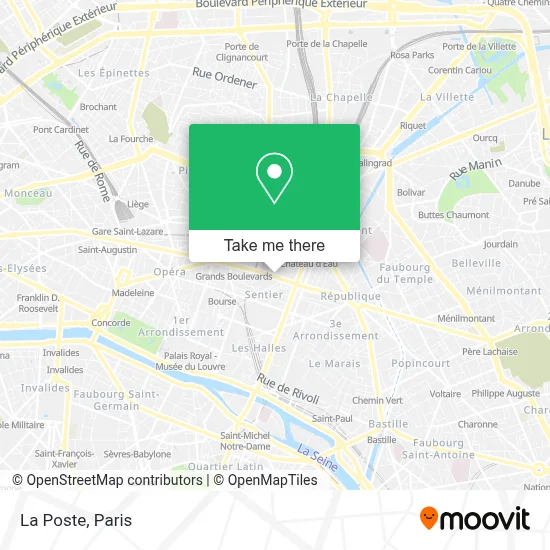
See La Poste, Paris, on the map
Public Transit to La Poste in Paris
Wondering how to get to La Poste in Paris? Moovit helps you find the best way to get to La Poste with step-by-step directions from the nearest public transit station.
Moovit provides free maps and live directions to help you navigate through your city. View schedules, routes, timetables, and find out how long does it take to get to La Poste in real time.
Looking for the nearest stop or station to La Poste? Check out this list of stops closest to your destination: Bonne Nouvelle; Porte Saint-Denis; Poissonnière - Bonne Nouvelle; Sentier; Réaumur - Sébastopol.
Train: L.Metro: 4, 8, 9, 3.Bus: 20, 32, 56, 39.
Want to see if there’s another route that gets you there at an earlier time? Moovit helps you find alternative routes or times. Get directions from and directions to La Poste easily from the Moovit App or Website.
We make riding to La Poste easy, which is why over 1.5 million users, including users in Paris, trust Moovit as the best app for public transit. You don’t need to download an individual bus app or train app, Moovit is your all-in-one transit app that helps you find the best bus time or train time available.
For information on prices of metro, bus, train, light rail and RER, costs and ride fares to La Poste, please check the Moovit app.
Use the app to navigate to popular places including to the airport, hospital, stadium, grocery store, mall, coffee shop, school, college, and university.
La Poste Address: 18 boulevard Bonne Nouvelle street in Paris
- Memphis,
- 4. Rue Mazagran,
- Hôtel Mazagran Paris,
- 5. Rue de la Lune,
- 75010,
- Hotel Mazagran,
- Choco-Story - Le Musée Gourmand du Chocolat,
- Musée du Chocolat,
- Le Cristal,
- Coin Coin Frat,
- Marché De Barbès,
- Église Notre-Dame-de-Bonne-Nouvelle,
- Notre Dame de Bonne Nouvelle,
- Hôtel Regina Opéra Grands Boulevards Paris,
- Taxi,
- Hotel Les Théâtres Paris,
- Delaville Café,
- 96 Rue de Clery,
- Théâtre du Petit Gymnase,
- 17-19 Rue de Mazagran
Places Near La Poste (Paris)
- Beaugrenelle, Paris,
- Hôpital Saint-Joseph, Paris,
- Galeries Lafayette, Paris,
- Théâtre Mogador, Paris,
- Gare Routière Flixbus, Paris,
- Fondation Louis Vuitton, Paris,
- Hôpital Beaujon, Clichy,
- Hopital Foch, Suresnes,
- Hôpital Henri Mondor, Creteil,
- Hopital Lariboisière, Paris,
- Marché Saint-Pierre, Paris,
- Hôpital Cochin, Paris,
- Hôpital Pitié Salpêtrière, Paris,
- Galeries Lafayette Haussmann, Paris,
- Hôpital de la Pitié-Salpêtrière, Paris,
- 29 Rue Manin, Paris,
- Créteil Soleil, Creteil,
- Atelier Des Lumieres, Paris,
- Hôpital Necker, Paris,
- Centre Hospitalier des 15/20, Paris
How to get to popular places in Paris with public transit
Get around Paris by public transit!
Traveling around Paris has never been so easy. See step by step directions as you travel to any attraction, street or major public transit station. View bus and train schedules, arrival times, service alerts and detailed routes on a map, so you know exactly how to get to anywhere in Paris.
When traveling to any destination around Paris use Moovit's Live Directions with Get Off Notifications to know exactly where and how far to walk, how long to wait for your line, and how many stops are left. Moovit will alert you when it's time to get off — no need to constantly re-check whether yours is the next stop.
Wondering how to use public transit in Paris or how to pay for public transit in Paris? Moovit public transit app can help you navigate your way with public transit easily, and at minimum cost. It includes public transit fees, ticket prices, and costs. Looking for a map of Paris public transit lines? Moovit public transit app shows all public transit maps in Paris with all Bus, Train, Metro, Light Rail, RER, Funicular and Gondola routes and stops on an interactive map.
Paris has 7 transit type(s), including: Bus, Train, Metro, Light Rail, RER, Funicular and Gondola, operated by several transit agencies, including RATP, RER, RER Bus de remplacement, Train, Train Bus de remplacement, Tramway Bus de remplacement, TER, ADP, Magical Shuttle, Argenteuil - Boucles de Seine, Autocars Dominique, Bièvre, Brie et 2 Morin, Le Bus - C.C. du Clermontois and Cœur d’Essonne